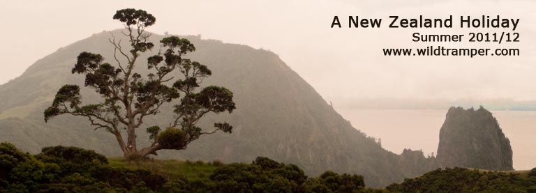
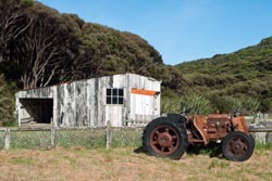
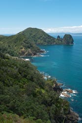
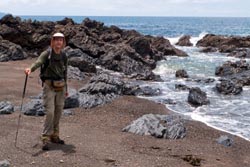
Sugar Loaf, Coromandel Peninsula Coastal Walk
Click NzReport2012.pdf for a copy of this report, OR click to view its photo gallery, OR click to read about my 2008 New Zealand Holiday, OR click to read about my 2006 New Zealand Holiday.
New Zealand ~ Summer 2011/12
The two young ladies approached with beaming smiles, their hair drenched, their bodies wet down to their toes. As I neared they both spoke excitedly, forceful over the howl of wind and water, "you must go through it, it's absolutely outrageous." I was on the Routeburn track, the two ladies had just passed through the hurricane from Earland Falls, and I had a decision to make. Walk as they did through the tempest or take the alternate route. How could I not brave the tumult with that testimonial. So I battened down my gear and continued, walking in front of Earland Falls where the force from the past few days rain created a maelstrom of turbulence across the foot path. One foot at a time I guided my boots to secure footing, inching carefully forward so as not to falter, while being pummeled by gale force wind and wet. I paused when I reached the middle, but other than a quick glance at the falls I dared not linger, certainly no photos here. The journey across the tumult was short, but the excitement was exhilarating, and once on the far side I too had drenched hair, a body wet to my toes, and a beaming smile. I also had a story to tell, especially to fellow trampers approaching the falls. This was by far the most thrilling 15 minutes of my recent New Zealand holiday.
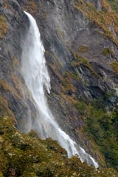
Earland Falls |
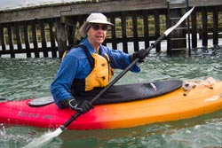
New Zealand is my favorite holiday locale and this was my third visit. On this journey I revisited many of my favorite places and explored others that I briefly touched on past visits. And while on my previous voyages I mostly tramped, this one I gave equal time to kayaking. When I finally returned home I had completed four multi day tramps, many day walks, and seven kayak trips.
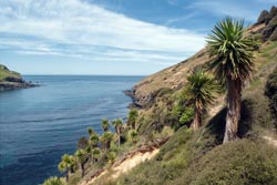
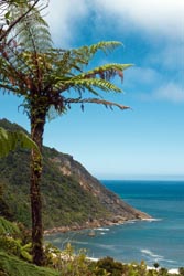
Cabbage Trees, Otanerito Bay |
My itinerary in brief was: On November 26 flew from San Francisco to Auckland to Christchurch to bus to Akaroa, kayak trip in Akaroa harbor, multi day walk of nearby Banks Peninsula including a guided Little Blue Penguin tour one evening and a kayak adventure one morning, flew to Invercargill, ferry to Oban on Stewart Island, two kayak trips and a day walk, a water taxi and walk to Mason Bay (two nights) where I viewed five kiwi in the bush by night and walked an iconic perfect bay by day, walk and water taxi back to Oban, ferry to Invercargill and bus to Te Anau, kayaked Milford Sound, tramp Routeburn Track starting at the Divide, one night in Queenstown, rented car, drove West Coast spending two nights in Hokitika, drove to Nelson, returned car, spent three nights in Motueka with two days of walking and one day kayaking Abel Tasman, bused to Karamea and walked to the Heaphy Hut for two nights over Christmas, returned to Nelson, another day kayaking in Abel Tasman, bused to Picton, stayed four days with friends along the Queen Charlotte Sound over New Years, flew to Auckland, rented car, spent two days in Bay of Islands' Mount Maunganui, drove to Coromandel Peninsula spending two days in Coromandel Town with one day on the Coromandel Coastal Walk, spent two days in Hahei, spent one day in Thames, returned car, spent two days in Auckland, flew home on January 11.
My Trip
Listed in order of occurrence are places and activities. Unless lodging or food was special those comments are left out, but there may be comments in my detailed itinerary at the end of this report.
Akaroa Harbor Kayak |
Akaroa: On my 2008 New Zealand holiday, my friend and I drove to nearby Akaroa after visiting Christchurch, a curiosity sidetrip before heading elsewhere. With that short visit, I realized Akaroa was a place I would like to properly explore. So I chose to begin my third New Zealand holiday in Akaroa. Not only did my time there resolve jet lag, but it also put me in a relaxed holiday spirit.
It was a perfect start to my holiday. Getting there from Christchurch airport was with Akaroa Scenic Shuttle, a guided bus trip which traveled the ridge top roads with commanding views of the many bayed landscape. Along the way the driver informed us of numerous features and history of the area. I remembered eyeing these bays in 2008, wanting to view them up close. But that would have to wait a couple more days until the start of my walk of the Banks Peninsula.
While in Akaroa I stayed at Chez La Mer, and although it is a backpacker facility I had a generous private ensuite room. As my holiday progressed, I realized that my tolerance for cozy backpacker facilities was waning, but Chez La Mer was fine. On the morning of my second day, I had my first kayak trip with Akaroa Kayaks. It was a morning with wind and turbulence, but it was also a time of fun, and thankfully I piloted a single kayak. That evening I dined at Ma Maison having a fine meal, and I enjoyed that experience so much that I dined there three nights while I was in Akaroa.
Banks Peninsula Track |
Banks Peninsula Track: As advertised in the Banks Peninsula Track literature:
The Banks Peninsula Track takes you beyond Akaroa to the remote outer bays of Banks Peninsula. This unique walk covers 35 km of spectacular volcanic coastline, native bush, waterfalls and sandy beaches. Its blend of whimsical and historical accommodation and a stunningly diverse track route will enchant and delight you as it has for walkers over more than twenty years.
Although accurate, this short description does not suitably convey the enjoyment of the days I walked the track. The track can be walked in either two or four days, but the longer walk allowed me to enjoy some special amenities: At Flea Bay I enjoyed an evening penguin tour and a morning kayak. It was a walk and experience I will definitely repeat. Let me explain.
Ok, the first day was short and non eventful. Late in the afternoon I was shuttled from Akaroa to the Onuku Hut. Well, not exactly a hut, more like a holiday home with stunning views. The lodging has three bedrooms sleeping 4-6 each, a nicely furnished living room, a fully equipped kitchen, a shower, and did I mention the piano. That night I dined nearby, but that meal was just so-so. When I do it again, I'd enquire if the start time could be earlier so as to enjoy the afternoon on the hilltop, and I would prepare my own evening meal.
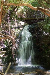
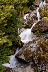
Waterfall near Flea Bay |
The next day was my first walking day. Up over the ridge, climbing from 200m to 700m, while along the way were spectacular views of the bay. At the top I lunched. From here it was all down hill, but unlike the open expanse of the walk up the track paralleled a creek through the woods nearby several waterfalls to Flea Bay. Another holiday home turned hut awaited me complete with piano and a kitchen stocked with snacks, soda, beer, and a large assortment of wines all at fair prices. The best part of the day was yet to come, a guided penguin nature tour.
Flea Bay is designated a marine sanctuary where more than 1000 breeding pairs of little blue penguins make their home, all to the thanks to hosts Francis and Shireen Helps of the farm at Flea Bay. They offer guided evening tours which can originate in Akaroa with ground transportation for those not on the Banks walk.
At the start of the guided walk I watched Shireen feed cut up fish for an orphaned penguin chick. She more or less shoved the pieces down its hatch, but the chick seemed happy. Penguin box homes were all over the place, we peeked into a few - phew that stinks! The guided walk took us along the bay perimeter where numerous blinds had been erected. We saw hundreds of little blue penguins, most were on the bay awaiting the right moment to come ashore, but we also saw a few on land. We even saw a pair of yellow-eyed penguins. As darkness fell, we returned from our outing. An excellent first day.
But my adventures at Flea Bay were not over. The following morning I went kayaking. On this outing I saw more little blue penguins, a few up close while they were on the rocky shoreline having not yet decided to take the morning's plunge. Also viewed were numerous fur seals and from a distance a pod of (believed to be dusky) dolphins breeching. It was only me and the guide in a tandem kayak, and thankfully it was tandem because as we left the bay the swells picked up. By the time I finished kayaking it was late morning and my day had barely begun.
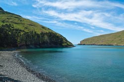
Flea Bay |
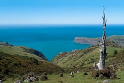
Banks Peninsula Summit View |
The walk to Stony Bay was 8km. It was up and down, then up and down, then up and down, then up and down as I walked from bay to bay to bay to Stony Bay. I can't help but marvel at how gorgeous the scenery was. Most of the path was across grassland, which I suspect centuries ago was forested. Now sheep enjoy the green carpet. At the midway point by one of the bays was Seal Cove Shelter, a place complete with picnic table and chairs to enjoy the views, while nearby was yet another wonderful waterfall.
Stony Bay Shower |
The days walk ended not as expected, which I thought would be another holiday home. Rather, the lodging were huts. There were maybe 6-8 huts with sleeping arrangements from 2 to 8, each with their own kitchen and whimsical personalities. At first I didn't know what to think about these "down-graded" accommodations, but after I explored the grounds to find first a shower which was a structure built around a huge old tree, an experience of showering outside with privacy, the place felt marvelous. There was even a cast iron tub - the instructions read "fill with water, then light wood under tub to heat." For recreation there was an outdoor pool table, volleyball net, and a rope swing fastened high from a tree. There was even an old time clothes washer with crank ringer which came in handy to spiff up my sweaty shirt. Of course there was beer and wine, but there was also numerous other goodies for purchase such as fresh fruits, vegetables, free range eggs, cheeses, snacks, and various cuts of meat. I supplemented my dinner with a beer, some veggies, a desert of ice cream, and 2 eggs for the mornings breakfast. Yummy, yummy.
| |
|
The Banks walk is advertised as either a 2 or 4 day walk. For the 2-day walk you miss the penguins and kayak at Flea Bay and head directly to Stony Bay. For my walk, I did it in 3 days to resolve an itinerary problem, so thus I combined the walk for days 3 and 4. I would probably not do that again, but it was a satisfactory decision. The walk from Stony Bay to the next "hut" was 6 km, again with ups and downs over ridges adjacent to small bays and on to Otanerito Bay. The scenery continued as outstanding and the skies were blue and the temperatures were perfect. Lodging at Otanerito Bay was more hut quality with 3 dorm rooms sleeping about 6 each. The hut had a small kitchen and living room, while facilities were outside. The activities near the hut were walks along its bay and various nature walks, but I suspect an avid birder might also spy flighted enjoyment.
At Otanerito I took a break for an early lunch supplementing it with a few purchased items, for afterwards I would walk another 10km and climb 600m over the hill to Akaroa. The walk up was delightfully pleasant. Rather than walking grasslands, the track followed a creek through forest. The slog up hill was made enjoyable by a cool breeze and by forest diversity. Although there were a few waterfalls along the track, most were somewhat off track which was more than I cared to tackle on this long day. I was amazed at the abundance of other walking paths along the way, but at the intersections were easy to follow signs. Although there were numerous informational signs along the entire Banks Track, this section seemed to have the most, some explaining history and others conveying information about native plant restoration. At the summit (600m) I met several other people out for the day, most drove from Akaroa. The walk down to Akaroa was moderately steep, but except for one spot the footing was suburb, and at that spot I played "slide on your butt" for safety. The views of the bay from up high were wonderful. My last day of walking (16km and about 1000m up/down) was 2-1/2 hours to Otanerito and another 4 hours to Akaroa with a break of about 1 hour for lunch. A most enjoyable outing, one which I will definitely repeat.
Fallen Arch from 2010 Earthquake |
Invercargill: On the evening of my last full day in Akaroa I had another fine dinner at Ma Maison. The next day I again boarded the Akaroa Shuttle to Christchurch airport. By mid afternoon I was in Invercargill, staying at the restored Victoria Railway Hotel, it was very nice. That evening, per recommendation of some locals, I dined at Thai Saigon enjoying (and also recommending) the Cashew Nut Stir Fry. The following morning I was picked up at the hotel by Real Journeys, shuttled to Bluff, and boarded the ferry to Stewart Island.
Stewart Island: Fair weather continued to follow me. I arrived by ferry in early afternoon, and late that same day I did an evening kayak trip from 7-10PM with Rakiura Kayaks. Although the outing was fun, the water was choppy and the winds were up, but at least I was piloting a single kayak. I saw one little blue penguin, certainly not as exciting as Flea Bay.
The next day I walked along the nearby Fern Creek track and continued the walk with the Ryan track for return. Fern Creek was delightful, an easy walk which I highly recommend, it follows a creek with handsome vegetation. The Ryan track was fine, but not nearly as diverse. The following morning I kayaked, again with Rakiura Kayaks, this time to calm seas and no wind.
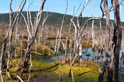
Wetland near Fresh Water Landing |
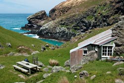
Mason Bay: My outing to Mason Bay was neither wet nor windy nor overcast nor muddy nor anything else of the like, those described my 2008 walk here. It was however fantastic. I enjoyed stupendous blue skies with a light breeze for perfect comfort. The Seaview Water Taxi to Fresh Water Landing was a great idea, but nonetheless I'm still glad I tortured myself by the walk between the North Arm Hut and Fresh Water Landing in 2008, for as they say adversity makes for the best stories (see story of Best Mud in my 2008 New Zealand report). After the 40 minute water taxi ride I was at Fresh Water Landing. The walk to Mason Bay was another 3-1/2 hours. At the three bunkroom hut during this mid December day were three small groups, so I had my own hut room, very pleasant.
At dusk I went kiwi spotting, and this I did by slowly pacing the 1km track between the wardens hut and the Mason Bay hut. That first evening I viewed one kiwi shortly after dusk, and it was a good 20 minute sighting of a large female. The second evening I viewed four. I believe I finally got the hang of kiwi spotting, that is, you must use your ears more than your eyes. Just listen for the crunch of little feet on leaf litter, and voila a kiwi. I eyed my favorite sighting when after hearing the crunch on leaf litter I turned around to find a kiwi following my foot path, I'm sure I heard it say "daddy."
Mason Bay |
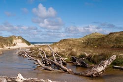
On my layover day I walked the seemingly endless beach of this quintessential perfect half-moon bay. That day, I enjoyed the sun, blue skies, a mild breeze, surf, and of course the expansive sandy beach. Stupendous!!! I walked south about 7 km to the junction for the Doughboy Hut and then returned. Along the way I observed, among other things, the remains of a stranded pod of pilot whales. I counted 8, but I was later told the original stranding was over 100, all but about 14 survived.
Te Anau: After returning from Mason Bay, I spent one more night in Oban. The following morning I took the ferry to Bluff, and then a bus to Invercargill and Te Anau. Here I spent three nights, using the locale as a hub for a Milford Sound kayak trip and a place to prepare for my tramp of the Routeburn Track. The extra gear I did not carry on the tramp was transported to Queenstown by Info&Track and coordinated by the Tracknet office in Te Anau.
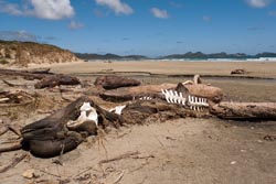
Beached Whale ~ Mason Bay |
Milford Sound: Not all adventures go as hoped. This was my 5th kayak trip for this holiday, a trip to Milford Sound with Kayak Fiordland. The weather was neither here nor there, a moderate amount of wind and overcast skies, so the seas were turbulent from wind and the waterfalls thin from no rain. But it was my luck being paired with "someone's mother-in-law" in a tandem kayak that made the outing unpleasant. It was quite a workout, I pulled for two. Sadly, most of the others in this kayak group were ill prepared. This leaves me to the conclusion that "entry level" outings should be avoided, especially in heavily touristed places like Milford Sound. On my next visit to New Zealand, I would consider repeating the Doubtful Sound overnight adventure, also with Kayak Fiordland, as I had done in 2006, that trip had a minimum skill criteria to participate.
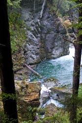
Routeburn River |
Routeburn Valley |
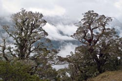
Routeburn Track: With a forecast of foul weather I considered walking the Hollyford rather than the Routeburn. That might have been dandy, but I stayed with my original schedule to walk the Routeburn. It was a excellent decision. On my last day in Te Anau the weather was warm and sunny, although the forecast was for a front to pass through the next day or so. Of course the weatherman lied, the front came in early so my outdoor dinner in Te Anau went from warm and sunny to cool and windy. I toughed it out!
The next morning I joined a throng of other trampers on the bus to the trailhead. Thankfully, all but a few got off at Te Anau Downs to walk the Milford Track. Those remaining looked more up to the part of tramping.
Before I ramble further, I have to say walking the Routeburn from the Divide to the Routeburn Shelter is the best direction. The last time I did it the other way (along with the Greenstone Track), but from the Divide the best scenery is always ahead of you.
Because last time I walked the Greenstone, I never reached the Divide, although I did the side trip walk to the wetlands at Key Summit. The walk from the Divide was delightful, especially in the light rain. The forest was tantalizingly green and the diversity of trees were just perfect to enjoy. Of course being a Great Walk the track was easy to follow. I had a wonderful time from the Divide to the turnoff to the wetlands at Key Summit, but because I had viewed the wetland once before I skipped it on this wet day.
Fog Shrouded Hollyford Valley |
From the summit I walked down to the Howden Hut and then onto the Mackenzie Hut. Along the way I pasted a couple of young ladies with beaming smiles, they had just walked through the forceful spray from Earland Falls. Of course they convinced me to do the same rather than take the side track around the wet. It was one of the coolest (literally and figuratively) encounters I've had in a long time, the blast of wet caused by all the recent rain made the falls a total body experience. The blast was wet with high velocity winds that buffeted me as I scrambled across the base of the falls. Stupendous!!!
That first day I walked the 12km in about 4 hours arriving at the hut at 3PM with a 30 minute break at the Howden Hut. I was surprised that in mid December the hut was fully booked, and of course I feared the pending sleepers nighttime music. Fear turned to reality, so I picked up my sleeping gear and headed to the quiet of the kitchen.
I noticed most of the trampers were walking the opposite direction, but at that time I hadn't realized the benefit of walking from the Divide. Much of the time I walked with a group of five Australians, they too had tramped Stewart Island. Their SI experience was a bush flight in, a walk of most of the Northern Circuit, a walk to Mason Bay, and then to Fresh Water Landing and North Arm and out. They too thought SI was magical, and they too thought the walk from Fresh Water Landing to the North Arm was dreadful. Sadly, they didn't view any kiwis.
Along the Routeburn |
The walk from Mackenzie to Routeburn Falls could not have been more delightful. The wet from the day before turned to broken clouds, light winds, cool tramping temperatures, and mostly blue skies. The views along the ridges and down the fog shrouded Hollyford Valley was stupendous. At one point I viewed Martins Bay in the distance, and of course I remembered that glorious 2008 adventure. Walking toward Harris Saddle along the ridge meant the views were always ahead, absolutely marvelous. As I approached Harris Saddle fog from the Hollyford Valley was just starting to creep up the ridge. I took a break at the warming hut and enjoyed the endless views. After my break, I had a bit more of a climb to the real saddle and to views of Harris Lake and the Routeburn Valley - how do you spell awesome!!!
The walk to the Routeburn Falls Hut was a delightful journey. Of course with the recent rains the waterfalls were gushing. When I reached the hut I first explored the turbulent falls. This was my third visit to the hut [the first was a day walk on 2006], and the quantity of water was deafening. I reached the hut at about 1:30PM, found a good bunk (at least I hoped good meant quiet), and then sat on the deck to read and enjoy the views. A perfect day. At 5PM the weather changed to medium hard rain, it was nice to have a roof overhead.
The hut filled to its 48 tramper capacity, but fortunately the Routeburn Falls Hut has compartmentalized sleeping arrangement with four bunks to a compartment. That mostly worked, for at 12:30AM someone's alarm went off which sounded like the fire alarm. It woke everyone up in the hut, and I heard people mumble "is there a fire." But the alarm subsided after 5 seconds and everyone decided they would rather burn than go out into the rain. So much for priorities!
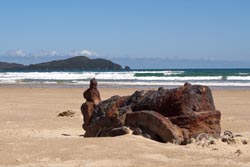
Bad Tractor Day ~ Mason Bay |
Historic Wool Shed ~ Mason Bay |
The next morning the rain subsided to fog and mist. Since my connection with the shuttle was at 2PM, I got a late start. The walk out was through fog and mist, but because the walk was through forest it was quite pleasant.
I still rate the Routeburn Track as my favorite, and I would do it again. But next time, while I'm in the area, I think I would also tack on the best of the Hollyford, that is a walk to, and an extra day at, the Hidden Falls Hut. It was while I was on the ridge looking down that I remembered how lovely sections of that walk are.
Queenstown: I spent one short night in Queenstown, just enough time to organize my gear, clean up from the Routeburn, and refuel with a good dinner. That one overnight in Queenstown was more than enough for me.
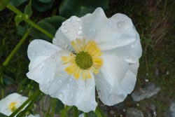
Alpine Flower ~ Routeburn Track |
Hokitika: From Queenstown I rented a car to drive the west coast to Nelson. Along the way I had a two day holiday from my holiday, relaxing in Hokitika. Staying at Teichelmanns B&B was a excellent choice. The hosts were great, providing me with tea and homemade biscuits at all times of the day and night. Both nights I dined at Stumpers, not only were their prices reasonable, but the food was outstanding. My first dinner was a salad, sort of a Kiwi version of a Nicoise only with grilled lamb rather than tuna, most excellent. The second night I enjoyed a lamb shank, and I use the singular of shank since the dish usually comes with two, and it came over a pile of mash and a fine assortment of fresh veggies - yummy, yummy.
On my extra day in Hokitika, the B&B host shuttled me to the start of a one-way track after I left my rent-a-car at the other end. It was a pleasant walk, but certainly neither Stewart Island nor the Routeburn. Afterwards I drove to Dorothy Falls, a bit of a haul to drive and not very impressive. I think I'm jaded from all the sights I enjoyed on the Routeburn.
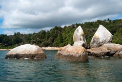
Split Apple Rock ~ Abel Tasman |
Nelson: Anyway, it seems the weather is upside-down here down-under. Fiordland was dry and Nelson was wet. I drove the distance from Hokitika, dropped the car off at the Nelson Airport, and hired a taxi to my lodging. Along the way I learned that the primary road from the airport to the city centre was now, as the sign said, "permanently" closed. All this the result of the very heavy rains of the previous week which caused landslides and other devastation. My taxi driver drove a circuitous route up and down hills, and then around and around to bypass closed roads. As we progressed he pointed up steep driveways where I could see mud slides or houses with stupendous views that had lost their front yard, oops, and he explained that many of these houses were "red tagged."
My stay in Nelson was as a hub for the next week to Abel Tasman, to the Heaphy Track, and to the Queen Charlotte Sound. As my time in Nelson progressed, the "permanently" closed roads opened.
Motueka: Just as Nelson was a hub for many activities within that region, Motueka was the town I use as a hub to Abel Tasman. I spent three nights there, followed by three days of play. Two of those nights I had fine dinners. My favorite was a fine meal at Elevation Cafe having yet another lamb shank and a yummy desert, and a close runner up was a meal at Simply Indian.
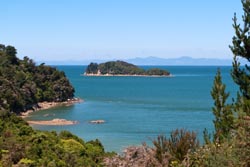
Fisherman's Island ~ Abel Tasman |
Abel Tasman: Seems I've been following the weather, with turmoil ahead and fine where I'm at. Akaroa, Stewart Island, the Routeburn (with a tiny bit of weather to add contrast to the bush walks), the west coast, and now in Motueka for varied activities in beautiful Abel Tasman - all with sunny blue skies.
On my first day in Abel Tasman I took the bus from Nelson for a day kayak trip with Abel Tasman Kayaks. Since I was the only signup for their Remote Coast outing along the western boundary of the park, I got bumped to another group. It was a fine day with four guys from Spain. We were three tandem kayaks, I was paired with the guide. In 2006 I did a three day overnight kayak trip of much of Abel Tasman, this was the middle day of that trip, and it was in my opinion the least interesting of the three. Nonetheless, the water was fine, the sights were great, and it was a day of fun in the sun.
Torrant Bay ~ Abel Tasman |
On my second day I took a water taxi to Bark Bay in Abel Tasman and then walked back to the eastern entrance of the park. The recent rains made the start of the track at Bark Bay a bit challenging with small sections washed out, thus requiring a bit of scrambling. The last time I walked this section of track I had a car rental, giving me freedom from a cloistered bus schedule return. Sadly, I felt I rushed and didn't have enough opportunity to explore. At low tide I was at Torrent Bay which allowed me to walk the tidal flats as a short cut, and it turned out to be an expensive alternative. Crossing the sand of the tidal flats was more like walking in mush, so I removed my boots to walk barefoot. Somewhere along the way on what I suspect was a jump across a tidal creek my GPS took a leap into the muck, but of course I didn't realize this until it was much too late. When I finally grasped my mistake I could visualize my GPS yelling out from under the muck "I know where I'm at, where are you," but I didn't listen. That inattentiveness cost me NZ$600 for a replacement in Nelson. To bad I was in denial and didn't backup my tracks, they were what I felt was the real loss. Now I wasn't able to coordinate my pictures with the locales from the GPS, and use some of the tracks for this report.
On my third day I returned to Abel Tasman for a short walk and a lot of exploring. It was a fine day. I walked about two hours into the park to Stilwater Bay where I had a fine lunch and time to relax and enjoy a few pages of a book. On return I stopped at numerous other bays along the way, finding others that I would enjoy at some future date. When I returned to the start of the track, I stuck my nose into Abel Tasman Kayaks hoping that someone found my wayward GPS. Of course I knew that answer beforehand, but I had to ask. While there I changed my next kayak trip with them to my favorite section called the Remote Coast.
Fern Palm along Heaphy |
Heaphy Track: On the day before Christmas I boarded an early morning bus from Nelson to the West Coast and to Karamea for the start of my Heaphy adventure. This was my third visit to the Heaphy Hut, it is one of New Zealands magical places. At 2PM I arrived at the track and the start of a magnificent 15km (often) beach walk along the Tasman Sea. [Note: There is an air flight between Collingwood and Karamea, useful as alternative transportation to/from Nelson.]
My weather karma was holding, comfortable temperatures and blue skies, while I also nailed the tides - low tides for best beach access. There were many opportunities to skirt the track and snuggle up to the wild surf for a beach walk, but my favorite sections were Twin Beach and 20 Minute Beach. It was an easy and delightful 4-1/2 hour walk in.
There were few at the hut, I guess about 8 the first night and 10 the second. Thus, the normally cozy sleeping arrangements were relaxed. On the first night I decided to occupy an entire upper bunk platform which normally sleeps four, it turned out to be a very quiet night.
Although the hut itself is no big deal, its locale is my favorite. It is located at the terminus of the Heaphy River with the Tasman Sea. The hut sits on a small rise above the terminus with Nikau Palms scattered everywhere for a tropical flair. The sand flats below the hut are enormous, and exploring them was everyones favorite pastime. There were two other pair of trampers at the hut who, like myself, decided to walk into "their favorite hut location" (their words, just like mine) for a relaxing Christmas. I guess my opinion of nice places isn't very original!
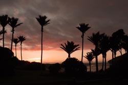
Nikau Palms ~ Heaphy Sunset |
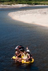
On my layover day I walked to the Lewis Hut, about 10km away. At the hut I bumped into two Hut Wardens plus a boy friend, the three of them were about to embark on a float trip down the Heaphy River back to the Heaphy Hut in a very cozy inflatable raft. Shortly later I was on the swing bridge crossing the river when they were floating under it, and I was able to catch there afternoon fun on "film." As it turned out, their float trip turned into a paddle adventure because upstream winds picked up and the current was not strong enough for a float down. Nonetheless, they had a grand Christmas day adventure.
It was good that I explored that day. At the hut a couple of trampers brought in a whole roasted chicken, that was their Christmas mid afternoon dinner. It would have been just too much to bare, my dinner fare was ok but spaghetti made from instant noodles isn't even close to the same league.
Heaphy Wardens at Play |
After dinner on both nights we chatted around the dining table. I think that is what's best about small groups, everyone socializes. At 10PM all was quiet.
On my day out I woke up early, 5:30AM, to the hums of a pair of other trampers preparing for an early departure. So I decided, what the heck, me too. It turned out to be a brilliant idea. I was on the track by 7AM, a time when the temperatures were comfortable and the morning sun was behind the hills. Walking out was a time of approaching high tide, so I had to be a bit more careful, but on this day the Tasman Sea was flat as glass, something I have never seen before. I again opted to walk the beach when possible rather than the track, it was much more interesting. I had plenty of time to return, my shuttle connection was at 1PM, that gave me 6 hours for the 4-1/2 hour walk, and I savored it for 5-1/2.
Abel Tasman again: I returned once more to Abel Tasman for the Remote Coast kayak outing, the one which includes lots of rocky coves and lots of fur seals. I got everything I hoped for and then some. It was a slightly larger group than I expected with groups normally limited to 8 plus the guide. Today there were 9 plus 2 guides. I was paired with the extra guide for a day of going places that were fun, fun, fun. The rest of the group was also great, there were no slackers. I know I lost count of fur seals, no doubt I saw hundreds. Some of the males had impressive harems. Some of the moms had young pups, none were old enough yet to swim, but I saw several on the rocks and they were cute, cute, cute. After lunch, with rising tide, we explored several hidden waterways only accessible at high tide, again more fun.
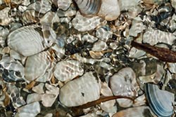
Shells ~ Mason Bay |
Queen Charlotte Sound: Over New Years I spent four nights with some Kiwi friends staying at their holiday home along the Queen Charlotte Sound. I originally met them in 2010 while walking the 190 miles of England's Coast-to-Coast route. Their holiday home was quite nice to say the least. Of course they had all the proper toys: Boat, kayaks, wind surf boards, fishing gear, tractor to put the boat in the water, and all the rest. On my arrival we went fishing along the Sound, we caught perch and blue cod, enough for two dinners - yummy, yummy.
Although I had been ahead of the weather, that was not the case for the days around New Years. Fortunately there was sufficient clear and broken skies to enjoy some outdoor activities. On New Years Eve we took a water taxi to a nearby resort for a stupendous dinner, and then at midnight we watched the fireworks at Picton harbor to bring in the New Year. The next day, after sleeping in, we boated to a secluded beach for a picnic lunch, then we walked a section of the Queen Charlotte Track.
Tidal Zone ~ Mason Bay |
Bay of Plenty, Mount Maunganui: Just after New Years my time on the South Island had ended, I boarded a plane in Blenheim to fly to Auckland. After renting a car I drove three hours to Mount Maunganui along the Bay of Plenty. Here I had another holiday from my holiday along an almost endless stretch of sandy beach. I booked into the very fine Beachside B&B, a short distance from the throngs of tourists. Like my stay at another fine B&B in Hokitika, I had a fine room and a wonderful place to relax and a view of the ocean. Of course the hosts provided a wonderful breakfast and at other times offered tea and biscuits.
With the weather continuing to falter, I had a quiet time here. I spent my time walking the beach and reading a book. Of course I didn't have the entire beach to myself as I did at Mason Bay, but I felt the beach was generally uncrowded, there was ample space to relax and enjoy. But unlike Mason Bay, choices for dining were plentiful. A few days later I was in another beach town, Hahei, and for my tastes I enjoyed my time at Mount Maunganui more.
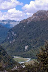
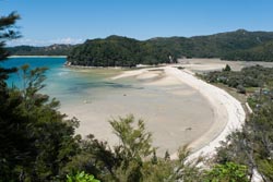
Coromandel Walk |
Coromandel Town: In 2008 I spent one day in Coromandel Town with a visit to the wonderful Driving Creek Railway. This visit was two days, providing me ample time for a fine walk to the farthest reaches of the Coromandel Peninsula on a semi guided Coromandel Discovery outing. I and a few others were driven the sometimes perilous roads to the top of the peninsula where we were let loose at Fletcher Bay for a 10km walk to the other side at Stony Bay, and of course our waiting transportation for return. The drive up took about 2 hours with a short stop for tea & coffee. It was a very pleasant coastal walk, all took a break midway at Poley Bay for lunch and just to enjoy the scenery. The drive up was to clear skies, but when we began the walk the skies started spitting. Thankfully they cleared about 30 minutes later, at which time the walk was "steamy." All in all it was a delightful day. I recommend the walk if you're in the area.
Hahei: My first few hours in Hahei were fine. I strolled the beach and at one point struck up a conversation with the kayak group I hoped to join the next day. The guide said that that day was likely the last day they would be having outings for a while, he continued by noting that the forecasted weather was expected to be tumultuous. So that night a storm came in with a vengeance. The following day there was a steady stream of rain and strong winds. The normally placid beach had two meter surf, but that was expected to increase as the days continued. That day, I along with everyone else at the lodge, succumbed to indoor activities. Thankfully my umbrella survived the short two minute walks to the nearby village shops where I had fine meals, particularly at The Grange Bar.
Banks Peninsula Walk |
Thames: The morning I left Hahei the skies were spotty. But the roads from Hahei were, to say the least, exciting. Several of the secondary roads near Hahei were under water, while the primary road had slips that were (thankfully) being cleaned by road crews. My plans to visit the Miranda Bird Sanctuary were thwarted by more foul weather. Rather, I spend the day watching the trotters in Thames on the one day of the year they run. At best I can say I was dry, but watching a horse race was not my idea of holiday fun.
Changed Plans: With a long term forecast of stormy skies, I decided not to tackle the roads north of Auckland, rather I shorten my visit. The eight days I had planed to tour the Bay of Islands and parts north will wait for another time.
Auckland: Although this was my third New Zealand holiday, this was my first visit of Auckland. With lodging near the piers of City Centre, I spent two days visiting museums and just walking around. My favorite museums were the Maritime Museum and the Auckland War Memorial Museum. Of course dining choices in Auckland were numerous, but the two dinners I had along the piers can best be described as expensive. Throughout my holiday I enjoyed much fine dining, but those places were far from the big city. All in all it was a fine holiday, I will return.
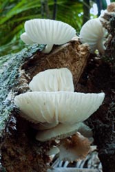
Mushrooms ~ Heaphy |
Oddities
• Total distance of multiday tramps: Banks Peninsula (35km), Mason Bay (22km), Routeburn Track (30km), and best of Heaphy Track (32km) ~ Total is 119 km = 71 miles.
• Tramping Times: I believe I finally understand the estimated times given by DOC for various segments of track. DOC classifies tracks in increasing degree of difficulty as: (a) Easy access walks, (b) short walks, (c) walking track, (d) great walk/easy tramping track, (e) tramping track, and (f) routes. The posted time needs to be tempered with the purported difficultly of the track. So it may take the posted 20 minutes to traverse an easy access walk for someone with disabilities, but a fit person may traverse it in less than 10. Similarly, I believe all Great Walks are designed for nearly any ability, so an experienced tramper may traverse a track posted as 3-4 hours in less than 3. And then there are the difficult tracks, such as the one I did in 2008 between the North Arm Hut and Fresh Water Landing Hut on Stewart Island. Here it is posted as 6-7 hours, but this time is tempered to a tramper experienced in difficult muddy and root bound terrain, thus it took my friend and I much longer, 9-1/2 hours.
• Estimated expenses: As itemized in the table at the end, the estimated expenses for air transportation, car rentals, lodging, food, special activities, and other items was US$8,978 for the 46 day adventure, about US$1,400/week. By comparison, my 2008 expenses for that 12 week holiday was about US$1,100/week, and my 2006 expenses for that 6 week holiday was about US$1000/week. Some of the additional expenses in 2012 was from the cost to replace a US$470 GPS, while inflation, a less favorable exchange rate, and upgraded lodging accounted for some other expenses.
• Customs: Before passing through customs, make sure your tramping boots are absolutely clean, otherwise they will be washed for you.
• Snoring: Not that I don't snore, I sometimes do, but I am also a light sleeper. So when in huts with a real noise maker I often just move the bunk mattress to the common area, or one time I just slept outside. My most remembered occasion was when in a small bunkroom of eight with supposedly no snorers, another person bellowed to the loud snorer "would you please turn over," a lot of good that did! All I needed was a night with both a snorer and an operatic whiner, so I picked up the mattress and moved.
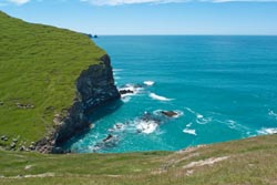
Poley Bay, Coromandel Coastal Walk |
Equipment
When in town I wore cotton Ts, when on the track I wore wool socks, wool shirt, nylon pants, bandana, and had both light-weight cotton cap and nylon rain hat. On multi day tramps I carried a nylon overshirt, 100-weight fleece shirt, silk bottoms, zippered rain pants, full length gaiters, bomb-proof Gortex jacket, wool cap, fleece glove liners, extra socks & wool shirt, small towel & extra bandana, and alternate footwear (usually neoprene booties) for the huts. Sleeping gear was silk sleep-sheet with 30° F down bag (too warm). Kitchen was a 24 oz Glad bowl, small pot, lexan cup, and fork/knife/spoon - cooking only with boiled water but many Kiwis had more regular meals. My ditty bag always included insect repellant (deet worked well), sunscreen, and iodine. I saw no water filters, most Great Huts claim water is potable and I rarely iodized my water. For foul weather, I used light-weight "Sea to Summit" dry bags for sleeping gear and extra clothes (worked great), a full length heavy plastic pack liner (purchased in NZ and worked perfectly), and pack rain cover (didn't work in most rain). I recommend sturdy boots, a walking stick, and full length gaiters. I carried 1st aid & survival kits, and a small stiff bristled brush to clean boots from time to time. I used a 1-1/2 liter thru-the-straw Platypus drinking system (always adequate between water points). My luxury items were a small point-and-shoot camera, voice recorder, and GPS (to timestamp photo locales and to record tracks).
Detailed Itinerary
Cost column in US$, with NZ$1= (about) US$0.79, however the exchange rate fluxuated from the time of numerous bookings in August 2011 (US$0.84) and my visit in December/January 2011/2012 (US$0.78). Items with triple daggers (†††) in Activity column are highly recommended, with single dagger (†) are notable, while lodging with contact information I would use again.
|
Date |
$8,978 |
Activity |
Description |
|
|
1849.94 |
Misc |
• Food & other |
|
11/26 |
1328.10 |
|
• Fly SFO to AKL, AirNZ#7, 7P-5A (next day) |
|
11/27 |
|
|
• Cross international date line |
|
11/28 |
|
|
• Arrive Auckland @5:00A, then Fly NZ0501@6:50A to Christchurch(CHC) @8:10A
|
|
11/29 |
66.95
|
|
• stay
Chez La Mer,
50 Rue Lavaud, Queen ensuite, NZ$83, 3-304-7024
|
|
11/30 |
184.62 |
Banks |
• Explore until 5:45, then Banks Track Walk, walk/stay Onuku Trampers Hut, NZ$220 |
|
12/1 |
|
Banks
|
• Walk 11km Onuku to Flea Bay, stay Flea Bay Cottage
|
|
12/2 |
16.13
|
Banks
|
• Morning kayak in
Pohatu Marine Reserve, NZ$20
|
|
12/3 |
|
Banks
|
• Walk 6 km to Otanerito Beach + 10km to Akaroa
|
|
12/4 |
|
|
• Bus
Akaroa Direct Shuttle,
to Christchurch airport, 3-379-4260
|
|
12/5 |
76.37
|
|
• Bus Invercargilll to Bluff, ferry to Stewart Island, NZ$91
Real Journeys, 3-212-7650
|
|
12/6 |
48.40 |
Stewart |
• Stay Jo & Andy's B&B, NZ$60, 3-219-1230, 22 Main Rd |
|
12/7 |
48.40
|
Stewart
|
• Stay Jo & Andy's B&B, NZ$60, 3-219-1230, 22 Main Rd
|
|
12/8 |
44.37
|
Stewart
|
•
Seaview water taxi
to Fresh Water Landing, NZ$55, 3-219-1014
|
|
12/9 |
4.03 |
Stewart |
• stay Mason Bay Hut, NZ$5 |
|
12/10 |
44.37
|
Stewart
|
• Walk 11km to Fresh Water Landing, then
Seaview water taxi
to Oban, NZ$55
|
|
12/11 |
115.81
|
|
• Ferry to Bluff, bus to Invercargilll then Te Anau, NZ$138, Real Journeys (www.realjourneys.co.nz)
|
|
12/12 |
159.96
|
|
•
Kayak Milford Sound,
NZ$197, 3-249-7700
|
|
12/13 |
96.80 |
|
• stay Aplenhorn Motel, 35 Quintin Drive, Te Anau, 3-249-7147, NZ$120 |
|
12/14 |
8.06
|
Route
|
• Drop off gear
Tracknet,
NZ$10 - pickup Queenstown
Info&Track
|
|
12/15 |
43.70 |
Route |
• Walk 8.8km (4-6hr), stay Routeburn Falls Hut, NZ$51.10 |
|
12/16 |
|
Route
|
• Walk 8.8km (2.5-4hr) to Routeburn Shelter
|
|
12/17 |
105.49
|
†††
|
• Drive 489km (6.5hr) to Hokitika, stay
Teichelmann's B&B,
20 Hamilton St, NZ$135
|
|
12/18 |
105.49 |
††† |
• stay Hokitika, Teichelmann's B&B, 20 Hamilton St, NZ$135 |
|
12/19 |
23.50
|
|
• Drive 325km (4.5hr) to Nelson Airport, return car(3-547-2299), taxi (NZ$29.60) to lodging
|
|
12/20 |
144.80
|
|
• Bus Nelson to Marahau,
Abel Tasman Kayak,
NZ$175, Onetahuti to Anchorage
|
|
12/21 |
27.55
|
|
• Bus Motueka to Marahau, Aqua-Taxi to Bark Bay & walk & return, NZ$33.30
|
|
12/22 |
14.75
|
|
• Bus Motueka to Marahau, NZ$20, then walk Abel Tasman
|
|
12/23 |
9.59
|
|
• Bus Intercity#8891 Motueka to Nelson, NZ$13
|
|
12/24 |
24.33
|
Heaphy
|
• Bus Intercity#8825 Nelson to Westport-iSite, NZ$33
|
|
12/25 |
26.20 |
Heaphy |
• stay Heaphy Hut,NZ$30.60 |
|
12/26 |
12.10
|
Heaphy
|
• Walk 16.2km to Kohaihai Campground, then bus Karamea Express to Last Resort, NZ$15
|
|
12/27 |
24.20
|
|
• Bus Karamea Express to Westport, NZ$30, NZ$30
|
|
12/28 |
163.82
|
|
• Bus Nelson to Marahau,
Abel Tasman Kayak,
NZ$198, Remote Coast
|
|
12/29 |
15.10
|
|
• Bus Intercity #8701 Nelson to Picton, NZ$18
|
|
12/30 |
|
|
• stay with Kiwi friends along Queen Charlotte Sound |
|
12/31 |
|
|
• stay with Kiwi friends along Queen Charlotte Sound |
|
1/1 |
|
|
• stay with Kiwi friends along Queen Charlotte Sound |
|
1/2 |
|
|
• Fly NZ8018 Blenheim to Auckland
|
|
1/3 |
79.70 |
††† |
• stay Beachside B&B, 7-574-0960, NZ$100, 21B Oceanbeach Rd |
|
1/4 |
55.78 |
|
• Drive to Coromandel Town (269km, 3hr), stay Anchor Lodge, NZ$70, tiny room - shared bath |
|
1/5 |
55.78
|
|
• stay Anchor Lodge, NZ$70, tiny room - shared bath
|
|
1/6 |
70.35
|
|
• stay Hahei,
Tatahi Lodge,
7-866-3992, shared bath, NZ$86, great locale but tiny room
|
|
1/7 |
70.35 |
|
• stay Hahei, Tatahi Lodge, 7-866-3992, shared bath, NZ$86, great locale but tiny room |
|
1/8 |
118.51 |
|
• stay Grafton Cottage, NZ$150,Thames, great view but nasty narrow road |
|
1/9 |
20.67
|
|
• return car@AucklandAirport, then AirBus(return) to city centre NZ$26
|
|
1/10 |
116.60 |
|
• stay Mercure Hotel, 8 Customs St, 9-377-8920, NZ$139 |
|
1/11 |
|
|
• fly ALK to SFO, AirNZ#8, 7:30P-10:30A (same day) |