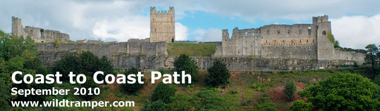
Richmond Castle, circa 1071
Click c2cReport2010.pdf for a copy of this report, OR click for a comprehensive set of Coast to Coast Path GPS waypoints, OR click to view my photo gallery.
Coast to Coast Path ~ September 2010
Background
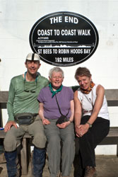
I did it. I walked 190 miles coast to coast across England from St Bees by the Irish Sea to Robin Hood's Bay by the North Sea. Joyously, I was treated with fine weather my last day so the walk along the North Sea cliffs was simply marvelous. I won't mention much of the weather in between, nor the bogs, nor the mud, nor the howling wind, nor the visibility when in mist and fog, but I will mention there were no mosquitoes. It was, however, a grand journey with stays at lovely inns, great food, stupendous beer, lots of local color, and especially the making of new friends. Returning to hectic city life I found a challenge.
My journey with two friends was 22 days, walking 18 days and relaxing 4, plus a couple of days beforehand to explore Carlisle and a few days afterwards to explore York and London. I walked an average of 10 miles a day with the shortest day being 7 miles and the longest 15. The relaxation days included a day in Grasmere, Kirby Stephen, Richmond, and Robin Hood's Bay.
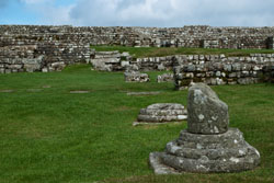
Housestead's Roman Fort |
This report describes my three week walk over Alfred Wainwright's Coast to Coast Path. Equally important, this report includes what to expect for weather, how best to navigate, what clothing & equipment to use, getting to/from the path, lodging & gear transfer, and a detailed itinerary & expense list with positive and a few negative comments.
Weather:
When my trip was in the planning, I read multiple times about England's fickled weather. Because September was touted as statistically drier, I counted on my good luck for sunny skies. Undoubtedly, I was in denial of what would come. As it turned out, the gods were not kind to me, and this September turned out to be wetter than normal. Of my time walking, 1/4 of the days had stunning weather, 1/4 had dry but overcast weather, 1/4 had misty weather, and 1/4 had wet and stormy weather. Fortunately, the gods did grace me with fine weather for my relaxation days in Grasmere, Kirby Stephen, Richmond, and most of my pre holiday in Carlisle and post holiday in York and London.
Pathway Through Hadrian's Wall |
Less than optimum weather as it was, I found the adversity of walking in sometimes a foul climate a minor concern. Armed with good quality rain pants, Gortex rain shell, gators, and boots, I was prepared with what the elements had to deliver. I always wore gators to keep the always wet track from soiling my feet, most of the time I wore rain pants, and when the weather turned foul I donned a Gortex rain shell.
Let me make this perfectly clear, you will go off path at some point walking the Coast to Coast. The important consideration is to learn of these errors and recover as soon as possible. In my opinion, there isn't any one navigation aid that will keep you on path, rather I recommend a minimum of two. These are a set of Ordinance Survey of Great Britain (OSGB) maps of the route and a GPS unit. A GPS unit will tell you where you are, while the OSGB maps will identify your location. Additionally, a guide book such as Henry Stedman's "Coast to Coast Path" can be both useful and informative.
WP |
Grid |
Elev |
Description |
Take-Along Waypoint Guide |
C001 |
NX9615 |
8 |
St Bees - Start of C2C |
|
P001 |
NX9743 |
53 |
Fleatham House, St Bees |
|
C002 |
NX9456 |
23 |
Fleswick |
|
P003 |
NX9412 |
89 |
St Bees Lighthouse |
|
C003 |
NX9410 |
57 |
Bear R, follow coastline |
|
C004 |
NX9565 |
97 |
Quarry bungalows, head S |
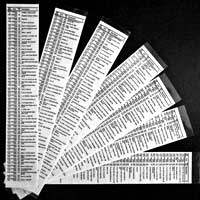
Before my walk, I searched the web for a set of free waypoints of the Coast to Coast Path for my GPS. After finding a couple of similar sets, I created a new value-added set which now identifies the main path from numerous alternate paths comprising more than 700 waypoints. I also created a Take-Along Guide which identifies each waypoint, a milepost, OSGB coordinate, elevation, % grade, and a brief description. A snippet of this guide is illustrated, while clicking on c2cWaypoints links you to this comprehensive set of GPS waypoints and their usage.
When my companions and I were walking, I personally relied on my Garmin 60C GPS with downloaded waypoints and 1:25000 maps of the Coast to Coast Path, while my friends preferred Stedman's "Coast to Coast Walk" guidebook. The maps I used came from Martin Wainwright's book "The Coast to Coast Walk," and I extracted the appropriate maps from the book for the next day's walk and placed them in a waterproof (Ortlieb brand) 9"x11" map carrier. I found using a map carrier both reliable and convenient, much more so than cumbersome sheet maps.
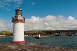
Whitehaven Harbor & Lighthouse |
Throughout this document I reference many obscure places with OSGB coordinates, an example of one such place is Robin Hood's Chair (NY10060/15146).
Navigation Issues:
• Probably my best example of navigation confusion occurred between Shap and Orton near Oddendale (OSGB coordinate NY59185/13460). Much of the day's walk was through rolling fields bounded by yet more stone walls and yet more rows of trees. On this day you can't help but notice on any map the numerous right and left turns alongside other established paths. My companions using Stedman's book thought we were about 1 mile further along than we actually were, and insisted we turn left to follow a row of trees as Stedman's book indicated. However, my GPS along with Ordinance Survey maps answered the explicit question of where are we, thus to learn that we should bear right. Had we not had a GPS and appropriate maps, we would have traversed far off track in likely utter confusion.
• Through much of the Lake District, Coast to Coast signing does not exist, presumably, I am told, to maintain the solitude of the path. Of course this makes route finding more difficult, especially when well defined tracks don't exist. On the stormy day of my walk from Rosthwaite to Grasmere past Greenup Gill and near a saddle (NY28594/10741) the track became boggy and indistinct. Although there were numerous cairns, there was no signage, and it then became confusing where and how much to bear left to head downhill. Bearing left too soon as I initially did could have led me down an alternate path that ultimately follows Wyth Burn, rather, with the aid of my GPS, I corrected my heading towards Far Easedale Gill.
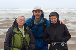
Friends at St Bees Beach |
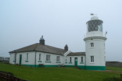
St Bees Lighthouse |
• Along the path, I found two road crossings especially dangerous. The most hazardous was at Catterick Bridge (SE22733/99365) on the day's walk from Richmond to Danby Wiske. Here, during the morning's traffic, the walking path crosses several intersecting roadways all vying to merge and cross the Catterick Bridge. Because the road crossings appear rural, they gave the false impression of safer, which it was definitely not. The other dangerous crossing was at busy A19 (NZ44252/01142) on my day's walk from Danby Wiske to Osmotherley. But unlike the Catterick Bridge crossing, this danger was better managed by the crossing of the southbound lanes to a medium and then the northbound lanes to the far side.
• On the day from Littlebeck the main route bears right from Midge Hall in Little Beck Wood to cross a footbridge and then a ford over May Beck. But the night before was one of continuous rain and thus the becks were running hard. As a result, a ford over May Beck was not safe. Rather, at Midge Hall I beared left over a different footbridge, then immediately crossed a road bridge, and then beared right adjacent to May Beck on an alternate path to connect with the main route.
Equipment:
Narrows of Nannycatch Beck |
Clothing:
While walking I always wore nylon pants, long sleeve silk shirt, sturdy waterproof boots with wool socks, gators, and a hat. When the temperature cooled down I added a nylon shirt and/or Gortex shell, and when the weather turned wet I also donned rain pants. While walking I almost never required any additional layers to stay warm, but my day pack always included a fleece shirt, wool cap, and light weight gloves that I sometimes used when taking a break. I recommend walking only with fast drying, wicking fabrics (e.g. nylon, fleece, and wool) and to stay away from cottons because as the adage says cotton kills, and while I personally like the feel of silk, in truth it doesn't wick well and wool/synthetic are generally more appropriate materials.
I strongly recommend bringing a bomb-proof rain jacket. Bomb-proof means a rain jacket that is made of seam-sealed, three-layer-laminated, Gortex fabric, and a jacket with proper head protection, that is a hood that stays in place in heavy rain or wind, and a shell length sufficient to cover part of your lower body. I own both three-layer-laminated Gortex and lighter two-layer-lamented rain gear, and I have learned that the lighter weight materials do not stand up to prolonged foul weather. It pays to use what I call bomb-proof construction for best prolonged comfort in inclement weather as you will likely experience at some point along the Coast to Coast Path.
Robin Hood's Chair |
Ennerdale Water |
Like rain jackets, I own various grades of rain pants. For the Coast to Coast walk, I used a good quality, light weight, waterproofed and breathable, nylon rain pant rather than bomb-proof Gortex. I wore my rain pants more than half of the days. Whether sunny skies or not, I always wore gators to protect my legs from the wetness of the track and at other times from the mud and the bogs. I brought two hats, one to keep the sun off my thinning hair and the other with a large brim to shed rain from my face.
What I Carried:
I carried a small 25 liter day pack outfitted with a 2 liter Platypus through-the-straw drinking system. Among other things, the pack contained a personal first aid kit [dental floss, iodine, paper tape, nitrile gloves, second skin, protective mask for first aid/CPR, ibuprofen, acetaminophen, moleskin, various bandages, sew kit with various needles, scissors], survival kit [knife, whistle, duct tape, matches, fire starter, compass, various plastic bags, emergency personal survival bag, mirror, small flashlight], LED headlamp, extra batteries, bandana, emergency TP, ditty bag [sunscreen, lip balm, deet (never used), hand sanitizer, eye drops], fleece shirt, wool cap, fleece gloves, and pack rain cover. Attached to the pack was a Garmin model 60C GPS with downloaded waypoints. I carried a walking stick.
Other Logistics:
Valley of Loft Beck |
Reference Books and Maps:
• "Coast to Coast Path" by Henry Stedman is an excellent comprehensive book of the path. It includes numerous hand drawn maps of the route with detail to local terrain. It has sections on where to stay and eat and includes accurate maps of villages. It also includes various other information such as flora & fauna, weather, public transport, and the like. Although I recommend this book for anyone walking the path, the maps are not to scale and do not include OSGB reference coordinates, thus I found the maps often lead to confusion as to where you might be. The 4th addition of this book includes a limited set of GPS waypoints, but this set is far too few to be useful. Rather, view my version of waypoints for the path described briefly in this document and in detail on my website (www.wildtramper.com).
• "The Coast to Coast Walk" by Martin Wainwright has very excellent 1:25000 scale maps of the route and identifies notable features along the way. I found these the easiest to read maps of those I purchased, and I chose to disassemble the book for the maps and then assembling the maps into a waterproof (Ortlieb brand) 9"x11" map carrier of one day walks. This made for a very convenient way to reference my GPS to OSGB coordinates of "where am I" so as to reference the map to "that's where I am."
• Harvey's "Coast to Coast West" and "Coast to Coast East" polyethylene maps are continuous strips to 1:40000 scale. These maps identify both main and alternate routes. I found these maps useful to absorb a days journey, but the smaller scale and the large physical format I found cumbersome to use on the walk, preferring the maps of "The Coast to Coast Walk" by Martin Wainwright.
• "Coast to Coast Walk" by Paul Hannon is more or less a compact version of Henry Stedman's book including hand drawn maps (also without OSGB reference coordinates) and some description, but no other information.
• My GPS was downloaded with Great Britian contour maps. Although these maps should be available through your GPS manufacturer, I chose to use free open source maps from Talky Toaster, and I found these maps were both detailed and reliable.
Wordsworth's Dove Cottage |
Gear Transfer & Lodging:
Unlike most people who walk the Coast to Coast, I booked my own lodging, whereas most use either Packhorse or Sherpa Van to arrange accommodations and baggage transfer. If you choose to book as I did, I recommend booking early. I booked nearly a year in advance and was thus able to pick nearly any B&B or inn. I then selected Packhorse as my baggage transfer service, and I would give them my highest recommendations for their service and also because they are local to the Coast to Coast route based out of Kirby Stephen. One group of people I met along the path used Packhorse to first book half their route, and then when they decided on their ultimate walking rate they instructed Packhorse to complete their bookings. Another group mentioned that Packhorse had a prebooked package for their size group already set up about two weeks before departure. Of course I recommend to book as early as possible.
Ruthwaite Lodge |
The table at the end of this report identifies the bookings I used along with price, telephone numbers, web IDs, etc. Stedman's book identifies various lodging along the route, and the Sherpa Van website lists numerous lodging along with patron ratings. I found both these references of recommendations spot on.
Cell Phones:
Any unlocked, 4-band, GSM cell phone should work fine in England, the trick is to purchase the correct service provider. Mistakenly, I purchased a SIM card and minutes from T-Mobile, and then learned it had little to no service across the Coast to Coast Path. One of the locals I spoke to recommended Orange as a service provider, but I suggest that before you make a decision check the advertised coverage via the web. Assuming you pass through Carlisle on your way to the start of the walk in St Bees, you can go to any of a number of convenience stores to purchase a SIM card and minutes.
Tall Ship Lord Nelson
|
Train Tickets:
There are many ways to book train travel, but I choose TransPennine Express. By booking early and by being moderately flexible with travel times (such as off-peaks hours) and by traveling standard class, I was able to book train travel at rock bottom prices. My train travel expense was £91.70 including: London (Euston Station) to Carlisle at £28, Carlisle to St Bees at £9.50, Scarborough to York at £15.20, and York to London (Kings Cross) at £39.00. My companions preferred to travel in more comfort and booked first class rail passes at a senior rate for about twice my expense. If you plan to use a rail pass I suggest booking the travel from Carlisle to St Bees at £9.50 separately if this is your only train travel that day.
The Walk:
Two Days Before ~ Carlisle: As luck turned out, the Hallmark Hotel in Carlisle was located exactly next to the train station, so I was given pleasant payback for the turmoil I endured from that day's London Tube strike and my diversion from Heathrow Airport to reach the Euston train station. It was an arduous day (or days) traveling from the States to begin my long awaited holiday. My companions and I decided to spend the first full day visiting Hadrian's Wall before moving onto the start of the path at St Bees.
The Day Before ~ Hadrian's Wall: Hadrian's Wall was at one time 80 Roman miles (73.5 statute miles) long. I visited a small segment near Housesteads Roman Fort. Local bus service from Carlisle made getting to and from easy. The fort, now but a skeleton of ruins, was impressive. From the fort I walked along Hadrian's Wall for about 3 miles, then returning to the bus route at Once Brewed / Twice Brewed Inn. This inn's fame began in 1934 as a youth hostel that opened adjacent to Twice Brewed Inn. At the time of the grand opening Lady Trevelyan, a staunch teetotaler, said "Of course there will be no alcohol served on these premises so I hope the tea and coffee will only be brewed once."
Footbridge over Grisedale Beck |
Grisedale Beck to Patterdale |
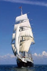
Day Zero ~ St Bees: My companions and I were on our way to St Bees, hopping on the 9:40 train. One hour later we reached St Bees. Our hosts from Fleatham House were waiting to transport us one short mile to their lovely inn or maybe I should call it a stately manor in a wonderful garden setting. I was given the honor of staying in one of the state rooms with views of the garden, which I understand Tony Blair had used years earlier. Our hosts offered us tea and scones, and then offered to drive us to nearby Whitehaven. At Whitehaven we walked the harbor, arriving to the thunder of canon fire and a tall ship departing. Wandering to the canon, we inquired and learned that its significance was as a salute to tall sailing ships entering or leaving the harbor. On this day and hour the tall ship Lord Nelson was departing. We viewed the ship with sails lowered, it was being escorted through the narrow harbor gate. The ship was on a 100-day voyage around the UK and crewed by members of Girlguiding UK.
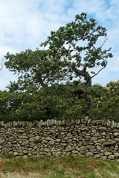
Stone Wall |
Day 1 ~ St Bees to Moor Row: It was a short walk to the beach along the Irish Sea to the start of the Coast to Coast Path, and it was then time for the ceremonial ritual to ensure safe travel. At the beach, I selected three stones. Two I carried with me to Robin Hood's Bay and one, while dipping my toe into the water, I cast into the Irish Sea to plant my essence. It would be three weeks later when I would cast one of my two remaining stones into the North Sea to join a bridge of essence of my journey, and the third stone I would take home as a remembrance of my travels.
After my sense of worthiness was granted by the gods, and in stormy weather, I headed north along the Irish Sea cliffs. The well marked path skirted pasture land high above the sea, but the blowing mist made the views meager. The lighthouse along St Bees Head, shrouded in fog, was silent except for grazing cows.
This first day was a short walk of 7 miles ending at Moor Row. Arriving in early afternoon in light rain I found a tea shop with sheltered, outdoor seating, and enjoyed a chat with the friendly proprietor. I learned this tea shop was the only food service in town, that it stayed open only through late afternoon, so I ate more than I had planned. Later, I walked across the street to the nearby Jasmine House. Under new management, the sign on the locked entrance indicated they would return at 4:00 but it was closer to 5:00 when I was admitted. Their late arrival and other demeanor left me the conclusion that the proprietors were unappreciative. In retrospect, Moor Row, without food and questionable lodging, was a place I would not recommend.
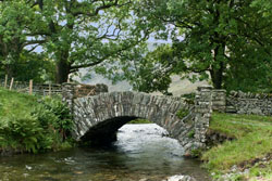
Lovely Bridge |
Day 2 ~ Moor Row to Ennerdale Bridge: It was another short day, 7 miles to Ennerdale Bridge, but along the way were wonderful sights. Unlike the stormy weather of the first day, this day started with clearing skies to the west and the tail end of a storm to the east. From Moor Row, through Cleator, I walked to Black How forest and then up to Dent Summit. Along the way were panoramic views to the west and the Irish Sea. After the summit, I choose the more scenic but steeper of two paths down to Nannycatch Beck. Yes, the path was steep, but even squeamish me quickly realized that the footing downhill was excellent, and the views made this path an outstanding choice. Along Nannycatch Beck under dappled skies I began to sense the grandeur of the Lake District, albeit its fringes. The day ended in early afternoon at the Shepard Arms where I enjoyed an afternoon pint of local cask beer. This was my first cask beer, and as I journeyed I particularly enjoyed the complex, full bodied flavor that had a typical low 4.6% alcohol content leaving me to savor the beverage rather than to wallow in a buzz. I can't say I had a favorite, I enjoyed so many. Besides, a favorite would be impossible as every pub seemed to have their own local brew.
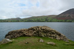
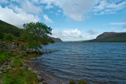
Day 3 ~ Ennerdale Bridge to Rosthwaite: I was blessed with fine weather for my first challenging day, 14 miles. After a short walk from the Shepard Arms, I reached the dam at Ennerdale Water where the track followed the southern shoreline. As the track turned southeast from easterly I reached Robin Hood's Chair (NY10060/15146), it resembled less a chair than a vantage point along the water's edge. Further on I observed a rare sight, the swimmer of Ennerdale Water who was donned in a swimmer's wet suit. As he reached the southern shoreline he commented he made this swim three times a week.
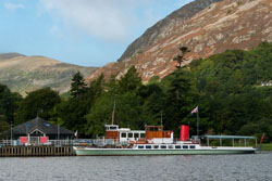
Ullswater Steamer |
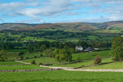
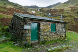
Pastorial Countryside |
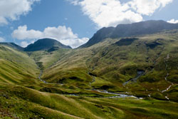
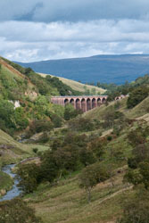
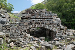
From the headwater of Ennerdale Water I followed the River Liza along its north side. Throughout my journey I always choose the easier main path even though on this day the weather was fine to tackle Red Pike and High Stile. On this spectacular Sunday the walk along the River Liza was enjoyed by numerous adventurers, and I saw more people on this day than any other day of my Coast to Coast walk, save maybe my final day with its walk along the North Sea Cliffs. At the Black Sail Hut I brewed a cup of tea (£1.20 donation), ate lunch, and relaxed. Afterwards, I followed the track alongside rising Loft Beck walking on a well laid path of stone stairs gaining roughly 1000 feet elevation to nearby Grey Knotts. From there I walked downhill to the old tramway and to the Slate Mine Visitor Centre. At the Visitors Centre I took another break purchasing tea and a scone, and walked around to learn of the mine's history. From the mine, the path paralleled B5289, then to Seatoller, and finally to Rosthwaite. At Rosthwaite I stayed at the upscaled Scafell Hotel where my companions and I had a fine dinner.
Shap Abbey |
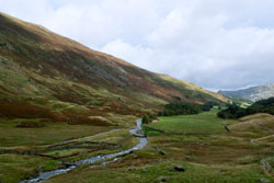
Day 4 ~ Rosthwaite to Grasmere: The morning brought wet, stormy weather, it was going to be an arduous day with much climbing and many fords. I can't help but wonder what this day would have been like under fair skies, the scenery would have been superb. From Rosthwaite the track followed Stonethwaite Beck up a track of often slippery stone stairs. Like the previous day, there were numerous adventurers, thankfully some had highly visible orange rain-pack covers to follow in the distance. As the track leveled off near the saddle between the peaks High Raise and Ullscarf the walk passed through extents of bog. Like so much of the Lake District, Coast to Coast signage does not exist, rather there are few cairns to identify the path. But in this saddle region, I found it easy to go off track. Had it not been for my GPS and the orange rain-pack covers I might have beared too left from the saddle down another path following Wyth Burn. Past the saddle there were numerous fords to cross. At Mere Beck the water was flowing dangerously fast, my companions and I were thankful to the helpful hand of another walker to cross safely. Soon afterwards, with so much rain, the path turned into mud bogs where at one point I had to assist my height challenged companion up a vertically steep bank, now of slippery mud. All this adversity was worth the effort, the hills were wonderful to be part of, even in this foul weather. I now walked down following Far Easedale Gill as the sky made a sorry attempt to clear. This was definitely a stunning place to be. After a five hour day of walking 9 miles, I reached Grasmere, the Glenthrone Guest House, and a well deserved relaxation day.
The Glenthrone Guest House was situated about a 3 minute walk north of Grasmere. Besides offering bed and breakfast, it had a quiet garden setting and had a wonderful, glassed-in conservatory to relax and chat with other guests. Although the guest house offered dinner meals, I found the family style service and meals not to my liking, rather I suggest walking three minutes into town to one of several excellent restaurants.
Homestead |
Day 5 ~ Grasmere: The morning brought dappled skies, a perfect relaxation day to explore Grasmere. The village was home to poet William Wordsworth who once described it as "the loveliest spot that man hath ever found." Dove Cottage, where Wordsworth lived much of his life, was a fine historic place to visit. Nearby was St. Oswalds Church with distinctive grave yard, and at the edge of town was Grasmere Lake. The village had numerous shops and restaurants.
Day 6 ~ Grasmere to Patterdale: This was my worst weather day, it also turned out to be one of my favorite. With a forecast of foul weather, my companions chose to peruse wool and yarn shops rather than tackle the elements. I walked from Grasmere to Patterdale solo in stormy weather where gusts of wind were periodically fierce enough to force me to hunker down in safety for fear of being blown off the ridge. Near the ridge top by Grisedale Tarn I met an old salty dog (with thinning hair, sun scoured face, and dentist's nightmare teeth) walking the reverse direction. We chatted a few minutes during a moment of peaceful weather when I told him of my two lady companions. He responded "Man is better without woman." And with that I kept a straight face and continued on.
Brother's Parting Stone |
With the weather in turmoil, the alternate paths along Sunday Crag or along Dolywaggon Pike were not reasonable, not that they were a choice for me anyway. But shortly past Grisedale Tarn, the skies cleared to mottled, and the wind and rain subsided.
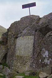
Soon I reached the memorial "Brother's Parting Stone" (NY35360/12440) where William and brother John Wordsworth last parted before John's death in 1805. The stone reads: Here did we stop; and here looked round / While each into himself descends, / For that last thought of parting Friends / That is not to be found. / Brother and friend, if verse of mine / Have power to make thy virtues known, / Here let a monumental Stone / Stand--sacred as a Shrine.
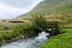
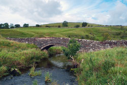
Further along stood Ruthwaite Lodge, and then a pleasant downhill walk along Grisedale Beck. I walked in the pure delight of photogenic skies. Reaching the Lovely Bridge (NY37342/15114) I said it was truly lovely. I reached Patterdale and the White Lion Inn with a brimming ear-to-ear smile. A day beginning with adversity ended as a lovely day.
Smardale Bridge |
Day 7 ~ Patterdale to Bampton: A short 10 minute walk north of Patterdale is the village of Glenridding and Ullswater. The lake is home to the Ullswater Steamer, offering transportation to How Town at mid lake and at Pooley Bridge at its eastern edge. A steamer ride to either How Town or Pooley Bridge and then an easy walk to Bampton provides an alternate activity to the traditional Coast to Coast Path. My companions and I choose the steamer ride. From Glenridding, the steamer ride took 45 minutes to How Town, and would have been another 30 minutes to Pooley Bridge had the past winter's rains not caused damage to the then closed pier.
From the How Town pier, I walked northeast along a track with simple elevation gain of improving views across the lake. My first destination was a stone circle (NY48272/22241). From the stone circle I traveled southeast to Bampton and the Mardale Inn.
The Mardale Inn was a delightful gem, offering superior rooms, service, food, and ambiance. When I arrived I sat in the charming pub to relax with a pint of beer and a light snack. That night I ordered the very best Steak & Ale Pie either I or my companions had on our holiday, and of course I had a pint to wash it down. If you're in the area, I highly recommend the Mardale Inn.
Smardalegill Viaduct |
Day 8 ~ Bampton to Orton: Another consideration for spending a night in Bampton is its proximity to the Shap Abbey. Wainwright's formal path stretches the day from Patterdale to Shap, thus at the end of the day when you're likely worn out you won't have proper energy to visit the circa 1199, Shap Abbey. However, with a morning start in Bampton, a visit to the Abbey was a morning delight.
The walk from Bampton to the Shap Abbey was about one hour, and the morning visit was a grand plan. With luck from the weather gods the photogenic morning light made the visit perfect. From the Abbey, I walked to Shap with a diversion at a tea shop for a late morning tea and scone. Past Shap the path meandered across open landscape with numerous stone walls and rows of trees. It was near Oddendale where navigating solely by Stedman's book might have failed, and this was largely because much of the repeated terrain looked alike so knowing your explicit position was difficult. I was happy I brought along a GPS and map to know where I was and where I should go.
Later in the day I sought out a short side path to Robin Hood's Grave (NY61724/10688). Other than a place with a famous name, it was not much to look at, mostly a large cairn next to a plot of rocks the size and shape of a grave. No doubt this is how legends are made.
The 15 mile, relatively flat elevation day ended after 6-1/4 hours. When my companions and I arrived at the Barn House in Orton, our gracious host directed us to relax in their third floor conservatory and offered us tea and scones. I even enjoyed their electric foot massager as I wound down from the long walking day. The Barn House was certainly a grand place to stay.
Temperance Hall |
Parish |
Day 9 ~ Orton to Kirby Stephen: Although the track from Orton to Kirby Stephen wasn't as spectacular as the Lake District, nonetheless I enjoyed this 13 mile segment. Along the way were numerous distinctive ruins, a stone circle, the Smardale Bridge, and the Smardalegill Viaduct. It was an easy walking day with plenty of time to contemplate the world (or maybe just the sheep in the pasture).
As I approached Kirby Stephen, I viewed the largest village since I left Carlisle before the start of my walk. The outskirts of Kirby Stephen were very domestic, while the center of town was bustling on this Sunday with auctions for what appeared to be for horses and ponies. The Black Bull Hotel seemed to be the center of action, with several horses tied out front, and I noticed I had to be careful where I stepped. I was looking forward to the next day for relaxation.
With a wide variety of places to eat, my companions and I chose the Mango Tree Indian Cuisine located in the market square. Their menu was extensive with many of my favorites. We all enjoyed the dinner and decided to eat there again the next day, the Indian food was a pleasant change from traditional pub food.
Maniacal |
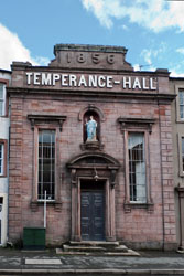
Day 10 ~ Kirby Stephen: Recovering from a cold, I spent most of the day relaxing rather than exploring. At lunch time I ate at the Mulberry Bush, located across from the Black Bull. The food and service was excellent, it was a worthwhile place to stop for a meal. Between the boredom of my runny nose, I found time for a walk around town visiting the Parish, Temperance-Hall, and other historic buildings. That evening my companions and I returned to the Mango Tree Indian Cuisine for another enjoyable meal.
Day 11 ~ Kirby Stephen to Keld: The weather turned foul again, and my hopes to view the Seven Standards diminished. I had heard that the route to the Standards was boggy and now it had reduced visibility from fog. Afterwards, I spoke with a walker who said he got off track on his way to the Standards to sink nearly waste deep into a bog, a time when he said he held his camera high to keep it dry. Of course he recovered, but that story put the day's route in perspective. So with that in mind the walk to Keld along the winter route hugging B6270 much of the way was just fine.
Swinner Gill Kiln |
Keld Lodge was a wonderful restored barn, nicely appointed with a friendly space to relax and chat. My room was called a Pod, and although it was tiny it was smartly laid out with both a sink and commode, and there was a shower down the hall. I liked the Keld Lodge, although I thought the food disappointing.
Day 12 ~ Keld to Reeth: With a day of fine weather I chose to walk the low route to Reeth. The path followed the ever scenic River Swale with its tea colored waters. Rather than walking the foot path near the river, I walked the nearby road above the river with panoramic views. Along the way I diverted to the pleasant village of Muker, and while there my companions delighted in their visit to Swaledale Woollens, a wool and yarn shop. I, rather, passed my time next door at the most excellent Crafts Shop and Gallery.
I retraced my steps from Muker to follow the road along side the River Swale. At about noon I was in Gunnerside, a time for lunch. The Kings Head Pub was along the walking path, and was a friendly place to stop. After a proper lunch I was on my way, walking again alongside the River Swale.
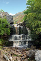
Swinner Gill Waterfall |
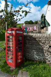
Telephone & Laundry |
With the numerous stops over the day, I reached Reeth in late afternoon, but the variety of the day's exploration made for a most enjoyable excursion. In Reeth, I checked into the Black Bull Hotel. The hotel itself was an enigma of confusing stairways, stair treads severely out of plumb, and passageways with low clearance, all tolerable idiosyncrasies, but the plumbing in my room was, simply put, out of character.
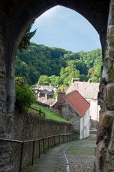
Day 13 ~ Reeth to Richmond: The walk from Reeth to Richmond was quiet and uneventful across pastoral green farm land. With little elevation change, it was an easy day. After 4 hours and 11 miles I reached the wonderful town of Richmond. Soon I found the Black Lion Hotel on Finkle Street.
The Black Lion Hotel was a true find. Not only did it have superb location in Richmond, but the rooms, the pub and its food, the breakfasts, and especially the staff service were top notch. For £5 they did a bag of laundry, sorting the fast drying synthetics from the slow drying cottons. The excellent breakfasts were in their fine dining room away from the hustle of the pub. I can't help but complement their always brilliant service.
That night my companions and I and two new friends from New Zealand had dinner at Rustique, this would be the last time on the path we could meet as they would now be a day ahead. Rustique was a French restaurant on Finkle Street. We all ordered different starters and mains, and not only did each have a dazzling presentation, each was prepared for succulent dining, and everyone agreed that their meal was the best. Besides enjoying the best meal I had (or would have) on this journey, the fine dinner was a great way to say until we meet again.
Station Road, Richmond |
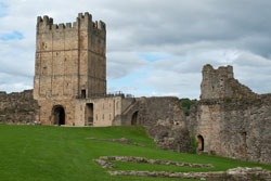
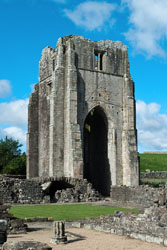
Richmond Castle |
Day 14 ~ Richmond: Richmond was my favorite town that I visited while on holiday, and that also includes my post holiday visits to York and London. On this relaxation day, I had a full and delightful day exploring under dappled skies in the morning and a bit of rain as evening approached.
With morning light, I walked that part of the Coast to Coast Path that has views of the Richmond Castle (circa 1071). From there I walked to Easby Abbey (circa 1152) to explore the expansive and impressive ruins, and while there I was amazed at its size, extent, and amazing stone architecture.
At noon I circled back to The Station, a wonderfully restored train station now used for community activities. At the Station were a cinema, art gallery, brewing company, ice cream parlor, restaurant, plus others. At the restaurant, I eyed the tuna nicoise salad, a most excellent choice of fresh mixed greens, perfectly grilled tuna loin, and the usual sides of new potatoes, green beans, tomatoes, et. al. Being a glutton, I also submitted to the call for a chocolate brownie as desert. It was all very good.
In the afternoon, I toured the Richmond Castle. From the outside during my morning walk the castle looked imposing, while this afternoon from within the castle grounds it had an expansive feel. Besides exploring the grounds, I walked the many stairs up the tower. The stone mason work was impressive, many of the walls were several feet wide, and all this was designed and built close to a millennium ago in 1071.
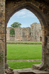
Easby Abbey |
Afterwards I visited the Richmond Museum, learning the history of this delightful town. That evening I attended the historic Georgian Theatre Royal (circa 1788) to see a fun play called Pedal Power. It was a grand day.
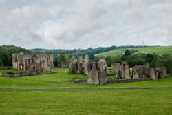
Easby Abbey |
Day 15 ~ Richmond to Danby Wiske: It was quiet day, walking largely on hardtop to Danby Wiske under threatening skies. But the excitement of the day was the managing of the very dangerous Catterick Bridge, and here automobile traffic merged from several directions making a safe crossing challenging.
The day ended at the Ashfield B&B, a place with fine hosts. My companions and I had a great dinner of salmon and fresh vegetables at the B&B, while my companions brought in glasses of wine for themselves and I a pint of beer from the nearby pub, later returning the empties.
Day 16 ~ Danby Wiske to Osmotherley: It was another quiet day, although this day the walk was predominately on foot path. Again the excitement of the day was the managing of a major road crossing, this time highway A19. But the A19 was easier to navigate than the Catterick Bridge. That was because the high speed A19 traffic approached first only from the north which was followed by a safety medium in the middle and then followed by high speed traffic that approached only from the south.
Black Sheep of Osmotherley |
As the day wore on I reached Ingleby Cross hoping for a quick refreshment at the Blue Bell Inn. Sadly the posted hours indicated it would not open until evening. I continued on through the Arncliffe Woods, a disappointing stand of farmed trees. Finally I reached Osmotherley.
Osmotherley was a quaint village, a quiet place to relax and enjoy a luxurious holiday. I stayed at The Three Tuns Inn, both a fine restaurant and a B&B. Throughout, The Three Tuns Inn had finely appointed decor, and I particularly thought the hand-forged wrought iron a handsome accent. My room was equally pleasant. I had both a light lunch and full dinner at the B&B, both meals were outstanding. Maybe the best part of walking day after day was that my appetite was propelled into overdrive, so much better for a fine meal.
Lord Stones |
Day 17 ~ Osmotherley to Clay Bank Top: After two quiet days, I was thrilled to again experience varied terrain. The day brought several significant features, the first was much of the path was paved for miles in stone, something that gave the walk an old world charm. While the stone mitigated erosion, it also resulted in difficult footing from the damp skies.
This was also a day of many moors. That is to put it succinctly: The open, often hilly, expanse of land characterized by wet, spongy, peaty soils and vegetation such as moss, coarse grass and heather. Additionally, the day was one of expansive views when atop the moors. And the day was one of growing winds and as the day progressed of driving rain.
Fortunately the start of the day brought only overcast skies. From Osmotherley I skirted much of the Arncliffe Woods to rejoin the Coast to Coast Path midway. It was from there that the paved stone began. Up Beacon Hill then down, and then up to Live Moor and Carlton Moor and down again. It was now noon and I was near Lord Stones.
Memorial on Cringle Moor |
Lord Stones, a cafe and tea room built into the moor nearby Carlton Bank, had an architecture of a monumental bunker. At the cafe I escaped the now windy, overcast, but dry skies for a lunch of tea, soup, and scone. On this Sunday the cafe was bustling from both walkers and car patrons. At the nearby plateau hang gliders were airing their craft, while further down the walking path a radio controlled glider slithered through the sky.
Lunch in the warm cafe was not long enough, but I had to be on my way. I then climbed Cringle Moor in bustling winds and then Cold Moor when driving rain joined the winds. I continued on to the Wain Stones, viewing their massive and impressive arrangement. By now, with the mood of the weather foul, I opted down to a forest road to the north. While preparing for my Coast to Coast walk I created a set of GPS waypoints to guide me to this forest road in anticipation, at that time, that the route down from White Hill to Clay Bank Top was steep and nasty. In any case, I was all smiles as my GPS fulfilled its guidance, I was now walking the safe, mostly dry, mostly windless forest path to Clay Bank Top.
At Clay Bank Top I walked to the nearby car park for a car pickup from the Wainstones Hotel. But luck as it be, I had no cell phone service. Rather, walked the remaining 2-1/2 miles downhill, along B1257, to Great Broughton.
Lion Inn at Blakey Ridge |
Although it had been a long day with moderate adversity, the day was thoroughly enjoyable. The scenery was new and varied, my stop at Lord Stones was pleasant and while at Lord Stones I encountered yet another couple (with their Coast to Coast dog) who would become new friends, and along the way were numerous interesting features.
The Wainstone's Hotel was out of character with the other inns and B&Bs along the Coast to Coast Path. It was more a business center than a quaint rural hovel. The 1970s avocado green bathroom decor said it all. But the shower felt good, dinner served its purpose, and I had a fine night's sleep.
Day 18 ~ Clay Bank Top to Blakey Ridge: Back at Clay Bank Top, the walk to Blakely Ridge was a day of no views, none! Clouds hung low and the track along the moors was shrouded in mist and fog. Fortunately, navigation was manageable with most of the day's path along a meandering dismantled railway, and with the assistance of my GPS I had confidence of staying on track. I reached the Lion Inn at Blakey Ridge in early afternoon.
Fat Betty Cross |
The Lion Inn is located on Blakey Ridge at 1625 feet, and is a 16th century stone freehouse. Like so many reused stone structures, the Lion Inn had numerous weird and wonderful passageways with low clearance, and they all added character to the inn. The Lion Inn had a magnificent pub with a wide selection of cask beers and a tall menu, while portions for meals beat all standards for those who are either very hungry or for couples who prefer to share. Like Lord Stones, the Lion Inn was a destination that had to be visited.
Day 19 ~ Blakey Ridge to Glaisdale: Morning brought more fog, but the route to Glaisdale was all down hill so I had hopes of walking into drier weather. Near the Lion Inn, along the road, were several historic markers. The first was the Margery Bradley Stone (NZ67515/01282) just north of the Lion Inn, then further along the same road, but slightly off path along the hardtop, was Young Ralphs Cross (NZ67724/02094), and lastly on path was Fat Betty's Cross (NZ68225/01995). As hoped, the declining elevation brought drier weather across the moors. All in all, it was an uneventful, easy day. I reached the village of Glaisdale and then continued another mile to the Glaisdale Station and to the Beggar's Bridge B&B.
The Beggar's Bridge B&B was yet another example of wonderful hospitality and a place with a fine conservatory to relax with a view of the Beggar's Bridge. A short walk from the B&B was the Arncliffe Arms Free House, a delightful pub where not only did I enjoy their cask beer, but I savored their cuisine. This was a pub with a menu of fine dining in addition to traditional pub fare. The new owners employed a fine chef to prepare their excellent meals.
Grosmont Steam Train |
Day 20 ~ Glaisdale to Littlebeck: I was looking forward to the variety of this day's walk, and the overcast skies was not going to deter my enjoyment. From the Beggar's Bridge, I walked alongside the River Esk through East Arncliffe Wood. Here much of the path was paved with stone, and you can't help but notice the concave shape of the stone pavers as they have been worn through time. Certainly a pleasant beginning to the day. From the wood I passed through the village of Egton Bridge, and then on to Grosmont.
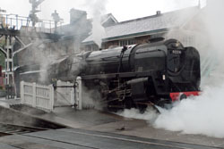
Grosmont (pronounce grow-mont with silent s) is home to the North Yorkshire Moors Railway. I had hoped to arrive in time to catch a steam train for a short round trip ride, but the train which was about to depart was not scheduled to return to Grosmont anytime soon. Rather, I enjoyed watching the train start its journey, steam bellowing from the locomotive in ear-deafening shrieks. While in Grosmont I visited the train yard and museum, and then relaxed in a tea shop for a well deserved tea and scone.
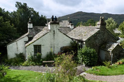
From Grosmont I continued onto Littlebeck for my last night's stay before reaching Robin Hood's Bay. I stayed at the lovely Intake Farms, located one mile off track. After being spoiled with numerous gracious hosts along the route, my hosts at Intake Farms once again made me feel at home. By the time I arrived, the weather had turned wet, so my hosts suggested I get comfortable in their study, now with a roaring wood fire in an impressive stone fireplace to remove the chill. While relaxing, I was offered tea and cakes, and I had an enjoyable time chatting with other visitors. As Intake Farms was one of but few lodgings nearby, it was the only place where a walker could get a meal. I had a fine family style dinner with my companions, with others staying at the farm, and with a few others staying nearby.
North Sea Cliffs |
Day 21 ~ Littlebeck to Robin Hood's Bay: After an overnight of continuous rain, the morning brought a delightful blend of dappled and clear skies. The rain had caused Little Beck to swell, and after I retraced my steps to the village of Littlebeck the water from the beck flooded the road. Rather than ford the rushing waters, I walked the nearby footbridge.
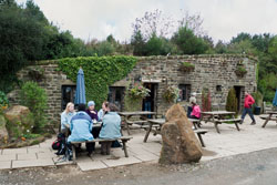
I then walked through Little Beck Wood, its creek rushing hard, and the landscape glistening from the recent rain. Along the wood was The Hermitage, a structure that is thought to be hewn out of a single rock in 1790. Further along Little Beck Wood was Falling Foss and Midge Hall Tea Garden.
The main route from Midge Hall bears right to cross a footbridge and then a ford over May Beck. But with the overnight rain, a ford over the beck would have been difficult. Rather, at Midge Hall I beared left over a different footbridge, then immediately crossed a road bridge, and then beared right over an alternate path to soon connect with the main route.
Robin Hood's Bay |
At the southernmost locale of Little Beck Wood the path turns north along hardtop passing numerous farms. Soon the path follows B1416 to reach the expanse of Low Moor. The path through Low Moor was in general easy to follow and was well signed. It was however extremely boggy and there were often side paths that led off route. I found I had to be careful to follow the correct set of footprints and to watch the horizon for the next posted Coast to Coast sign to stay on track. At one point when I followed the wrong set of footprints into a wet bog, I was able to return to the correct route with the aid of my GPS and the careful eyeing for the next Coast to Coast signpost. In the middle of the bogs of Low Moor I had my first view of the North Sea, it was a momentous occasion.
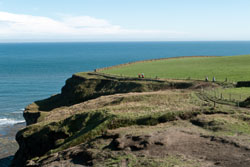
Before noon I reached Hawsker and hoped to stop at the Hare and Hounds for lunch. It was, however, not scheduled to open for another 30 minutes, so I chose to continue. I reached the North Sea cliffs to brilliant skies in early afternoon. The walk along the cliffs was stupendous, a well earned and delightful milestone. On this midweek on the last day of September the cliffs were being enjoyed by numerous walkers and explorers alike.
At the end of the cliffs I reached Robin Hood's Bay. It was a quaint fishing village with a 19th century charm. The steep narrow streets were lined row after row with terraced, stone cottages often haphazardly organized. The village of Robin Hood's Bay was a perfect location to conclude this fabulous journey.
By reaching the Bay I was now entitled to close my journey. Carried now 190 miles, I removed the two remaining stones from my day pack previously collected on the Irish Sea beach at St Bees. One was white quartz and the other granite. As a remembrance I returned the white quartz stone to my day pack. I then sidled down the now low tide beach, dipped my toe into the water, contemplated a moment, and cast the granite stone into the North Sea so that my essence would mingle with the stone I cast three weeks earlier into the Irish Sea. My journey was now complete.
Whitby Harbor |
My last lodging was at the Boat House B&B, located just a few feet from the beach of my journey's end. Across the way was The Bay Hotel & Wainwright's Bar, a place where I signed the Coast to Coast register and ordered a pint of beer in celebration. That night my companions and I and new friends had a celebration dinner at Wainwright's Bar. It was a most fitting close to a brilliant walk.
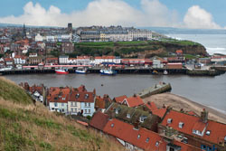
Day 22 ~ Robin Hoods Bay: Yet another day of threatening weather. This day my hosts from the Boat House offered to drive my companions and me to the nearby town of Whitby, just north of Robin Hood's Bay. So that morning I set out to be simply a tourist. Whitby was an expansive version of Robin Hood's Bay, with organized rather than haphazard streets and cottages. The harbor vicinity was lined with businesses and homes, some terraced along the backdrop of hills. At the end of the harbor boardwalk was a handsome stone lighthouse, it was built in 1831 and stands 83 feet tall. Near and above the harbor was Whitby Abbey. Numerous shops lined the harbor area and my companions perused yet another wool and yarn shop. After a light lunch at a tea shop I returned to Robin Hood's Bay. That evening my companions and I had a spectacular meal at Bramblewick.
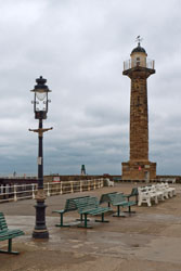
Whitby Lighthouse |
The Days After: I joined my companions for an early morning taxi ride to Scarborough, and then a train to York where they continued onward to London, Heathrow airport, and home. I, rather, spent the next two days in York, and then three days in London. York was a fine town with lots of history. Although I enjoyed my time in York, I found it too peopled as compared with the days of my Coast to Coast walk. Then of coarse there was London where nobody makes eye contact, let alone engage in conversation. As I progressed from Path to York to London, the cost of dining increased, but more notable were the shapes of people as they went from fit to often fat. York was fine, London was ok, but I preferred the peaceful and serene enjoyment of the rural space found along the Coast to Coast Path.
Detailed Itinerary & Expenses:
The table below lists the places I stayed, various places I ate, and expenses I incurred along the Coast to Coast Path but not including my pre holiday in Carlisle nor my post holiday in York or London. The expense column is listed in English Pounds, while the totals at the top of the column are in both Pounds and approximate 2010 US Dollars. Unless otherwise stated, all lodging is for single, ensuite rooms with bed and breakfast. The comment column generally denotes favorable impressions, but there are exceptions.
|
Date |
£2,303 |
Description |
Comments |
|
|
£52 |
• Guide books and maps: Coast to Coast Path by Henry Stedman,
The Coast to Coast Walk by Martin Wainwright,
Coast to Coast Walk by Paul Hannon,
Harvey's Coast to Coast Map.
|
|
|
9/7 |
£15 |
• Arrive Heathrow, Express/Walk Euston Station
|
• Oops, undergound on strike!
|
|
9/8 |
|
• Visit Hadrian's Wall, take bus to/from
|
|
|
9/9 |
£10 |
• Take train (Northern Rail) Carlisle to St Bees
|
• Fleatham hosts met us at train
|
|
9/10 |
|
• Walk St Bees to Moor Row
|
|
|
9/11 |
|
• Walk Cleator to Ennerdale Bridge
|
|
|
9/12 |
|
• Walk Ennerdale Bridge to Rosthwaite
|
|
|
9/13 |
|
• Walk Rosthwaite to Grasmere
|
|
|
9/14 |
£36 |
• Layover day, stay Glenthrone, see previous |
|
|
9/15 |
|
• Walk Grasmere to Patterdale
|
|
|
9/16 |
|
• Walk Patterdale to Burn Banks, then off track to Bampton
|
|
|
9/17 |
|
• Walk to Shap Abby, to Shap, to Orton
|
|
|
9/18 |
|
• Walk Orton to Kirby Stephen
|
|
|
9/19 |
|
• Layover day, Kirby Stephen
|
|
|
9/20 |
|
• Walk Kirby Stephen to Keld
|
|
|
9/21 |
|
• Walk Keld to Reeth
|
|
|
9/22 |
|
• Walk Reeth to Richmond, stay
|
|
|
9/23 |
£40 |
• Layover day, stay Black Lion Hotel, see previous |
|
|
9/24 |
|
• Walk Richmond to Danby Wiske
|
|
|
9/25 |
|
• Walk Danby Wiske to Ingleby Cross, then to Osmotherley
|
|
|
9/26 |
|
• Walk Osmotherley to Clay Bank Top, call for pickup
|
|
|
9/27 |
|
• Walk Clay Bank Top to Blakey Ridge
|
|
|
9/28 |
|
• Walk Blakey Ridge to Glaisdale
|
|
|
9/29 |
|
• Walk Glaisdale to Grosmont (steam train) to Littlebeck
|
|
|
9/30 |
|
• Walk Littlebeck to Robin Hood's Bay
|
|
|
10/1 |
£60 |
• Layover day, stay Boat House, see previous
|
• Visit Whitby
|
|
10/2 |
£8 |
• Take taxi to Scarborough train station, £25 (split 3 ways)
|
|