
Click on NzReport2008.pdf for a PDF copy of this report, or view the pictures. If you enjoy armchair travel gluttony, then read about my 2012 and 2006 New Zealand adventures.
A New Zealand Adventure ~ Summer 2007/8

South Fiord of Lake Te Anau from Kepler Track |
T'was the dark hours before Thanksgiving, when all through the flight few creatures were stirring, to slumbers delight. The attendants were watching our comfort and care, in hopes to hide their mischievousness lair. To the way-back machine these gremlins proclaim, transport these souls on a New Zealand airframe. By the end of the flight turkey-day had been missed, instead to pleasant times, a holiday, a sprite's love tryst.
Indeed I did board a New Zealand Airlines plane the evening before Thanksgiving for what would be my second visit to this grand country. As I flew I crossed the international date line to skip my favorite day of gluttony. Rather, I was beginning an eleven week holiday in a country of wonderful sights and the always cheery, smiling, helpful, and fun Kiwis.
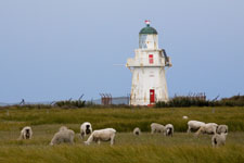
Waipapa Point Lighthouse |
My adventure was divided into two segments. The first I was solo with tramping being my prime activity. All in all I had six multi-day tramps, some were Great Walks such as the Routeburn and Milford, while others were less renown such as Hollyford and Steward Island. It was on these outings where I met and swapped stories with other trampers, and occasionally met these folks elsewhere. For the second segment my friend Heidi joined me to do many activities best done as two. Nine of the weeks were spent on the wonderfully scenic South Island, the last two on the North. When possible I used very excellent public transportation, I rented a car four times.
This very long report [mind you it covers eleven weeks] is ordered from the best to the mundane, so you can stop at anytime if it gets too boorrrrrring. The last pages are my final itinerary complete with costs and phone numbers along with a few comments. Mostly I stayed at B&Bs (private room with bath down the hall), all these were fine. On tramps, I stayed in huts often with lots of other people and always neighborly sleeping arrangements, this was part of the New Zealand experience.
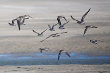
Bar-tailed Godwits |
My itinerary in brief was: November 21, flew from San Francisco to Auckland to Hokitika on the west coast of the South Island, rented car, meandered north to Cape Foulwind and then tramped to the Heaphy Hut (my favorite hut locale) for two nights to get over jet lag, then south along the west coast with three nights in Okarito (my favorite out-of-the-way place), further south along the west coast to Okura (3 nights), through Mount Aspiring, dumped car in Queenstown, tramped five days on the Routeburn & Greenstone Tracks, bussed to Te Anau, tramped four days on the Hollyford track, tramped four days on the Kepler track, tramped four days (celebrating Christmas) on the Milford Track, met my friend Heidi in Invercargill, rented car, spent three days (over New Years) in the Catlins, to Dunedin for penguins and birds, dump car in Invercargill, fly to Steward Island for two days exploring Oban and then a four day tramp of "it's all about the mud" to Mason Bay to view Kiwis in the wild with a beach airstrip flight out, fly to Christchurch for few days of culture, rented car, to Kaikoura for whale watching, dump car in Nelson, day tramp in Abel Tasman staying at Awaroa Lodge, three day (fully catered) kayak trip in Abel Tasman, bus to Collingwood for Farewell Spit tour, bus to Nelson then fly and rented car in Wellington for culture, ferry to Kapiti Island (from Paraparaumu) for bird watching, to Taupo tramping Tongariro Crossing, to Rotoura, to Coromandel Peninsula (four days), ferry to Tiritiri Matangi (from Orewa) for bird watching, and then home on February 4.
The Best
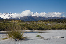
Okarito Beach with view of Alps |
Favorite Place: As with my 2006 visit, my favorite place was the village of Okarito. It is located on the West Coast, is 16 km off route 6, and has a population of (I guess) 50. It is very secluded, has neither food nor restaurants, but is an absolute peaceful place nestled next to the Tasman Sea and the Okarito Lagoon. I rented a cottage for three nights to take in its tranquility. One day I walked the beautiful beach at low tide to watch and listen to the wild and wicked surf of the Tasman Sea and continued south to an area where the snow covered alps were visible. That evening I took a guided tour (www.okaritokiwitours.co.nz) to view Kiwis in the wild - I saw three, two of which were a mating pair and they appeared to be wooing each other, very cool! Another day I rented a kayak and paddled on the lagoon to view the swans and spoonbills feeding. I do have to admit that with both tail wind and incoming tide the paddle out on to the lagoon was swift and easy, but I won't mention the words I spouted for the difficult return. But it's all part of my wonderful holiday experience.
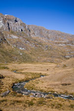
Alpine Meadow |
Best Tramp: An alpine climb, views of snow covered granite peaks, high mountain lakes, waterfalls, and stunning views made the Routeburn Track my favorite tramp. Starting with a bus shuttle from Queenstown through Glenorchy and finally to the trailhead, the track climbs through lush forest, over easy to walk peaty soil, follows the jade green water of the Routeburn River, over several swing bridges to the alpine region where views of snow covered, jagged granite peaks abound. My first day ended at the Routeburn Falls Hut where I was greeted with dazzling views and a chance to take a dip in the cold water at the base of the falls. This was also my favorite hut which in addition to the views it was designed with a large common area and compartmentalized sleeping arrangements.
The second day took me up to Harris Saddle first climbing through an alpine meadow where the Routeburn River meanders and to beautiful Lake Harris where along the way I was surrounded with views of snow covered alpine peaks. At the saddle I took a break enjoying the contrast of deep blue alpine skies with dark gray granite peaks. After the saddle, I continued along a ridge trail which provided continuous views of the Hollyford Valley. Then all of a sudden around a bend the ridge trail caused me to pause in awe as Lake Mackenzie shined from below. I followed the switchback trail past a breathtaking waterfall then down to the hut to end this dramatic day.
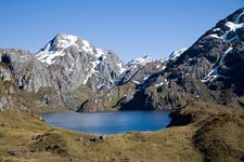
Lake Harris |
On the third day after a short climb, the track continued downhill with more grand views to Lake Howden (and hut) where I dropped my pack for a side trip to Key Summit. Not only did this summit provide 360 degree views, but there was a nature trail which displayed eye-popping examples of high mountain wetlands. On this third day I was surprised to learn that virtually all trampers continue onto the Divide to end their outing, whereas I chose to continue on the Greenstone Track, adding two days and making the trip into a loop. Although the two extra days didn't have the same impressive scenery, it was an easy walk along a beautiful river where I met interesting people. When I reached the Lake McCarren Hut there were few signs of other trampers, so I expected to spend a quiet night. Then "oh shit," first a group of eight kids and shortly thereafter another group of eight showed up with four parents as escorts. The kids ranged in age from 10 to 15 and were having a great time making chaos out of an otherwise peaceful day. I learned the kids were part of a school group which uses tramps to teach self reliance. The two groups of eight were walking the Greenstone & Caples Tracks as a loop with one group going clockwise and the other counter-clockwise. The Lake McCarren Hut was their middle day.
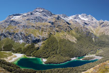
Lake Mackenzie |
The hut had capacity to sleep 16, so with the four regular trampers and 16 kids and their four escorts the hut was buzzing with activity. But these were Kiwis, a trip to learn self reliance, so the boys slept outside in tents with foul weather approaching. It's hard to believe, but I actually enjoyed watching the controlled chaos. That evening with all the bunks full, I had a great sleep, everyone was quiet!
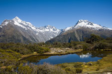
Key Summit |
By morning the weather had changed from bright and sunny to dull and drizzly. So I tramped to the Greenstone Hut following the river of the same name. The eight young girls also followed my course and when we all arrived at the hut I was treated with their fine company. Mom must have helped them load their packs because they weighted more than mine, imagine a 10 year old girl who may weight 30-40 kg carrying a pack of 15-20 kg - ouch! They had so much food remaining that they made cheese and cracker hors d'oeuvres for everyone in the hut. At one point the girls took off their boots and socks to which I had the unique opportunity to say "girls, you have some of the ugliest legs I have ever seen." They laughed while looking at the bruises and blisters and cuts and abrasions on their legs. But they all took it in stride, making great company. My day out of the Greenstone was uneventful to more dreary weather.
Best Mud: Certainly not for the timid, the second day of track from Oban (Steward Island) to Mason Bay was a trip for those who enjoy adversity. Heidi and I had learned that Mason Bay was a great place to view Kiwis in the bush during daytime, that is because Steward Island is so far south it doesn't provide sufficient night time for the nocturnal Kiwis to feed, thus they extend their feeding time to include dusk and dawn.
Our first day started in Oban where we followed the Rikiura Great Walk Track to the North Arm Hut, this track was by all standards easy. At this hut I learned from a stout husband, his track-beat-up wife, and their head-to-toe mud covered son what the track was like to Fresh Water Landing. The 11 km (6-1/2 mile) track to the hut was posted as 6-7 hours (guide book as 5-6 hours), but it took them 9. He said our first couple hours would be easier, but then you hit the mud, tree roots, and steep climb.
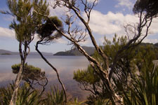
North Arm, Steward Island |
It was good to be forewarned, but nothing could have prepared us for what we endured. The weather was at best mildly cooperative, throwing at us only drizzle and lots of wind. So Heidi and I got an early start. In the drizzle we first climbed for 3/4 hour along the last stretch of the easy Great Walk Track where we diverted to "advance at your own risk" bush track to Fresh Water Landing. There was an obvious difference in track quality, we continued downhill carefully watching our step over slippery track.
Back at sea level again, the track skirted the North Arm coast, then more or less climbed west over a ridge, then down to Fresh Water Landing. But abundant Steward Island rain has no where to go, so it turns the bush track into mud and bogs, turning thin top soil into exposed tree roots. We both had full length gaiters and rain pants, I had sturdy boots but Heidi only light-weight walking shoes (but the strap under her shoes from the gaiters was essential equipment to retain her footwear from the all to often sucking action of the mud).
It's not that my walking stick turned out to be indispensable to probe the depth of the mud, it's not that the bogs were expansive with no alternate routes around them, it's not that the tree roots created dangerous stepping zones, it's not that the climb up to the ridge was often 45 or more degrees with little foot support, it's not that creek crossings often meant dropping vertically into a gorge and then climbing vertically out, it's not that on one occasion Heidi shrieked "oh shit" when the drop into a creek gorge also meant crawling on hands and knees to pass under a fallen tree, it's not that we too often misstepped into knee deep body sucking mud, it's not that the ridge had no views, it's not that the wind and drizzle made stopping unpleasant, it's not that we spent too much time trying to avoid the mud rather than plowing directly through it, it's just that after more than six hours of adversity we only knew we were still on the ridge with unknown more hours to go.
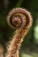
Maori Symbol of |
When our travels reached 8 hours we were finally on the down side of the ridge, here we met a couple coming from Fresh Water Landing and going the way we came. Their welcome news was the distance to the hut was 1-1/2 hours. But it was now 4:30 and neither Heidi nor I could understand why anyone in their right mind would attempt another 4-5 hours [that is if you're expert] at that time of the day. We reached Fresh Water Landing Hut, it only took us 9-1/2 hours, but other than being dead tired and caked in mud we made it in one piece. Of course insult was added to injury when we learned that we could have taken a water taxi from Oban to Fresh Water Landing - but then I wouldn't have had a story!
The following day took us to Mason Bay, and although the weather was still drizzle with lots of wind we arrived at the hut in 3-1/2 hours. That evening we went Kiwi spotting which turned out to be a relatively simple affair. As advertised, the Kiwis start browsing before dusk. We saw two, and unlike their skittish brethren in Okarito these Kiwis seem to be oblivious of tourist gawkers. Grooooovy!
We kicked back on our final day. The drizzle had stopped, but the wind had picked up - it was so strong that sand was flying from the beach. Our exit was a beach landing flight back to Invercargill, we both hoped the plane would arrive as promised. Low tide that day was 7 PM, so we timed our departure from the hut accordingly. The walk to the beach was through estimated 40-50 mph winds, we had to shield our eyes from the sand. We weren't sure a light aircraft could land in such adverse crosswinds. But at the scheduled time our plane miraculously appeared, and it landed almost as if there were no wind at all - quite amazing. Not only was the flight out liberation, but also a spectacular time to view the stunning Steward Island coastline.
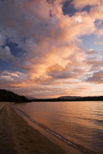
Lake Manapouri |
Best Sunset Beach: Often overlooked, the Moturau Hut on Lake Manapouri of the Kepler Track consistently has stunning sunsets and often equivalent sunrises. I have tramped this track twice, first during my 2006 holiday and once again on this trip. The Kepler Track is a wonderful journey, especially if you're blessed with fair weather on the day over the ridge. But it is the last hut which I like best because of the stunning sunsets from the beautiful beach of Lake Manapouri. Sunset watching certainly was not an original idea because after dinner it seems all trampers headed down to the beach to gawk. On both visits here there were enough clouds to add dramatic color and contrast to complete the day. As an important bonus, Lake Manapouri was an enticing place to swim, relax, and otherwise scour three days of sweat off my body. The water was warm, shallow, and very swimmable - besides, while in the water the sandflies stayed away!
Best Kayak Trip: Close your eyes and pick your favorite coastline with sandy beaches and turquoise blue waters and then transport yourself to Abel Tasman. It was here that Heidi and I had signed up for the "Three Day Classic Kayak" trip with Kayak Abel Tasman. Our adventure began (after a luxury night at Abel Tasman's Awaroa Lodge) with a water taxi ride up the coast to Totaranui where we were met by our guide (Kate) and one other couple.
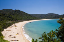
Onetahuti Beach |
After an introduction we packed our personal stuff and catered gear & food into two tandem plus one single kayak, we would be self contained for our voyage. Over the next three days we paddled with blue skies, along stunning coastline, skirting scenic rock formations, gawking at rookeries of fur seals, and viewing numerous sea birds - we even saw a blue penguin swimming at sea. When we entered the Tonga Island Marine Reserve, we circumnavigated the island of its name. At mid days we found secluded sandy beaches were Kate would prepare grand and well deserved lunches. At the end of the first day we camped at Onetahuti Bay and the second day at Anchorage. As a side trip coordinated with high tide on our second day we set out to Cleopatra's Pool, mooring our kayaks nearby and tramping the remaining distance. Here Kate and I went down a natural water slide, wet and wild!
Although our seas were fair on our first day, they got increasingly more turbulent as the days past. The morning of our final day took us around a point called "The Mad Mile." Here the crest and trough of the waves were two meters (6 feet): Certainly exciting, certainly an hour of non-stop strenuous paddling, certainly a time when Heidi got soaked while seated in the bow, certainly a time when at the trough we often couldn't see the other kayaks, certainly a time when at the crest I felt like we were surfing a wave, certainly a blast! During this exhilarating time, the only other water craft we saw were water taxis bouncing on the waves, we appeared to be the only paddlers - maybe we were crazy, but Kate was a great guide watching after us.
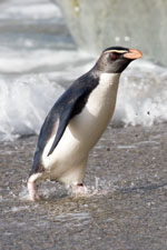 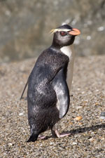 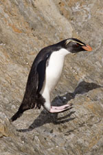
Fiordland Crested Penguin, Monro Beach |
Best Penguin Watching: Although I saw yellow-eyed penguins in Curio Bay (Catlins) and Roaring Bay (Catlins) and Otago Peninsula (Dunedin), for up close and personal views of the Fiordland crested penguins Monro Beach (20 km north of Haast) was best. Timing was everything, especially noting that these guys leave their roost after the first week in December not to return until March/April to molt. At dusk on the first of December I saw four penguins, one was special in that it marched from the sea after the a day of feeding onto the beach on the best photographic side of my camera. Certainly a camera bug's dream!
Best Bird Watching: Not just the occasional viewing of rare New Zealand birds, but repeated sightings, a trip to island Tiritiri Matangi (near Auckland) makes for a wonderful day. The island has numerous easy to walk tracks and it even kept me, a novice birder, happy all day. Birds I saw include: Endangered Takahe, it's cousin Pukeko, Saddleback, North Island robin, Fernbird, Kokako, Weka, Fantail, Silvereye, Stitchbird, Red-crowned parakeet, and of course Tui, and I'm sure there were others. There is even a bunkhouse if you want a chance to see the nocturnal Little Spotted Kiwi and other birds that are otherwise best seen near dusk or dawn.
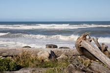
Heaphy Track on Tasman Sea |
Favorite Hut Locale: At the terminus of the Heaphy River with the Tasman Sea, the Heaphy Hut in 2006 was my favorite hut locale, and now with another visit it still holds that rank. My recent holiday began with a two night visit there upon arrival to New Zealand. With this tramp I got over jet lag and I got into the holiday spirit. The tramp was a great 16 km beach walk from the nearest town of Karamea, passing along the way groves of Nikau palms and beautiful views of the wild and wicked Tasman Sea. Few other trampers visited the hut during this late November date, there were six one night and eight the other, and during the evenings we and the hut warden all exchanged tall tales. Late in the day and before dusk, all meandered along the beach or on the grass near the hut, certainly a very pleasant atmosphere. In 2006 I hauled home a much too large beach rock, subsequently I wrote the spoof article Rocks Abducted (click to read it), and presented a copy of it to the hut warden - maybe you'll see it on the hut's bulletin board if you visit.
Best to Avoid: Picture yourself on the Tongariro Crossing with 500 other walkers crawling up 800 meters (2500 feet) on a steep, loose rock & dirt track with poor footing. You look downward and all you see are small moving images like ants, and then upward where more ants disappear into the fog and clouds and drizzle. But you and the other ants march on like drones up to reach the peak at Red Crater. This was the place for the proposed remake of the movie "The Twilight Zone," but this was even too outlandish for Rod Serling.
From Taupo, a cavalcade of tour buses haul unwitting tourists for a day purported to have spectacular views. And yes, the average summer day brings 500. But Tongariro, as with many volcanic peaks, has fickled weather. Through the fog and drizzle we had no views and what should have been a stunning sight of Emerald Lakes was a flop.
The most interesting part of the Crossing was how ill prepared many of the trampers were. Direct from the buses many trampers rather than carrying day packs were carrying in one hand a bottle of water and in the other a grocery sack presumably with snacks. Others wore shoes without socks, some wore sandals, some obviously had no foul weather gear let alone something warm when it got cold (and it did). It wasn't a pretty sight. After Heidi and I were on the down side of the Crossing, she offered my first aid help to a young lady with bloody (sockless) feet - a bit of second skin and gauze from my first aid kit and a pair of extra socks from Heidi did the trick. Do it at your own risk.
My Trip
Listed in order of occurrence are places and activities. Unless lodging or food was special, those comments are left out, but there may be comments in my detailed itinerary.
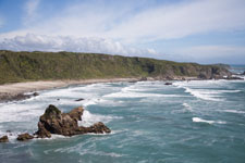
Cape Foulwind Coastline |
Cape Foulwind: Upon arrival in New Zealand I hopped a local plane to Hokitiki, rented a car, and crashed (that is sleep, not the car). The next day I drove up the coast to Cape Foulwind. Here I stayed at what could be one of the best beach houses ever, a B&B called "The Great Beach House." The house is on a peninsula comprising the cape, and it has stunning views of the bay to the north and equally stunning views of the Tasman Sea to the east. After some tea and chat with my hosts Michael and Yvonne, they drove me to the start of a track which encompassed the wonders of the cape, its seal colony, the light house, and a grand stretch of beach at low tide to scrutinize goodies from the sea, ultimately returning me back to the B&B. That evening I had dinner at the nearby bistro. In the morning I was greeted with a breakfast that included homemade bread, yummy. Certainly a very pleasant start to my holiday. If you're in the vicinity of Westport, I highly recommend staying with them.
Heaphy Track: In 2006 I tramped the entire length of the Heaphy Track starting from Collingwood (near Abel Tasman) and finishing at Karamea on the west coast. At that time I rated the last hut on the track, Heaphy Hut, as the best hut locale. So the start of my this holiday included a two night visit to this great place. It again gets my best hut locale rating, read about it as Favorite Hut Locale in the section Best Of.
Okarito: With a visit of just one night in 2006, I knew I had to return to Okarito the next time. So I rented a cottage for three nights and had a thoroughly enjoyable time. Read about it as my Favorite Place in the section Best Of.
Okuru: At the south end of the west coast is the town of Haast, and 12 km south of there is the small community of Okuru and the Okuru Beach B&B. Three nights here along with recommendations from my hosts gave me activities for two days including the all important visit to Monro Beach to view the Fiordland Crested Penguins.
With penguin viewing a dusk affair, I spend the morning and afternoon tramping an obscure place called the Paringi Cattle track, a place I describe as humble rather than grand. But it put me in the right area before dusk, not far from Monro Beach. At Monro Beach I had an outstanding view of the Fiordland Crested penguins. Read about these penguins as Best Penguin Watching in section Best of.
Relaxing at Smoothwater Bay |
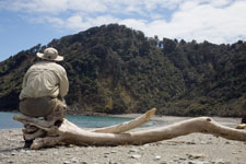
The next day, per recommendation of my hosts, I traveled south along Jackson Road to a wonderful little track called Smoothwater Bay. The track begins about 2-3 km east of the road end at Jackson Bay and is signed. This outing was divided into two sections: (a) Over the ridge, though the bush, to Smoothwater River and (b) Tramping through the river from gravel bank to gravel bank to beach and bay. So rather than wearing sturdy boots, I wore water shoes. The bush track was very pleasant showing a nice variety of flora and a few birds, it took about 45 minutes to reach the river. From here the fun began. The river level was low, its flow was slow, its temperature was mild, and it was at most 1/2 meter deep. Like a kid again, I tramped through the water from gravel bank to gravel bank. After about 45 minutes I reached Smoothwater Bay, a beautiful stretch of isolated beach. It was a great place to relax and collect some rays. Best of all the sky was crystal clear, the temperature was mild, and hard to believe there were absolutely no sandflies. Who could ask for more.
Queenstown: Still not my favorite place. Too many tourists, too much clutter. Unless you enjoy bungee jumping or jet boats or the like I would stay away. Even the B&B I stayed at was terrible. But using this place as a base for Routeburn and Greenstone tracks made it a necessity.

Mountain Daisy |
Routeburn & Greenstone Tracks: In 2006 I was only able to do a day tramp to the Routeburn Falls Hut, but that day impressed me greatly. So on this holiday I expected the Routeburn track would be my favorite, and it definitely met those expectations. Read about it as Best Tramp in the section Best Of.
Te Anau: My favorite tourist town, Te Anau is at the heart of Fiordland. I stayed here a total of seven nights in four segments. I enjoyed the great location and company of Tony and Denise at the Alpenhorn Motel. I picked this place largely because of its locale since I would be without a car. DOC was a 5 minute walk in one direction while downtown and a multitude of fine restaurants was a 5 minute walk in the other. From here I based tramps to the Hollyford, Kepler, and Milford tracks.
Hollyford Track: It ultimately turned out fine, but it certainly contained a lot of turmoil. My goal of the Hollyford track was Martins Bay, but since the track is one way it would take about nine days round trip. If, however, I flew in or out, then I could do it in half that time. So this is what I had originally planned: Bus to start of track, walk the track to Martins Bay, bush flight out (NZ$245 a plane load), spend night at Gunn's Camp, return by bus. But as the date approached I got anxious about a section of track identified as the "Demon Trail." Here the advertised difficult track consists of nonstop, undulating, slippery boulders and creek crossings with three-wire bridges. Now I know the kilometers of slippery boulders should have been a red flag, but what I knew then was as a solo tramper I didn't want to tackle three-wire bridges (two wires for two hands plus one wire for both feet). A few days before this trek I wised up and changed plans: Bus to Milford airstrip, fly to Martins Bay Lodge (as back-load for guided walkers, NZ$125), tramp to Martins Bay Hut, next day motor around Demon Trail (NZ$85), stay Alabaster Hut, stay Hidden Falls Hut, walk to end of track and to Gunn's Camp (spend night), return by bus. Well almost!
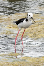 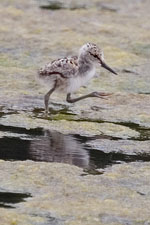
Pied Stilt & Chick, Otago Peninsula |
The weather forecast was overcast the first morning with rain coming that evening and thereafter. Certainly not optimum, but you take what's delivered. I arrived at the Milford airstrip, but there was no plane. Upon enquiring I learned that it was based out of Queenstown and all flights were grounded because of weather. "What now" I said. I soon learned that the Hollyford Guided Walk had to get their clients out from Martins Bay as promised, thus their standard backup was to use helicopters. Groovy, I was to essentially get a free helicopter ride. And that's what happened - the helicopter was loaded with supplies for their next set of clients with the pilot and I up front. We took off, glided down Milford Sound with stunning views in all directions, then near the end of the sound we gained altitude to travel north over many ridges. As we crossed each ridge there was a rush of upward air as we passed over, it felt as a rush of exhilaration. The views were astounding. Over the final ridge the expansive Martins Bay was in sight, more beautiful than anything else during the flight. Shortly thereafter we landed at Martin's Bay Lodge.
From the lodge the walk to the hut was basically easy, but there were two creeks to cross, neither of which seemed significant. I would learn later what a difference a day makes. After an hour I reached the hut, dropped my pack, and explored. I noticed that track from the hut in the direction of Big Bay was significantly more slippery and boulder bound. It was then that I realized another reason to avoid the Demon Trail. As evening progressed, rain started, by morning it was unremitting. My rendezvous with the jet boat at Martin's Lodge was 8:30, so I left the hut at 7:00. Things went crazy on this short trip back to the lodge, the two placid creeks were now torrents, one was knee deep. I then misstepped while going down a steep area of another creek and took a tumble, fortunately the water there was but ankle deep. What wasn't wet from rain was now soaked from the fall. When I reached the Guided Walkers Lodge I changed some clothes to keep warm and decided to motor further down the Hollyford to be dropped nearer to the Alabaster Hut.
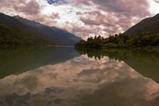
Lake Alabaster |
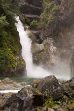
The jet boat ride was transportation rather than a thrill ride offered in places like Queenstown. We first traversed across Lake McKerrow hugging the shoreline near the Demon Trail. Then at the beginning of the lake we motored on to the Hollyford River. Here water levels were high and the river fast flowing. I was dropped off near the Guided Walkers Lodge. Rather than walk a short 2 km to the Alabaster Hut, I chose to continue the other direction on to the Hidden Falls Hut. Even in the fowl weather, the track to Hidden Falls Hut was dazzling. It was easy to walk, through beautiful red beech forest, paralleling the Hollyford River. A pause while crossing the swing bridge over Homer Creek gave views of Little Homer Falls, now not so little. A short climb over Little Homer Saddle (168 m) where side creeks abound added to the landscape. Even in the rain, or maybe because of the rain this was a pleasant walk. I reached Hidden Falls Hut after about 3-1/2 hours.
At the hut I tried to dry out, hanging nearly all my gear up on racks, then kicking back to read a book. Later that day I was joined by a pair of Czech Republic lads (and I use that term loosely). They had not only come from Martins Bay, but had done the very difficult Pyke/Big Bay route, I would learn more of their escapades the next day. That night we were joined by the most interesting hut warden anyone could ever meet, her name is Pat. To put it that she was seasoned would be a mild description of her experience. I learned later that she was 84 years old, but she could have passed for someone in mid 60s. The four of us had interesting conversation, she often sparring with the lads as they asked what she knew about such and such a route, always someplace difficult and inaccessible. She had been to all of them, and all within the last few years.
The next morning the Czech Republic lads completely cleaned the hut [kudos to them and their home town upbringing], and then took off for the end of the track and points unknown. The weather had turned fine so I decided on a day walk to Alabaster Hut. This stretch of track was definitely worth another visit. It was that magic time of the year when the red beech trees shed their leaves to push out new growth. The track and forest was carpeted in brilliant yellow and red leaf litter, glistening from the moisture of the recent rain. It was interesting that once I passed the Guided Walkers Lodge the quality of the track changed, certainly not tidy and prim anymore. 2 km further was Lake Alabaster and its hut. The lake water was flat as glass, in the background were billowy clouds and blue sky. In the foreground were incessant sandflies, they made for an uncomfortable lunch. Before returning to the Hidden Falls Hut, I gandered to Hidden Falls, quite nice. I would learn the next day how the falls succumb to the rain.
Hidden Falls |
That evening I was joined by three kids (and again I use the term loosely): A 21 year old brother, a 20 year old sister, and an 18 year old brother. They chartered a plane into Big Bay for a four day stay and then a walk out. "Why not bring luxury items and lots of food," they thought, "we're Kiwis." They were gleefully joined by the two Czech Republic lads who tapped into their fun, charm, and hospitality. They ate well, went snorkeling complete with wet suits in the bay, fished, and the Czech Republic lads caught and cooked eel to everyone's delight. When I met them at the Hidden Falls Hut, they were down to three swim fins and no fishing gear, it was all lost somewhere. That evening the boys went deer hunting, did I forget to mention they also carried a hunting rifle. Certainly cut from a different mold: Self reliant, bonded siblings, strong, knowledgeable of the bush.
On my day out the weather had turned to rain and then hard rain. But I had enjoyed the trip to this point, so why worry about a bit more adversity. On the way out I again passed Hidden Falls, now the rush of water was deafening, the mist from turbulence surpassed the wet from the rain. The track was still paved with red beech litter, and the views of the rushing Hollyford River were wonderful. An absolute great day walking in absolutely foul weather. Soon I was to pass the next set of guided walkers. One man asked "have you seen the sun?" I happily answered "yesterday." He wasn't pleased by my remark. But the strangeness of the guided walkers soon became apparent. The men were up front in one group, miserable. The women in a second group following, one was trying to keep her wet feet dry by tip-toeing around the incessant puddles on the track, were also miserable.
Gunn's Camp & Museum |
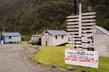
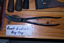
Soon I reached the end of the track, but I still had another 2 hours to walk to Gunn's Camp where I'd spend the night. Gunn's Camp is truly an unfashionable hovel, it has neither electricity nor telephone. You can only reach it by post or email (gunnscamp@ruralinzone.net), they have no website. It is the remnant of the housing used by workmen when the road was build, it is a museum piece. When I arrived I upgraded my lodging to a private cabin (NZ$48) rather than the bunkhouse (NZ$20). I fired up the wood/coal burning stove, set out nearly everything to dry, and then walked over to the wood fired shower for an overdue cleansing. By morning most everything was dry, even my boots. I took advantage of their free book exchange and gandered through their museum. Later that morning my bus back Te Anau arrived. Certainly a great adventure.
So you may ask what I learned. If nothing else Sierra gear is no match for Fiordland weather. Oddly I forgot to pack a set of rain pants, so I purchased a bomb-proof Kiwi version - that was fortunate. I brought half gaiters, but before Hollyford I realized they were inadequate so I purchased a bomb-proof Kiwi version. What I didn't change was my rain jacket, it turned out to be much too light weight than required. Fortunately I had sturdy boots. On a subsequent outing I purchased a large plastic bag [NZ$5] especially designed for packs. The combination of the plastic bag and several Sea-to-Summit dry bags kept everything dry. I probably could also have used a better rain hat, but this change I never made.
Kepler Track: Fine weather throughout made for a grand trip, none of the adversity experienced on the Hollyford. Huts were relatively empty with 30 at the Luxmore fading to 22 at the Moturau. It's odd that adversity is what I more easily remember.
On the first day the walk was fine. The track got interesting during the climb with contrasts amid the trees, the limestone bluffs, and the panoramic views of Lake Te Anau from the ridge.
Kepler ~ Peek-a-Boo Clouds |
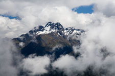
The all important second day on the Kepler is over the ridges. Unlike my tramp here in 2006, the day was mostly fine. There were many clouds in the sky, but there were also plenty of blue to add color. In some places fog was rolling onto hillsides playing peak-a-boo with mountain peaks. After the first warming hut I traversed the long expanse of ridges with astounding views in all directions. After the ridges came the second warming hut where I took a lunch break. From here it's 1 km down to the Iris Burn Hut over a section of track nicknamed the zigzag trail. When it was too steep for zigzags there were stairs, I lost count after reaching 400.
The third day follows the Iris Burn River. After a short bump in the track I reached the area called The Big Slip where in 1986 a distinctive landslide occurred, quite amazing the power of Mother Nature. Although some of the track was on the open flats with views from within the mountain valley, most of the track was in the bush. I reached the Moturau Hut early in the afternoon.
It is this hut on Lake Manapouri which I feel makes the Kepler Track special. Many trampers skip it because it is near an out point called Rainbow Reach, but I feel these trampers are doing themselves an injustice. Read about my Best Beach Sunset at the Moturau Hut in the section Best Of.
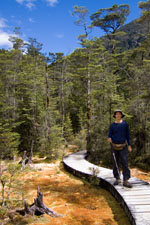
Wetland Boardwalk |
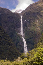
Sutherland Falls |
Milford Track: It might have been perfect, but it didn't seem so. With incessant rain the day before and again the day after the trek over the summit, there was plenty of water to make the waterfalls dance the Watusi and rivers move to the Tango. I enjoyed the Milford Track, but I felt it was too crowded and a bit overrated. No doubt I preferred the scenery and terrain of the Routeburn Track.
My adventure to Milford began on Christmas Eve. The first day comprised a 1-1/2 hour ferry ride to Glade Wharf and then a short walk over easy track to the Clinton Hut. Along the way there was a beautiful side track to a wetland. The weather this day was fine.
Over night, weather moved in delivering rain for Christmas day. Walking to the second hut was again over easy track, traveling about 4-1/2 hours with noticeable elevation gain to the Mintaro Hut. At the hut, one of the trampers started a fire in the wood/coal burning stove. Here we moved many benches together where all congregated for warmth and Christmas cheer. The drying rack above the stove filled with wet gear, it soon became our Christmas tree ornaments.
On the all important third day the weather was forecast to clear leading to a fine day. I got an early start reaching the 1069 meter Macinnon Pass in 1-1/2 hour at 8:30 climbing 574 meters through foggy but otherwise dry weather. At bush line the winds picked up, it was quite cold. At the pass I relaxed in the warming shelter for about an hour after which I learned it was snowing. Well, one must continue, so there I went. But - thank you weather forecaster - after 10 minutes the snow stopped, the clouds cleared, and I was greeted with blue skies, fluffy white clouds, and dazzling views of Authur's Valley. From here it was a 1000 meter drop. Along the way were switchbacks and stairs next to water cascades and gushing waterfalls contrasting the stunning scenery. As I neared the flats of the Authur River, Sutherland Falls came into view. The day ended at the Dumpling Hut. Here the tall hut warden was going on an outing in hopes to view the rare Blue duck, he said it would require a bit of wading, and when I asked how much he said knee deep, but he looked to be twelve foot tall thus knee deep was a bit too much, I said no thanks! That evening the warden gave an interesting lecture where I learned that many Fiordland wildflowers are white because the pollinators are nocturnal moths, very interesting.
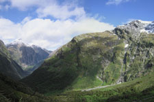
Milford ~ Authur's Valley |
With the best part of the Milford Track enjoyed in fine weather, it was again time for something else. Rather than just rain, we were given hard rain. Although I passed a multitude of surging waterfalls, my only interest was to plod on to the end of the track at Sandfly Point. Wet was the order of the day, lots of wet. 5-1/2 hours later I was at Sandfly Point where I along with everyone else waited in the warming shelter for the ferry to cross the sound to Milford. I never imagined that so many people could squeeze into such a small boat, so many that the trampers overflowed the small interior to brave the winds and heavy rain outside. Fortunately, I was dry and somewhat warm inside. After the 20 minute boat ride to Milford I hopped onto my bus for the trip back to Te Anau.
Invercargill: Just before New Years, Heidi and I rendezvoused. She just completed her trip to Antarctica, and I just completed - well you already know. We would spend another 5-1/2 weeks on holiday doing various things often best done as two.
Catlins: The Catlins is a stretch of enchanting coastline between Invercargill and Dunedin filled with wildlife, beautiful bays and beaches, numerous waterfalls, charming forests, and magnificent vistas. We based our three day stay in Papatowai in the heart of the Catlins. There wasn't a single identifying moment that made the Catlins great, rather it was the combined intensity of places to visit and view.
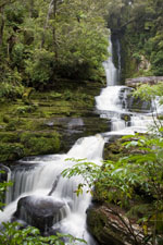
McLean Falls |
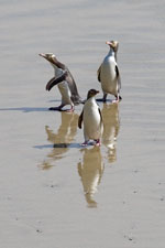
Yellow-eyed Penguin |
While at an overlook of Curio Bay we were delighted to view a solitary Yellow-eyed penguin return from the sea. It stealthily thread itself though otherwise preoccupied tourists to its hidden nest. Then Heidi and I saw "the changing of the guard" as the penguin's mate came out and likewise stealthily thread itself through the tourists out to the sea. We knew there were breeding penguin nests in this people overrun area, so viewing this feat was just plain cool.
Mid afternoon (3:30 PM) on another day we visited Roaring Bay where we stopped at the penguin hide in hopes to view Yellow-eyed penguins return from a day of feeding. We were rewarded, viewing about six. Not only did they return, but they bonded with each other in playful and amusing manners.
Of course there were numerous waterfalls, all were within a short walk on easy tracks. I personally enjoyed the two lighthouses in the area, one at Waipapa Point, the other at Nugget Point. We also walked beaches and visited Cathedral Cave at low tide, a striking limestone cave along the beach. Food was a bit thin, but the best and probably the only good restaurant in the area is a cafe located at Niagara Falls, here we had an superb New Years Eve dinner.
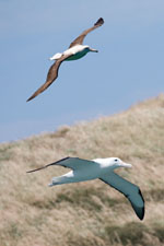
Royal Albatross |
Dunedin: A very long day of guided bird watching with Nature Guides Otago. Up at 4:30 AM to reach a blind at Sandymount Wildlife Refuge to view the Yellow-eyed penguins on their daily march down the hill to the ocean for a day of feeding. Then after breakfast, we toured nearby esturaries to watch various shore birds. Lastly, we took a boat tour near the Royal Albatross Center for grand views of the Royal Albatross.
Steward Island (Oban & Ulva Island): Arrive by plane or ferry, Oban is a small village, dominated by fishing, and often a tourist destination to the south of the South Island. With primordial forests and shorelines it is a place of ancient and wild scenery. At nearby Ulva Island we joined Ulva herself for a guided tour of its expansive bird life on this predator free island reserve. It's amazing and sad to how much destruction even a few non native possum or rats or stoats can do to an environment where no mammals originally lived. Ulva Island is still recovering, bird songs and sightings makes it worth a visit.
Oban is also the gateway to the varied tramping on the island. Whether day walk to Maori Beach as I did in 2006 or a full fledged bush tramp to Mason Bay as Heidi and I did or even something more untamed, Steward Island offers a wide range of primitive places to visit.
Steward Island (Tramp to Mason Bay): A tramp to view Kiwis in the wild turned into an adventure in mud. Read the story as Best Mud in the section Best Of.
Christchurch: A place for a bit of New Zealand culture. After nearly two months in rural New Zealand, reaching this small city was a bit of a shock, but Christchurch certainly has charm. We visited many excellent museums, had some superb food, and stayed at the Windsor B&B which both Heidi and I agree was our best lodging. One day I hopped a bus to visit beautiful Sumner Beach for a stroll in the sand and to catch too many rays.
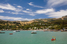
Akarora Harbor |
Akarora: Upon leaving Christchurch, we wanted to visit the Banks Peninsula to the south before heading north to Kaikoura. How do you spell "that was a stupendous idea." Our drive took us along the scenic Summit Drive with astounding views along the way of numerous bays and valleys and grasslands. At the end of our drive we dropped down to the town of Akarora. Definitely charming, it is a place I will visit on my next holiday here. You can enjoy food, gawk in shops, kick back on the beach, rent a kayak, or just relax at this peaceful place. Definitely fine.
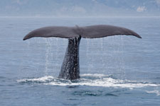
Sperm Whale |
Kaikoura: We got up early to catch the first whale watching boat, the weather and sea gods were cooperating. Whale Watch Kaikoura definitely knows their stuff. Tour boats accommodate a mere 40 passengers which allows all aboard good position for sightings. Their fleet consists of several boats, one is even used solely to scout locations of whales. In the coarse of our tour we spotted two Sperm whales, the second of which we had a long 15 minute up close view when after it had ventilated its lungs it dived providing all aboard that instant when its tail rises skyward to then sink slowly into the abyss. Later that morning we spotted a pod of Dusky and a pod of Hector dolphins.
Abel Tasman (track): In 2006 I spend a day exploring the Abel Tasman coastline first by taking a water taxi to Bark Bay and then tramping back to the park entrance at Motueka. Like my previous visit, Heidi and I again spend a day exploring the Abel Tasman coastline starting with a water taxi to Bark Bay but then tramping in the other direction to Awarora where we spend the night at its luxury lodge. It was a good idea, but I now know the more scenic track was what I did in 2006. Besides, the lodge needed to get their act together. Nevertheless our plan was to start a three day kayak trip the following day, and this excursion gave me a chance to view a new section of track by foot while we would view the entire coastline by kayak over the next few days.
Abel Tasman (kayak): A wonderful three day catered kayak trip along the beautiful Abel Tasman coastline. Read the story as Best Kayak Trip in the section Best Of.
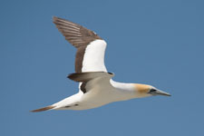
Gannet |
Farewell Spit: The Farewell Spit is a geologic / oceanographic gem at the northwest corner of the South Island which consists of the worlds largest sand spit, 21 km long. At low tide the spit widens by several kilometers, providing a path and time window to visit. Near that time, Heidi and I boarded a small sturdy 4WD bus for a 6-1/2 hour tour on the spit and to visit the Gannet bird colony near its end. Along the way we stopped at various places where shore birds could be viewed. At our most distant point, we took a short walk to the Gannet colony, here we watched the birds squeal, watched the nesting chicks, and viewed the graceful flight of these magnicifant birds. On the way back we stopped at the lighthouse, and then again along the way to view more shore birds as they presented themselves. Certainly a fun and interesting day.
After the tour, we spent the night in Collingwood, the base of the Farewell Spit Eco Tour's operation. Here we had a most excellent dinner at the Courthouse Cafe, the next morning we went back for breakfast. Try it, it's great!
Kapiti Island: Kapiti Island is a nature reserve located about 5 km off the west coast of the southern North Island. Here, with a DOC permit given to 18 people per day, we took a ferry in the morning to tour the north end of the island. Although the island is home to many native birds such as Tui, Bellbird, Weka, Kaka, Fantails, and others, our visit that day was hot and I believe we had fewer sightings because of it. Certainly an interesting place, but in retrospect my preference for bird watching is Tiritiri Matangi which we visited later.
Tongariro Crossing: Who would have guessed the true story of the Tongariro Crossing. Read the story as Best to Avoid in the section Best Of.
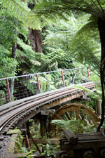
Driving Creek RR |
Coromandel Peninsula: Located on the Pacific south of Auckland, the Coromandel Peninsula has some of New Zealands best beaches and coastal scenery. It is a magnet for those seeking escape from the big city and it offers plenty of alternate art gallerys to visit. Our four day visit turned out to be more of a scouting trip over an ambitious area rather than a time of pure relaxation. We circumnavaged the peninsula spenting nights in Whangamata [note WH in Maori is like PH in English, pronounced as F], Thames, Coromandel Town, and Whitianga. Favorites were easily Coromandel Town and Whitianga.
Coromandel Town was certainly the most laid back with numerous artist studios to view interesting ware. While there we took a ride on the narrow-gauge Driving Creek Railway which not only weaves through beautiful forest with eye-catching views, but is itself an artistic gem because it was all handcrafted as a love project by its artist/owner over a period of 27 years. On the eco journey we passed through tunnels lined with pottery, viewed retaining walls made from wine bottles or old tires, passed over a water wheel on a viaduct, and otherwise viewed unconventional artistic uses for things not wanted anymore. After several reversing points we reached the high point called Eyefull Tower to expansive views of sea and peninsula.
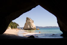
Cathedral Cove |
Whitianga was more populated, but that was probably because of the pleathora of nearby beaches. The harbor had a cavalcade of yachts and pricey resturants, but with so many nearby activities it was certainly suitable even for my more modest means. We only browsed the beaches, but at Hot Water Beach at low tide you can did a hole to heat your buns in the hot spring that flows below. We walked to Cathedral Cove at low tide, a beautiful beach and a remarkable limestone formation providing access between neighboring beaches.
We visited many small towns and walked many short tracks, but these four days felt rushed. Definitely another visit is needed.
Tiritiri Matangi: A day on this wildlife reserve island was a birders delight. Read the story as Best Bird Watching in the section Best Of.
Oddities
• Total distance of multiday tramps: Heaphy Hut (33), Routeburn/Greenstone (60), Hollyford (36), Kepler (67), Milford (54), and Steward Island (37) is 287 km = 172 miles.
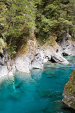
Blue Pools |
• Tramping Times: I believe I finally understand the estimated times given by DOC for various segments of track. DOC classifies tracks in increasing degree of difficulty as: (a) Easy access walks, (b) short walks, (c) walking track, (d) great walk/easy tramping track, (e) tramping track, and (f) routes. The posted time needs to be tempered with the purported difficultly of the track. So it may take the posted 20 minutes to traverse an easy access walk for someone with disabilities, but a fit person may traverse it in less than 10. Similarly, I believe all Great Walks are designed for nearly any ability, so an experienced tramper may traverse a track posted as 3-4 hours in less than 3. And then there are the difficult tracks, such as the one I did between the North Arm Hut and Fresh Water Landing Hut on Steward Island. Here it is posted as 6-7 hours, but this time is calibrated to a tramper experienced in its difficult muddy and root bound terrain, and since Heidi and I did not have this experience it too much longer (9-1/2 hours).
• Estimated expenses: As itemized in the table at the end, the estimated expenses for air transportation, car rentals, lodging, food, special activities, and other items is US$11,929 for the 76 day adventure, about NZ$1,100/week. By comparison, my 2006 expenses for that six week holiday was about US$1000/week.
• Customs: Before passing through customs, make sure your hiking boots are absolutely clean, otherwise they will be washed for you.
• Snoring: Not that I don't snore, I sometimes do. But I am also a light sleeper. So when in huts with a real noise maker I often just move the bunk matress to the common area, or one time I just slept outside. My most remembered occasion was when in a small bunkroom of eight with supposedly no snorers, another person bellowed to the loud snorer "would you please turn over," a lot of good that did! All I needed was a night with both a snorer and an operatic whiner, so I picked up the matress and moved.
Equipment
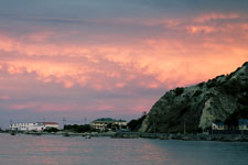
Kaikoura Sunset |
When in town I wore cotton Ts, when on the track I wore wool socks, silk shirt, nylon pants, bandana, and had both light-weight cotton cap and nylon rain hat. On multi day tramps I carried a nylon overshirt, 100-weight fleece shirt, silk bottoms, bomb-proof Gortex rain pants, full length gaiters, light weight Gortex-like jacket (not adequate, recommend bomb-proof Gortex jacket), wool cap, fleece glove liners, extra socks & silk shirt, small towel & extra bandana, and alternate footwear (e.g. neoprene booties) for the huts. Sleeping gear was silk sleep-sheet with 30° F down bag (too warm). Kitchen was a 24 oz Glad bowl, small pot, lexan cup, and fork/knife/spoon - cooking only with boiled water but many Kiwis had more regular meals. My ditty bag always included insect repellant (deet worked well), sunscreen, and iodine. I saw no water filters, most Great Huts claim water is potable and I rarely iodized my water. For foul weather, I used light-weight "Sea to Summit" dry bags for sleeping gear and extra clothes (worked great), a full length heavy plastic pack liner (purchased in NZ and worked perfectly), and pack rain cover (didn't work well in most rain). I recommend sturdy boots, a walking stick, and full length gaiters. I carried 1st aid & survival kits, and a small stiff bristled brush to clean boots from time to time. I used a 1-1/2 liter thru-the-straw Platypus drinking system (always adequate between water points). My luxury items were a high end SLR when the weather was promising, a small point-and-shoot camera for less than perfect weather, voice recorder, and sometimes binoculars.
Detailed Itinerary
Cost column in US$ - $NZ1=$US0.77. After 29 Dec. some expenses were split, denoted in cost column as each$$$. Items with triple daggers (†††) in activity column are highly recommended.
| Date | $11,929 | Activity | Description |
| ALL | 3,900 | ° Actual food and other expenses for entire holiday | |
| 11/21 | 1267 | ° Leave SFO @ 7:00P - NZ Air # 7, about 13hr. | |
| 11/22 | ° Cross international date line | ||
| 11/23 | 165 717 57 |
° Arrive Ackland @ 5:10A
° Fly Auckland to (NZ0513 @7:50A) Christchurch to (NZ2282 @9:45A) Hokitika (@10:20A) ° Rent car, Hertz, 1PM, Toyota Corolla auto, 12 days, NZ$915, 64-3-768-0196 ° stay Hokitika: Shining Start Beachfront, 11 Richards Dr, standard cabin, NZ$75, 64-3-755-8921 |
|
| 11/24 | 62 |
††† |
° drive (140km) Westport, tour Cape Foulwind, view lighthouse
° stay Great Beach House B&B, 41 Tauanga Bay, at Cape Foulwind, 64-3-789-5225, NZ$80 |
| 11/25 | 9 16 |
Heaphy |
° Drive to Karamea - Last Resort (120km from Westport), 71 Waverley St, 64-3-782-6617, leave car.
° Karamea Express transport from Last Resort (12:30) to Kohaihai Campground, NZ$12, 64-3-782-6757 ° 16.5km (5hr), stay Heaphy Hut |
| 11/26 | 16 | Heaphy | ° Layover day, enjoy and photograph, stay Heaphy Hut |
| 11/27 | 9 62 |
Heaphy |
° 16.5km, 5hr, to Kohaihai Campground, then bus Karamea Express to Last Resort (1or2PM), NZ$12.
° stay Karamea - Last Resort, 71 Waverley St, 64-3-782-6617, NZ$80, ensuite lodge room. |
| 11/28 | 54 35 |
° drive Okarito (370km from Karamea, 5.5hr)
° stay Okarito cottage, NZ$70, Elspeth Scott, 64-3-753-4058 or 64-7-378-9390, 14 The Strand ° Okarito Kiwitours, contact Ian Cooper, 64-3-753-4330, www.okaritokiwitours.co.nz, NZ$45. |
|
| 11/29 | 54 | ° stay Okarito self-contained cottage, NZ$70, Elspeth Scott, 64-3-753-4058 or 64-7-378-9390 | |
| 11/30 | 54 | ° stay Okarito self-contained cottage, NZ$70, Elspeth Scott, 64-3-753-4058 or 64-7-378-9390 | |
| 12/1 | 46 |
° stay Haast, Okuru Beach B&B, 64-3-750-0719, NZ$60, 12km south Haast
° Note: Penguin colony at Monro Beach (north of Knights Point Lookout) |
|
| 12/2 | 46 | ° stay Okuru Beach B&B, 64-3-750-0719, NZ$60, 12km south Haast on Jackson Bay Rd | |
| 12/3 | 46 | ° stay Okuru Beach B&B, 64-3-750-0719, NZ$60, 12km south Haast on Jackson Bay Rd | |
| 12/4 | 46 |
° Drive thru Mt. Aspiring
° stay Makarora Wilderness Resort, private room, NZ$60, shared bath, 64-3-443-8472, Wanaka |
|
| 12/5 | 54 |
° Drive to Queenstown, dump car downtown @ 1-7 Earl St, 64-3-442-4106
° stay Queenstown, Adelaide Street Guest House B&B, NZ$70, not recommended. |
|
| 12/6 | 54 | ° stay Queenstown, Adelaide Street Guest House B&B, NZ$70, not recommended. | |
| 12/7 | 28 32 |
Route |
° BP-Express NZ$36, Queenstown (8A) to Routeburn (10A), 64-3-442-9939
° Great Walk, 8.8 km (4hr), Routeburn Falls Hut |
| 12/8 | 32 | Route | ° 11.3km (4-6hr), stay Lake Mackenzie Hut |
| 12/9 | 8 | Green | ° 12.6km (4-6hr), stay McKellar Hut, no cookers |
| 12/10 | 8 | Green | ° 17.5km (7hr), stay Greenstone Hut, no cookers |
| 12/11 | 28 54 |
Green |
° 10km (5-6hr) to Greestone trailhead
° BP-Express NZ$19+18, pickup (2P), to Queenstown (4P) ° stay Queenstown, Adelaide Stree Guest House B&B, NZ$70, not recommended |
| 12/12 | 29 78 |
° TrackNet (NZ$38) Queenstown (10:30A) - Te Anau
° stay Aplenhorn Motel, 35 Quintin Drive, Te Anau, (Denise & Tony), 64-3-249-7147, NZ$100 |
|
| 12/13 | 32 95 8 |
Hollyford |
° TrackNet (NZ$42) Te Anau (9:30A) - Milford (11:45P), 64-3-249-7777
° Fly (was helicoptor!) Milford(12:30) to Martins Lodge (as backhaul), NZ125, with www.hollyfordtrack.co.n ° 4 km (1-1.5hr) , stay Martins Bay Hut, no cookers |
| 12/14 | 65 8 |
Hollyford |
° 4 km to Martins Lodge, Motor around Demon Trail to Alabaster Hut, NZ$85, with www.hollyfordtrack.co.nz
° 10.5 km (3.5-4hr), stay Hidden Falls Hut, no cookers |
| 12/15 | 8 | Hollyford | ° day tramp to Alabaster Hut, stay Hidden Falls Hut |
| 12/16 | 37 |
Hollyford |
° 9km (2-3hr) to Hollyford Road end, then (8 km, 2-2.5hr) to Gunn's Camp
° stay Gunn's Camp (no phone) gunnscamp@ruralinzone.net, NZ$48, cabin lodging, no food |
| 12/17 | 32 78 |
° TrackNet bus (NZ$42) from Gunns Camp (1:10P) to Te Anau (2:30P)
° stay Aplenhorn Motel, 35 Quintin Drive, Te Anau, (Denise & Tony), 64-3-249-7147, NZ$100 |
|
| 12/18 | 78 | ° stay Aplenhorn Motel, NZ$100, organize, buy supplies, do laundry, relax | |
| 12/19 | 30 | Kepler | ° 14.1 km (5-6 hr), Mt Luxmoore |
| 12/20 | 30 | Kepler | ° 18.6 km (5-6 hr), Iris Burn Hut |
| 12/21 | 30 | Kepler | ° 17.2 km (5-6 hr), Moturau Hut |
| 12/22 | 78 |
Kepler |
° 17.1km (4-5 hr) to control gates, then walk to town (1 hr)
° stay Aplenhorn Motel, 35 Quintin Drive, Te Anau, (Denise & Tony), 64-3-249-7147, NZ$100 |
| 12/23 | 78 | ° stay Aplenhorn Motel, NZ$100, organize, buy supplies, relax | |
| 12/24 | 15 45 30 |
Milford |
° Bus from Te Anau (9:30am) to Te Anau Downs (10:15am)
° Motor from Te Anau Downs (10:30am) to Glade Wharf (12noon), start of track ° Great Walk, 5 km (1hr), stay Clinton Hut |
| 12/25 | 30 | Milford | ° 16.5 km (5-5.5hr), stay Mintaro Hut |
| 12/26 | 30 | Milford | ° 14 km (6hr), stay Dumpling Hut |
| 12/27 | 23 32 78 |
Milford |
° 18km (5.5-6hr), end at Sandfly Point
° then motor from Sandfly Point to Milford ° then Bus from Milford Sound (2:30pm) to Te Anau (4:30pm) ° stay Aplenhorn Motel, 35 Quintin Drive, Te Anau, (Denise & Tony), 64-3-249-7147, NZ$100 |
| 12/28 | 78 | ° stay Aplenhorn Motel, NZ$100, do laundry, get haircut, relax, etc. | |
| 12/29 | 32 108 each165 |
° Tracknet bus (NZ$42) from Te Anau @LakeviewHolidayPark (7:30A) to Invercargill (9:45A)
° Meet Heidi, midday Invercargill, stay Kelvin Hotel, NZ$140 ° rent car, Avis, 11AM (10A-12only), Toyota Corolla, 6 day, NZ$428, |
|
| 12/30 | each37 | Catlins |
° Travel to Catlins, stay Southern Secret Motel, NZ$95, Papatowai, 011-64-3-415-8600
° Visit lighthouse at Waipapa Point, another lighthouse at Nugget Point (cool) |
| 12/31 | each37 | Catlins | ° stay Southern Secret Motel, NZ$95, Papatowai |
| 1/1 | each37 | Catlins | ° stay Southern Secret Motel, NZ$95, Papatowai |
| 1/2 | each323 | ° Stay Nesbit B&B, NZ$840/ 2-nights ~ includes daybreak penguin tour & birding tour, 64-3-454-5169 | |
| 1/3 | ° Stay Nesbit B&B | ||
| 1/4 | 69 each27 |
Steward |
° Drive to Invercargill (215km), dump car at airport
° Fly to Oban (NZ$90), 64-3-218-9129, 15kg max, 1P, no gas canisters ° Stay Jo & Andy's B&B, NZ$70, 011-64-3-219-1230 |
| 1/5 | 73 each27 |
Steward |
° Ulva Island Guided Walk (NZ$95), 64-3-219-1216, www.ulva.co.nz, 1/2 day, 8:30A at Golden Bay Wharf
° stay Jo & Andy's B&B, NZ$70, great location, shared bath, 011-64-3-219-1230 |
| 1/6 | 15 | Steward | ° 12 km (4-5hr) Oban to North Arm Hut, stay, no cookers |
| 1/7 | 8 | Steward | ° 11 km (5-6hr), stay Freshwater Landing Hut, no cookers |
| 1/8 | 8 | Steward | ° 14 km (3-4hr), stay Mason Bay Hut, no cookers, low tide 6:25PM |
| 1/9 | 139 108 |
Steward |
° rabble rouse all day. then fly Mason Bay to Invercargill (NZ$180), low tide 7:45PM
° stay Invercargill, Kelvin Hotel, $NZ140 |
| 1/10 | 110 84 |
††† |
° Fly Invercargill (NZ5062 @11:50A) to Christchurch (@1P)
° stay Christchruch, Windsor B&B, 52 Armagh St, 64-3-366-1503, NZ$109/room, shared bath |
| 1/11 | 84 | ° stay Christchruch, Windsor B&B, 52 Armagh St, 64-3-366-1503, NZ$109/room, shared bath | |
| 1/12 | 84 | ° stay Christchruch, Windsor B&B, 52 Armagh St, 64-3-366-1503, NZ$109/room, shared bath | |
| 1/13 | each72 each54 |
° rent car, Hertz, 9AM, Toyota Corolla, NZ$185
° Drive Kaikoura, 183km (2-1/2hr) ° stay Pacific Palms B&B, 2 bedroom cottage, $NZ140, 218 Esplanade, 64-3-319-5857 |
|
| 1/14 | 100 each54 |
° Whale Watch, 64-3-319-6767, 7:15A (2.5hr on water), NZ$130, www.whalewatch.co.nz
° stay Pacific Palms B&B, 2 bedroom cottage, $NZ140, 218 Esplanade, 64-3-319-5857 |
|
| 1/15 | 56 |
° Drive Nelson, 245km (3-1/2hr), dump car at airport
° Stay Grove Villa B&B, rooms 5/6, $NZ75/room, 36 Grove St, 3-548-8856 |
|
| 1/16 | each114 |
AbelTas |
° Bus from Nelson I-Site (7am) to Marahau (8:30), (included in kayak trip)
° Water Taxi (9am) to Bark Bay (10am), shuttle gear AND walk, (included in kayak trip) ° Stay Awaroa Lodge, 64-3-528-8758, NZ$295 (VISA), deluxe room w/2-beds |
| 1/17 | 416 |
AbelTas |
° Water Taxi (9:15am) to Totaranui (9:30)
° day 1 of 3 day Classic Kayak, Kayak Abel Tasman, 0800-732-529, NZ$540 ea, stay Onetahuti campsite |
| 1/18 | AbelTas | ° day 2 of 3 day Classic Kayak, stay Anchorage DOC campsite | |
| 1/19 | 65 |
AbelTas |
° day 3 of 3 day Classic Kayak
° Bus from Marahau (4:30pm) to Motueka ° Stay Motueka, Nautilus Lodge, 67 High St, (64) 3-528-4658, w/2 rooms, NZ$170 |
| 1/20 | 21 each37 |
††† |
° Bus #AT8890, Motueka (7:45A) to Takaka (8:59) + AT8899 to Collingwood (9:29A) NZ$27ea
° Farewell Spit Gannet Colony Eco Tour (NZ$110), 11A-5:30P ° Stay Collingwood Skara Brae B&B (on Eliz St), 64-3-524-8464, $NZ95/cottage, 2-beds ° Dinner at Court House Cafe, very good!!! |
| 1/21 | 28 58 |
° Bus #AT8898, Collingwood (11:10A) to Takaka (11:25A) + AT8891 to Nelson (2:00P) NZ$37ea
° Stay Grove Villa B&B, rooms 5/6, $NZ75/room, 36 Grove St, 3-548-8856 |
|
| 1/22 | 137 each347 each56 |
° Fly Nelson to (NZ8118 @10:05A) Wellington
° rent car, Hertz, Toyota Corolla, $900 ° stay Apollo Lodge, NZ$145, 2 room flat, 49 Majorbanks St, 64-4-385-1849 |
|
| 1/23 | 9 each39 |
° Walk Karori Wildlife Sanctuary, NZ$12
° drive to Paraparaumu, stay Paraparamu Motel on Hwy 1, NZ$100 |
|
| 1/24 | 42 each39 |
° Ferry (NZ45) to Kapiti Island, bird watch, DOC permit NZ$9
° stay Paraparamu Motel on Hwy 1. NZ$100 |
|
| 1/25 | each60 | ° drive to Taupo, stay Tui Oaks Motor Inn, 86 Lake Terrace, 64-7-378-8305, NZ$155 | |
| 1/26 | each60 | ° stay Tui Oaks Motor Inn, 86 Lake Terrace, 64-7-378-8305, NZ$155 | |
| 1/27 | 38 each60 |
Crossing |
° Bus for Tongariro Crossing, NZ$49
° stay Tui Oaks Motor Inn, 86 Lake Terrace, 64-7-378-8305, NZ$155 |
| 1/28 | each69 | ° Drive to Rotorua, stay Accolade Lodge Motel, 32 Victoria St, NZ$180 | |
| 1/29 | each69 | ° Drive to Whangamata, stayPipinui Motel, 64-7-865-6796, 805 Martyn Rd, NZ$180 | |
| 1/30 | each50 | ° Drive to Thames, stay Avalon Motel, 64-7-868-7755, NA$130 | |
| 1/31 | each58 | ° Drive to Coromandel, stay Central Motel, 64-7-866-8709, 50 Wharf Rd, NZ$150 | |
| 2/1 | 15 each58 |
††† |
° Driving Creek Railray & Pottery, 64-7-866-8703, www.drivingcreekrailway.co.nz, 10:15AM, NZ$20
° Drive to Whitianga, stay Cozy Cat Cottage B&B, not recommended, NZ$75/single |
| 2/2 | each64 | ° Drive to Orewa, stay Clipper Court Motel, 64-9-426-4098, 420 Hibiscus Coast Hwy, NZ$165 | |
| 2/3 | 31 each64 |
° Ferry to Tiritiri Matangi (bird watch), NZ$40
° stay Clipper Court Motel, 64-9-426-4098, 420 Hibiscus Coast Hwy, NZ$165 |
|
| 2/4 | ° Depart NZ Flight 8 @ 7:30P, SFO @ 10:45A |