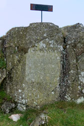
Nine Standards Rigg
Click c2cReport2016.pdf for a copy of this report, OR click for a comprehensive set of Coast to Coast Path GPS waypoints, OR click to view my photo gallery.
Background:
|
I did it again, walking 110+ miles of the Coast to Coast path in the north of England. Rather than starting in St Bees by the Irish Sea and ending at Robin Hood's Bay by the North Sea, I walked with a friend from Grasmere in the Lake District to Clay Bank Top at the summit of the Moors. Thankfully this time I was blessed with fine walking weather, while what little rain that fell coincided with a few of our layover days. It was fun to return to the lovely inns, great food, local history, and stupendous beer.
My journey with a friend was 14 days, walking 10 days and relaxing 3, plus a day afterward to explore York. We walked an average of 11 miles a day with the shortest day being 8 miles and the longest 15. We had relaxation days at our start in Grasmere and a day each in Kirkby Stephen and Richmond.
This report describes my two week walk over the middle section of Alfred Wainwright's Coast to Coast Path. Equally important, this report includes what to expect for weather, how best to navigate, what clothing & equipment to use, getting to/from the path, lodging & gear transfer, and a detailed itinerary & expense list.
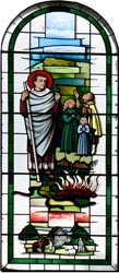
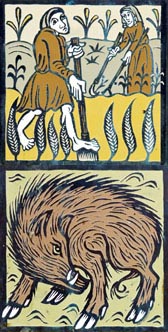
St Mary's had a Little Lamb |
Weather:
Having now completed many English walks I know about England's fickled weather. Because September is touted as statistically drier, I counted on my good luck for sunny skies. This time my good fortune held, for what rain did fall was both light and thankfully on non walking days. Of course not all dry weather days were equal, as many had overcast skies rather than beaming sun.
New Morality, 1798 @ Dove Cottage |
Not knowing what weather would come, I armed myself with good quality rain gear. With a Gortex rain shell, rain pants, gators, and boots, I was prepared with what the elements might deliver. I always wore gators to keep the often wet track from soiling my feet and I often donned a Gortex rain shell for a bit of extra warmth, while on this walk I never required rain pants.
Navigation:
Let me make this perfectly clear, you will go off path at some point walking the Coast to Coast. The important consideration is to learn of these errors and recover as soon as possible. In my opinion, there isn't any one navigation aid that will keep you on path, rather I recommend a minimum of two. These are a set of Ordnance Survey of Great Britain (OSGB) or Harvey's Maps of the route and a GPS. A GPS will tell you where you are, while the maps will identify your location. Additionally, a guide book such as Henry Stedman's "Coast to Coast Path" is both useful and informative.
WP |
Grid |
Elev |
Description |
Take-Along Waypoint Guide |
C001 |
NX9615 |
8 |
St Bees - Start of C2C |
|
P001 |
NX9743 |
53 |
Fleatham House, St Bees |
|
C002 |
NX9456 |
23 |
Fleswick |
|
P003 |
NX9412 |
89 |
St Bees Lighthouse |
|
C003 |
NX9410 |
57 |
Bear R, follow coastline |
|
C004 |
NX9565 |
97 |
Quarry bungalows, head S |
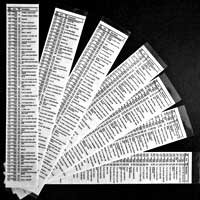
Before my first walk of the Coast to Coast, I searched the web for a set of free waypoints for my GPS. After finding a couple of similar sets, I created a new value-added set which now identifies the main path from numerous alternate paths comprising more than 700 waypoints. I also created a Take-Along Guide which identifies each waypoint, a milepost, OSGB coordinate, elevation, % grade, and a brief description. A snippet of this guide is illustrated, while a comprehensive discussion of these waypoints updated with the most recent route changes can be found elsewhere on my website at Coast to Coast GPS Waypoints.
Also, before the walk I color-copied the cumbersome Harvey maps into two-sided, letter-sized sheets which I then placed in a waterproof (Ortlieb brand) map carrier. I found using the map carrier both reliable and convenient, much more so than using cumbersome sheet maps.
Throughout this document I reference many obscure places with OSGB coordinates, an example of one such place is Robin Hood's Chair (NY10060/15146).
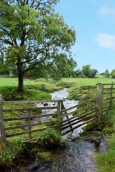
Tongue Gill |
Feeding Tongue Gill |
Navigation Issues:
• For up to date track changes visit the Wainwright Society.
• The most confusing navigation day was, once again, between Shap and Orton. Much of the day's walk was through rolling fields bounded by yet more stone walls and yet more rows of trees. On this day you can't help but notice on any map the numerous right and left turns alongside other established paths. Twice on this day I found myself off track by making a confusing turn, but thanks to my GPS these errors were quickly corrected.
• The most hazardous road crossing along the route is the Catterick Bridge (SE22733/99365) on the walk from Richmond to Danby Wiske. Thankfully this section has been rerouted. Although the reroute was still in progress, the new route follows a disused, now repurposed old railroad bridge to avoid the dangerous Catterick crossing. Visit the Wainwright Society for details.
• Another dangerous crossing is at the busy A19 (NZ44252/01142) on the day's walk from Danby Wiske to Osmotherley. The danger here is manageable because you can cross the southbound and northbound lanes in 2 stages, thus taking an all important safety break at the center medium.
Grisedale Tarn, 1765 feet |
Equipment:
Clothing:
While walking I always wore nylon pants, long sleeve wool shirt, sturdy waterproof boots with wool socks, gators, and a hat. When the temperature cooled down I added a nylon shirt and/or Gortex shell. I also carried a pair of rain pants (thankfully not needed). While walking I almost never required any additional layers to stay warm, but my day pack always included a fleece shirt, wool cap, and light weight gloves that I sometimes used when taking a break. I recommend walking only with fast drying, wicking fabrics (e.g. nylon, fleece, and wool) and to stay away from cottons because as the adage says cotton kills.
 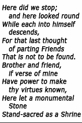
Wordsworth's Brothers' Parting Stone |
I strongly recommend bringing a bomb-proof rain jacket. Bomb-proof means a rain jacket that is made of seam-sealed, three-layer-laminated, Gortex fabric, and a jacket with proper head protection, that is a hood that stays in place in heavy rain or wind, and a shell length sufficient to cover part of your lower body. I own both three-layer-laminated Gortex and lighter two-layer-lamented rain gear, and I have learned that the lighter weight materials do not stand up to prolonged foul weather. It pays to use what I call bomb-proof construction for best prolonged comfort in inclement weather as you will likely experience at some point along the Coast to Coast.
Like rain jackets, I own various grades of rain pants. For the Coast to Coast, I brought a good quality, light weight, waterproofed and breathable, nylon rain pant rather than bomb-proof Gortex. Whether sunny skies or not, I always wore gators to protect my legs from the wetness of the track and at other times from the mud and bogs. I brought two hats, one to keep the sun off my thinning hair and the other with a large brim to shed rain from my face.
What I Carried:
I carried a small 25 liter day pack outfitted with a 2 liter Platypus through-the-straw drinking system. Among other things, the pack contained a personal first aid kit [dental floss, iodine, paper tape, nitrile gloves, second skin, protective mask for first aid/CPR, ibuprofen, acetaminophen, moleskin, various bandages, sew kit with various needles, scissors], survival kit [knife, whistle, duct tape, matches, fire starter, compass, various plastic bags, emergency personal survival bag, mirror, small flashlight], LED headlamp, extra batteries, bandana, emergency TP, ditty bag [sunscreen, lip balm, deet (never used), hand sanitizer, eye drops], fleece shirt, wool cap, fleece gloves, and pack rain cover. Attached to the pack was a Garmin GPS with downloaded maps and waypoints. I carried a walking stick.
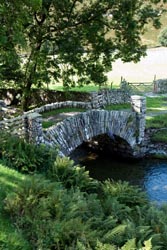
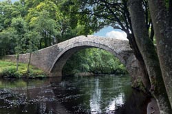
Lovely Bridge |
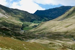
Valley of Grisedale Beck |
Other Logistics:
Reference Books and Maps:
• "Coast to Coast Path" by Henry Stedman is an excellent comprehensive guide of the path. It includes numerous hand drawn maps of the route with detail to local terrain. It has sections on where to stay and eat and includes accurate maps of villages. It also includes various other information such as flora & fauna, weather, public transport, and the like. Although I recommend this book for anyone walking the path, the maps are not to scale and do not include OSGB reference coordinates, thus I found the maps often lead to confusion as to where you might be.
• Harvey's "Coast to Coast West" and "Coast to Coast East" polyethylene maps are continuous strips to 1:40000 scale. These maps identify both main and alternate routes. I found these maps useful to absorb a days journey, but the smaller scale and the large physical format I found cumbersome to use on the walk. I thus two-sided, color copied these maps onto letter size paper and then inserted the copies into a waterproof (Ortlieb brand) map carrier
• My GPS was downloaded with Great Britian contour maps. Although these maps should be available through your GPS manufacturer, I chose to use free open source maps from Talkytoaster and I found these maps were both detailed and reliable.
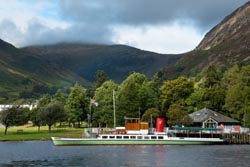 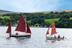
Ullswater by Steam and Sail |
Gear Transfer & Lodging:
Unlike most people who walk the Coast to Coast, I book my own lodging, whereas most use either Packhorse or Sherpa Van to arrange accommodations and baggage transfer. If you choose to book as I did, I recommend booking early. I booked nearly a year in advance and was able to pick nearly any B&B or inn. I then selected Packhorse as my baggage transfer service, and I would give them my highest recommendations for their service and also because they are local to the Coast to Coast route based in Kirkby Stephen.
The table at the end of this report identifies the bookings I used along with price, telephone numbers, web IDs, etc. Stedman's book identifies various lodging along the route, and the Sherpa Van website lists numerous lodging along with patron ratings.
Cell Phones:
Any unlocked, 4-band, GSM cell phone should work fine in England, the trick is to purchase a viable service provider. The problem is that along the Coast to Coast cell service is often spotty. On this walk I purchased a SIM and minutes from O2 for £15. Near Clay Bank Top, it was a godsend when I arranged for a car pickup to shuttle us 2 miles to the Buck Inn at Chop Gate, I made that call while high atop near the Wainstones. It was a local resident who told me to use that locale for a cell call rather than at Clay Bank Top, because at the Wainstones you can (as can your cell phone) literally view the cell towers far below to the north and not so at Clay Bank Top.
Train Tickets:
There are many ways to book train travel, but I choose Virgin Trains. By booking early and by being flexible with travel times and by traveling standard class, I was able to book train travel at rock bottom prices.
Ullswater above Pooley Bridge |
The Walk:
On Day zero I landed at Heathrow 45 minutes late, and then after another 45 minutes I burst through customs and immigration to meet my friend. We then hustled through the airport, then by train on the Heathrow Express to Paddington and by Underground to Euston. That left us a mere 5 minutes to board our 10:30 Virgin Train. It was a timetable made difficult because silly me made explicit train time reservations with too little cushion. We changed trains twice, in Preston and Oxenholme, to arrive in Windemere for a short bus trip to Grasmere, but I won't mention the 1 hour fubar we endured when we caught the wrong train (not) to Windemere. We checked into the Old Bank Hotel in late afternoon. We then walked around town where we found, lucky us, the 10th Grasmere Guzzler Beer Festival, a 3 day celebration with over 100 local beers, live music, and BBQ. I tried two 1/2 pint stouts and also devoured a scrumptious foot-long local sausage. All the while we had a fine chat with an Australian couple who described their recent 2 week canal trip, just the 2 of them. A fine day, but at 9 PM we zonked out, tired and jet lagged.
Easy Rider |
Now on English time, Day One, after a getting-over-jet-lag-night-slumber I had my first breakfast, one of many to come, of fresh fruit, free range eggs, mushrooms, tomato, Cumberland sausage, and toast. We then caught the bus back to Windermere to explore and take care of a bit of necessary business. I withdrew more pounds, purchased a SIM card (O2 service, £15), and postage stamps. We then walked the town in light rain and cool temperatures, and visited an old church where we gawked at an art deco lamb. We then boarded the bus again, getting off in Amberville. Again we walked the town, and at noon popped into a nice cafe for a simple lunch. We then toured the town, now in rain, and had wanted to explore an old church but it was in use for a wedding, how nice! Once again we boarded the bus to return to Grasmere where we caught the 2:00 PM tour of Dove Cottage, home of poet William Wordsworth. That evening we dined at the Old Bank Hotel, enjoying a scrumptious meal. I started with excellent scallops, then a main consisting of 3 cuts of lamb (fillet, back, and shoulder) with fresh vegetables, while M started with a tureen of rabbit, then a main of venison, also excellent.
 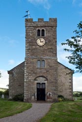 
St Patrick Church, Bampton |
Thankfully a restful sleep, now Day Two and our first day of walking. After a fine breakfast, now 10:00 AM, we checked out and were walking the track to Patterdale. It was a day forecast for morning overcast clearing to mottled skies by afternoon, and that's what we got. The walk was far superior from my 2010 turbulent excursion because then my companions smartly abstained from a walk in hard driving rain, silly them! Temperatures in the morning were in the 50s, and then peaked to low 60s by afternoon, near perfect walking weather. We walked up Tong Gill rather than Little Tong Gill (as I did in 2010), and I found this route both more scenic and less exposed in the event of foul weather. It was a slog up to Grisedale Tarn, but the views below towards Grasmere were outstanding. After a short stop at Grisdale Tarn, we were on our way again. Very shortly past the east side of the tarn I found Wordsworth's Brothers' Parting Stone, it is easily seen when traveling west, but is likewise easily missed traveling east (so look behind you for a large stake in the air as you walk from Grisdale Tarn). From here, or rather from the eastern side of the tarn was all downhill. Soon we reached the Rosthwaite Cabin, it was locked. Although going down was much easier, the terrain was rocky. We reached the Lovely Bridge, but a gate across the road prevented close access. We then walked the remaining 1.5 miles to the Grisedale Lodge B&B, arriving at 4:00 PM. The B&B is located midway between Glenridding and Patterdale. Our room was small with a tiny bath, but our hosts were first rate. We dined nearby at the White Lion, since the alternative, Fellbites in Glenridding, was booked because of the Tour to Britain Bike Race. I had a very fine Steak and Ale Pie and a beer.
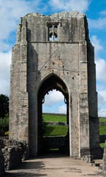 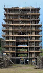
Shap Abbey 2010 and 2016 Restoration |
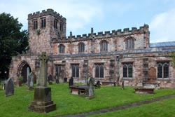
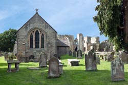
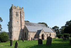
On Day Three we started a bit earlier because our bags would be picked up early, all because Stage 2 of the Tour to Britain Bike Race. Not a problem, we planned to take the Ullswater Steamer rather than walk the conventional path. Our host at the Grisedale Lodge shined when making breakfast, especially the wonderful homemade dark bread, and, lucky us, our sack lunch was prepared on that same bread at a bargain price of £3. At 9:45 we were on the Steamer for a one hour journey to Pooley Bridge. It was a delightful journey. Along the way we saw handsome mansions, fine countryside, and a few people sailing small boats. At Pooley Bridge we perused the town stopping at a few shops. At 11:30 we left Pooley Bridge to walk the 6 easy miles to Bampton. As we gained easy elevation we were treated to wonderful views of Ullswater below. Then after the summit we diverted slightly to view a not so impressive stone circle. We followed the sometimes muddy track from the stone circle, but in retrospect I recommend backtracking the short distance to the primary non-muddy track. At the summit the scenery looked like moor country. When we reached the town of Bampton, we spied a small local park which had the most delightful carved bench. The bench incorporated numerous cute critters like snails, frogs, man/woman, elephant, beetles, and more. Then we soon reached the village and visited St Mary's Church. At 3:00 PM we were at the Crown and Mitre. Our room was again small, but thankfully the shower was of reasonable size. That evening we dined at the pub, I had a lamb shank (fine, but not outstanding), while M had a steak and ale pie (not nearly as good as the one I enjoyed the night before at the White Lion).
Track Medallions |
Gill Fence near Orton |
With a potential 15 mile walk on Day Four, we chose to shave 2.5 miles of hardtop by hiring a taxi to drive us from Bampton to the Shap Abbey. So at 9:30 our taxi picked us up along with another couple, then as we cruised we waved to the other walkers marching on the hardtop, and that joy cost us a bargain £12. Sadly the abbey was in a state of restoration with scaffolding everywhere, it was not a pretty sight. Shortly thereafter we continued our walk. Most of the day was socked in with clouds and low visibility, and although it wasn't raining we were in a constant windblown mist. When we reached Shap, we popped into a tiny cafe to purchase sandwiches for a later lunch, and then we were on our way again. In low visibility we walked through featureless terrain and long faded trail markers. Thankfully my GPS did its job because I wasn't always diligent to keep us on track. Twice we had to backtrack because of confusing intersections. The first one was near a quarry where we missed our turn and walked an extra 1/4 mile off track, while the second we turned sharp left rather soft left for another extra 1/4 mile off track. After the 2nd fubar it was 1:00 PM, so we decided to lunch. Unfortunately with the wind, clouds, and mist there was no place to stop, so we ate our sandwiches on the go. Too bad we didn't wait a bit longer because soon afterward we reached an outcropping of karst where we could have sat down. The karst was at our high point, then as we lost elevation the track became muddy. No doubt it was a slog. Thankfully we identified Stedman's "Big Isolated Boulder" on the southwest side of the track, and that gave us a warm feeling that we weren't astray. The remaining walk continued to be muddy and was mostly down hill to Orton. At 4:00 PM we reached the George Hotel. After a delightful shower I went downstairs to the bar and ordered a pint of local beer, and ultimately joined a couple of locals in fun chitchat. At 6:30 PM, now after a pint and a half, we sat down for dinner. I had fish and chips, M had a chicken pot pie.
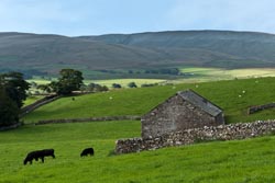
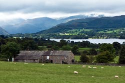
Cows & Sheep & Grass & Stone |
On Day Five we repeated our same routine from the day before by sharing a taxi to skim 4 miles off the walk. We then started our walk just south of Tarn Moor, and our walking day would now be 9 rather than 13 miles. It was a good idea to taxi, as while on the dreaded asphalt we passed the other walkers from Orton. Weather was fabulous, mostly clear skies, and warmish temperatures. It was a pleasant day, although not dramatic. The Smardale bridge was picturesque, as was the Smardale aqueduct. We lunched after the Smardale bridge at the high point in the Smardale Fell, and we were fortunate to have karst to sit on. Although today's track was easy to follow, I checked the map and GPS often. We reached the railroad tunnel easily, but when we reached Greenriggs Farm a sign by the farm owner diverted us to his alternate path and that led us astray. We ultimately came out ok, but we had to scramble over 2 locked gates, through random fields to get back on track. I think "never again" follow off track instructions from a homeowner wanting more privacy. We reached Kirkby Stephen and the Black Bull at 3:00 PM. We dined at the Mango Indian Restaurant and had an enjoyable meal (although the 2 star hot rating was very tame).
Smardale Bridge over Scandal Beck |
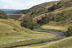
Smardale Viaduct over Scandal Beck |
A layover day on Day Six, one with light to medium rain and dark clouds over the track. We decided to visit Appleby and its castle. Mistakenly we hired a taxi to Appleby, then learned that we could have taken the bus, something we used on return, a difference between £32 and £3.50. Once in Appleby we joined the 1:15 PM tour of the Appleby Castle for £6 each [while an earlier tour started at 11:15]. The 1-1/4 hour tour was great, our guide was enthusiastic, exceedingly fun, and entertaining. We learned the history of the castle, viewed the castle grounds, and were allowed to view a small segment of the castle interior, whereas the remaining wings of the castle were dedicated to paying guests. Afterward, we had a late lunch. Then we walked the town to a sky now clear and blue. At 4:48 PM the bus to Kirkby Stephen arrived, and at 5:15 PM we were back. That evening we dined again at the Mango Indian Restaurant ordering with a request for spicy. And that it was, and certainly a bit too hot. Nonetheless, the meal was good. Back at the Black Bull we were entertained by a very boisterous crowd in the bar directly below our room. But thankfully the bar cleared around 10:30 PM and we were given quiet. So if you stay in the Black Bull make sure your room is on the 3rd (top) floor.
 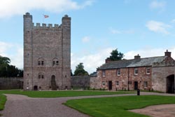
Appleby Church and Castle |
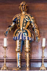
Appleby Castle Armour |
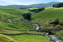
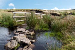
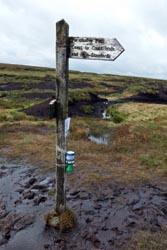
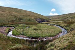
Day Seven was a walk to the Nine Standards Rigg and to Keld. We fueled up expectantly at breakfast with eggs, excellent Cumberland sausage, tomato, and mushrooms. Then at 9:15 AM we were on the track. This was a long day of 12 miles plus a gain of 1900 feet, but as it turned out it seemed much longer because of endless mud avoidance. The first part of the walk was on hardtop through the back end of Kirkby Stephen and the town of Hartley and its unsightly quarry. Soon we left the hardtop and reached the junction of the Green and Red/Blue routes. M went Green and I the other to view the Nine Standards, and we would hopefully meet again where the Red/Blue/Green tracks rejoined. The track along the Red/Blue route to the Standards was noticeably more difficult with many mud obstacles to avoid. One mile later I reached the Nine Standards, and of course I played photographer. Then 1/2 mile further I reached the Red/Blue route junction and followed the Blue route as it is recommended for September. The walk down was across bog, and bog, and bog, so whatever map distance it was, the walk was much longer from endless mud-avoidance deviations. Thankfully, the weather only brought strong winds, and for the most part no rain. It was a very long path down over a very wet bog. The next day I learned of a solo walker who dropped waste deep into the mud bog, and she said it took her 10 minutes to extricate herself, so be very careful! It was a pleasant sighting when I reached Whitsundale Beck, a very scenic meandering stream. Of coarse there was more mud and diversions, but it seemed much easier or maybe I just became more tolerant, as now my boots and pants were trashed and I didn't care if they got more trashed. At 2:45 PM I spied M at the junction on the Red/Blue/Green routes, and she said she had been waiting 20 minutes. How very nice! Here she was finishing her lunch time sandwich, so I pulled my out and devoured it. We were then on our way. Although the track was much better now, there were still numerous mud obstacles, but otherwise scenic. We passed Ravenseat Farm and chose not to stop for a snack. We were now 3 miles from Keld. We climbed a small hill, then with 2 miles remaining we were traveling downhill, a blessing after a long day. With 1 mile to walk, we mistakenly turned onto the hardtop to Keld rather than the higher dirt (and maybe more mud) track. That simple mistake made our final journey easier, because now the rain started coming down. Thankfully not much farther, and at 4:30 PM we reached the Keld Lodge. Now under new ownership (since 2012) the lodge had noticeably improved. Our room was delightful, certainly the nicest B&B we stayed at. And our dinner was excellent. M had a scrumptious sea bass, while I had a steak and ale pie, we both cleaned our plates. It was a wonderful day.
Murray, They're Staring At Us Again! |
Faraday Gill near Nine Standards |
On Day Eight we had hopes of a breakfast commensurate with dinner the night before, we had eggs and sausage and the rest. Sadly we were disappointed for they did not serve Cumberland sausage, so we now learned to ask. We chose to walk the low route to Reeth, following the River Swale. Along the initial part of the walk we gained elevation following hardtop to a dirt track. Then we diverted south to follow the river. It was going to be a fine walking day, slightly overcast sky in the morning, then sunny with spotty clouds in the afternoon. Of course we diverted to Muker. There M had a lovely time at Swaledale Woolens purchasing a few hand made items that were shipped home. Back on the track again, we took the diversion after the Muker bridge along the low river route. It was a delightful walk, and along the way we passed through numerous stiles as we were greeted by various groups of sheep. At 1:30 PM we reached Gunnerside, and popped into the King's Head Pub for lunch. We both had delicious roast beef with horseradish and greens, a side salad, and chips, yummy yummy. After lunch we walked (per Stedman) a route that climbed a ridge while still following the river far below. It was a significant climb and we had nice views of the valley and river. But I thought the walk along the ridge was arduous, and I would have preferred one of the many lower options near the river. As we walked we met up with two other couples, and as we progressed we used our collective knowledge to keep on path. At 5:45 PM we arrived in Reeth and the Hackney House B&B. Our host offered us tea and cake, and we gratefully accepted. We then cleaned up, and at 7:00 PM we went to town to find dinner. Our choices were limited to 2 pubs, while a third choice was closed for a party. We ultimately picked the Black Bull, it was not a good choice as service was terrible and the food was marginal, whereas in 2010 I dined at the unappealing Kings Arms. Now that I've been to Reeth twice, I can say the dining choices are disagreeable.
Nine Standards Mud! |
 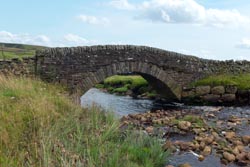
Whitsundale Beck & Bridge |
Breakfast on Day Nine at the Hackney House was splendid ~ local free range eggs, grilled on-the-vine tomatoes, most excellent bacon, and mushrooms ~ my five star rating. When we left, we stopped at the nearby Reeth Village Store to purchase sandwiches, but sadly all they had were meager prepared packaged varieties. Then at 9:15 AM we were on the track. The weather was splendid with mostly sunny skies and a sometimes light breeze. Unlike yesterday, this day's walk was easy and straightforward. We had some easy climbing leading to grand views. Along the way we passed and were passed, by now, familiar other walkers. At 1:00 PM we found a nice rock with sweeping views and sat down for our bag lunch. After the short break we continued along the easy track. We reached the Black Lion Inn in Richmond at 3:45 PM. We then took advantage of the Inn's generous laundry policy with a bag of dirty stuff to be cleaned, all for a bargain price of £5, and it all returned later that evening. At 6:30 PM we dined downstairs near the bar. I had an absolutely fabulous roasted pork shank with apple potato mash and various steamed vegetables perfectly prepared, while M had salmon, also perfectly prepared. Our room was a bit funky with nothing level, but everything else at the hotel was grand.
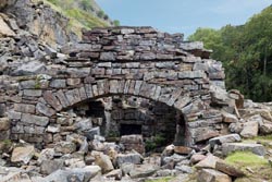
Swinner Gill Lead Mine Mill |
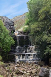 Swinner Mill Gill |
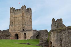
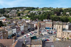
A well deserved and delightful layover day in Richmond on Day Ten. At 10:00 AM we walked to the nearby Georgian Theatre for their 1 hour tour, most enjoyable and highly recommended. The theatre was built in 1788 and is now the oldest theatre of its kind. Until about 1830 it was used for performance, but then fell into a variety of uses until 1963 when it reopened and was restored as a non-profit trust [see wikipedia]. After the theatre tour we walked about 1 mile along a delightful path following the east bank of the River Swale to the remains of Easby Abbey. There we toured the grounds taking in the 12th century structures. Adjacent to the abbey we viewed the still functioning Parish Church of Saint Agatha at Easby, where inside we viewed a large 13th century fresco. Then with hunger pangs we walked 1 mile to The Station for a delightful lunch. We then walked to the Richmond Castle and viewed the expansive grounds, structures, and tower. By now it was past 3:30 PM. M stayed in the town square to shop, while I returned to the hotel to compose postcards. At 6:30 PM we dined at nearby Rustique. I had a delicious sea bass with roasted potatoes and vegetables, while M had a casserole of seafood wrapped in a crape. Dinner was most enjoyable, I would certainly recommend Rustique, but I thought my pork shank at the Black Lion was superior, while M thought her sea bass at the Keld lodge was better. Nonetheless we were dining well.
Side Note: The walk from Richmond to Danby Wiske to Osmotherley was bland. If I had to do it again, I would stay 2 days but 1 night in Richmond and then at the 2nd day's end bus [~45 minutes/hourly: Richmond to Northallerton, ~£5] and taxi [~10 minutes, ~£25] to Osmotherley. With the extra days I would definitely walk along the North Sea cliffs to Robin Hood's Bay, and would choose another segment within the North Yorks Moors National Park.
Ivelet Bridge over River Swale |
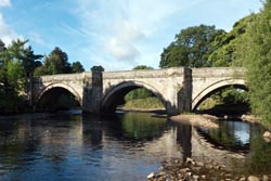
Grinton Bridge over River Swale |
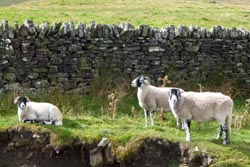
After a fine breakfast on Day Eleven we each picked up a sack lunch of ham, cheese, chutney, and greens for a bargain price of £2.50 at the Black Lion. Then at 9:15 AM we were on our way. We retraced our steps from the day previous to walk by The Station and through the woods, then after the abbey we followed the River Swale. We learned the day before of a diversion near the A1 and Catterick Bridge, and so we walked an extra mile along the remarkably well marked hardtop diversion. Thankfully the diversion and the soon to be new Coast to Coast route avoids the nasty Catterick Bridge, rather now exploits a disused, repurposed, railroad bridge. We then walked along the north bank of the River Swale. Although not very scenic, this section was vastly better than of things to come. Not so later we were walking hardtop, then more, and then yet more hardtop. Thankfully the sky was clear, but the temperature was a warm and muggy 80 degree (ugh). It was a day of miles of hardtop. Nearing 1:00 PM we found a patch of grass by the road in the shade for lunch. Then afterward we came upon an all-to-short path in grazing fields as a diversion, we shared this many stiled path with grazing cows and sheep. That short 1 mile path ended and we walked our final 2 miles on hardtop to Danby Wiske arriving at 3:00 PM. We stopped at the White Swan for a well earned refreshment. An hour later we walked the very short distance to the Ashfield B&B homestay. Our room was small, but the bath was fine, and we had access to the lounge and kitchen as a nice extension to our room. That evening we dined at the nearby White Swan. I had salmon while M had a roasted, stuffed chicken breast, and we both shared a fine assortment of vegetables. For desert we each had a serving of sticky toffee pudding.
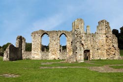 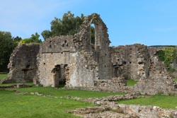
12th Century Easby Abbey Ruins |
Parish Church of St Agatha, Easby |
On Day Twelve we breakfasted with two other pair of walkers also staying at the Ashfield. It was our usual breakfast, but now with the fine conversation of other walkers. Our host was a hoot, she runs the B&B 6 months and then closes down in October for personal holiday. At 9:15 AM we started our walk to overcast skies. Unlike the day before, this day's walk was mostly on track, dirt road, and county lane, but the start was on hardtop. Early in the walk we were joined by a pair of ladies who we walked and talked with most of the day. The new and varied conversation was fun. As the day progressed the weather became more overcast and we felt like we were walking through a cloud. At 12:30 PM we spied a bench near a proud homestead and stopped for lunch, and shared a sandwich of cheese, cucumber, and chutney. Soon after lunch we reached the A19 near a gas station and a small tea shop. M and I plus our new found friends stopped for a tea AND to get out of the windy fog. Then M and I continued, while the others remained because they were lodging nearby in Ingleby Arncliffe, whereas we had another 3.5 miles to Osmotherley. We passed the Bluebell Inn in the nearby village of Ingleby Cross, then perused its nearby churchyard. We then continued on to reach the Arncliffe Woods. As we climbed we passed an area used (what we believe was) for breeding partridge. There were hundreds of them roaming the road and wood. As we walked many of the birds in front of us scurried ahead for dreadful fear of man. We followed, they scurried, for most of the path uphill in the Arncliffe Woods. Near the crest we decided not to visit the Mount Grace Priory. We then walked downhill to the turnoff to Osmotherley. At 3:00 PM we reached the Three Tuns Inn. Since my last stay in 2010, they remodeled the baths with a spiffy shower, it was most delightful. Afterward, I walked the village, and learned of the oldest shop in the community. Thompson, since 1786, was recently sold in May 2016 after the last heir died [the sign in the store front window read]. The property now has a deed restriction that it must be used for similar historic format. I then returned to the Three Tuns and enjoyed a pint and then a half. As 6:30 PM rolled around we dined, sharing an appetizer of fried mushroom balls, while I had a main of cod steak with shrimp, clams, potatoes, and spinach, while M had a steak and chorizo casserole, then we both had sticky toffee pudding. This pudding was my favorite of the trip while M preferred the one from the previous evening.
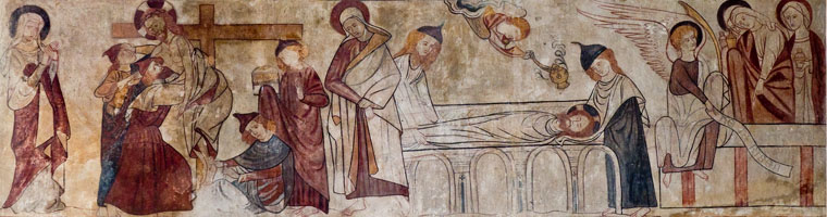
13th Century Fresco at Parish Church of St Agatha, Easby |
Day Thirteen was our final day of walking. At 8:00 AM we went down for a fine breakfast. Besides fresh squeezed OJ (yummy), I had a fried egg, local sausage, excellent mushrooms, and tomato. At 9:15 AM we were off. Rather than return to walk the other side of the Arncliffe Woods, we walked an easy road that took us by Cod Bank Reservoir. This diversion saved us a bit of foot tread, and it also saved us modest elevation near the woods. We learned too late that we could have walked a foot path along the reservoir rather than the hardtop, as we misinterpreted a sign and subsequently couldn't enter the fenced foot path even though we saw other walkers. We then reached the real track, now identified as the Cleveland Way. The entire day was excellent. We walked through woods and up to Live Moor. Most of the morning we were in fog, but as we gained elevation we poked our heads above it. Now on Live Moor we viewed highland heather on the plains and a sea of clouds below. It was a fantastic walk. Then we were descending, and soon reached Lord Stones. Under new ownership, the place has been spiffed up from my visit in 2010, and with brilliant weather we sat outside. I had a club sandwich with a side salad and chips, very good, while M had a roast beef sandwich also with a side salad and chips, and also very good. At 1:30 PM we were back on the track. The weather was now warn and muggy, about 80 degrees, with a wisp of wind. Up Cringle Moor to expansive views of a hazy valley below. Then down and up again to Cold Moor for more grand views. We now happened to meet up with a pair of young trampers carrying heavy packs. One had a bandana tied around his broken boot. I offered assistance by giving him duct tape for repair. He was a happy camper as he repaired his broken boot, and hopefully it would hold. They were walking the Coast to Coast at Wainwright's speed, thus the boot needed to survive another 2 days. We all continued, but the boys were gone in a flash. Down again then up to the Wainstones. Last time in 2010, with foul weather, I opted to walk the nearby forest, but no diversions this time. At the Wainstones I phoned the Buck Inn for a pick up in 45 minutes, a walk of 1+ mile. That 45 minutes we first scrambled up through the Wainstones (simple technical) and then we were on a high plateau with stupendous views. After 3/4 mile we were descending a steep track, but thankfully well laid out with good footing. Shortly we were near the motorway where we sighted our ride, and within a few minutes we were whisked to the Buck Inn in Chop Gate. The inn was most accommodating, above and beyond expectations. They arranged our complicated travel for the following morning to York. And that evening we had a fun and fine dinner at the inn, we were joined by 7 other walkers where we all ate and drank and told tall stories about our adventures.
| |
|
| |
|
St Mary's Church, Bolton-on-Swale |
A journey to York on Day Fourteen. After a fine breakfast, at 9:00 AM, our first-rate hosts at the Buck Lodge drove us to nearby Stokesley where we were soon greeted by a taxi that had been arranged for us the night before. We were then whisked to the Northallerton train station for £35. At 9:45 AM we were on the train, and 2 stops later arrived in York. All the while it was raining lightly, so I felt blessed not walking to dark and ominous skies. From the train station we walked a very short 10 minutes to our hotel, Bar Convent, and dropped our gear off. It was now time to play tourist. After visiting the information center for a map, we walked to York Minster. Entry to this ancient gothic church was £10. We joined a guided tour and were led to all corners of this marvelous cathedral. After the tour we walked below street level to view and learn the history of the ancient Roman structures that the cathedral now stands upon. Afterward, at 2:30 PM we sought out lunch. We spied a place called Betty's Café and were seated in the mullioned window of its second floor, a prime locale to view the activity on the street below. We each had a tiny tea size salmon sandwich, then shared a fine pastry desert. After lunch, now 3:30 PM, M went shopping and I went touristing. I returned to the Bar Convent at 5:30 PM, a place that is both hotel and working convent. The Bar Convent, formally known as Convent of the Institute of the Blessed Virgin at Micklegate Bar, is the oldest surviving Roman Catholic convent in England, established in 1686. The laws of England at the time prohibited the foundation of Catholic convents and, as a result, the convent was both established and operated in secret [see wikipedia]. That evening we dined at nearby Delrio's, I had an excellent linguine with seafood, we shared an appetizer of bruschetta, and I had ice cream for dessert, while M had an excellent pumpkin ravioli and our shared appetizer. A great final meal in England.
Café Wayfarer |
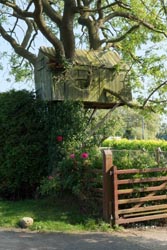
Treehouse in Streetlam |
On our Final Day we arose early to accommodate our breakfast and train schedule. We hustled down to breakfast at 7:45 AM, the earliest available, and our diligence the night before of ordering ahead worked well. It was a fine breakfast, but sadly it was more like "quick down the hatch." We left the Bar Convent at 8:00 AM, and walked to the train station reaching it 10 minutes later. Once on the train we hit a bottleneck of confusion as we approached our reserved seats. Seems our train car was full to capacity and a couple of ladies boarded this car in error and were sitting in our seats. Thankfully the 2 ladies acknowledged their mistake, so we didn't have to stand. It was then a pleasant and efficient ride to King's Cross London, arriving on schedule at 10:15 AM. We then took the Underground to Heathrow. At 11:45 AM we were at the airport, then an hour later after security we sat down for lunch. We walked to the gates, and then boarded our plane for departure. Seemed like ages later we were home.
Detailed Itinerary & Expense:
The table below lists the places we stayed, notable places we ate, and expenses we incurred along the Coast to Coast Path. The expense column is listed in English Pounds for 1 person (often with shared accommodations), while the totals at the top are in both Pounds and approximate 2016 US dollars ($1.30/£1), also for 1 person. Unless otherwise stated all lodging is twin, ensuite with bed and breakfast. The comment column generally denotes favorable impressions, but there are exceptions.
|
Coast to Coast Path 2016 ~ Detailed Itinerary & Expense |
|||
|
Date |
£1,452 |
Description |
Comments |
|
|
£78 ea |
•
Packhorse baggage transfer, (0-1768-371777)
|
• Reliable, highly recommended
|
|
9/2 |
£22 |
• Take Heathrow Express to Paddington Station
|
|
|
9/3 |
£6 |
• Take Bus (day use) to Windemere & Amberville
|
• Fun side trip
|
|
9/4 |
|
• Walk Grasmere to Patterdale
|
|
|
9/5 |
|
• Walk Patterdale to Burn Banks, then 2 mile to Bampton
|
|
|
9/6 |
£3 |
• Take shared taxi to Shap Abby (2-couples, £12), then
|
|
|
9/7 |
£5 |
• Take shared taxi to Tarn Moor (2-couples, £20), then
|
|
|
9/8 |
£38 ea |
• Layover day, stay Black Bull Hotel, see previous
|
|
|
9/9 |
|
• Walk Kirkby Stephen to Keld
|
|
|
9/10 |
|
• Walk Keld to Reeth
|
|
|
9/11 |
|
• Walk Reeth to Richmond
|
|
|
9/12 |
£45 ea |
• Layover day, stay Black Lion Hotel, see previous
|
|
|
9/13 |
|
• Walk Richmond to Danby Wiske
|
|
|
9/14 |
|
• Walk Danby Wiske to Ingleby Cross, then 1 mi to Osmotherley
|
|
|
9/15 |
|
• Walk Osmotherley to Clay Bank Top, call for pickup (see text)
|
|
|
9/16 |
gratis |
• Drive Buck Inn to Stokesley, then
|
|
|
9/17 |
£35 |
• Take Virgin Train
from York to London Kings Cross, then
|
• Advanced purchase for best fare
|