Click CotswoldReport2014.pdf for a copy of this report, OR click for a comprehensive set of Cotswold Way GPS waypoints, OR click to view my photo gallery.
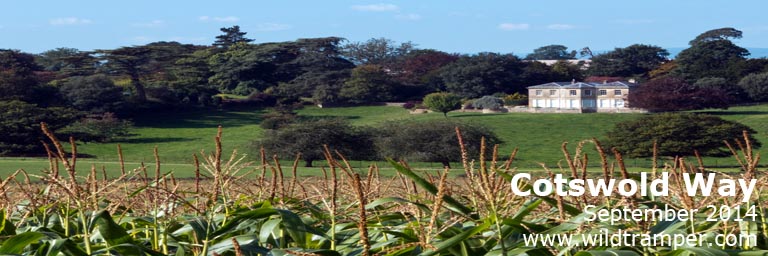
Cotswold Way ~ September 2014
Background:
My journey with a friend of the Cotswold Way was 13 days, walking 11 and relaxing 2, plus 2 days beforehand to explore Oxford, another 2 days beforehand to explore Stratford-Upon-Avon, and 3 days afterwards to explore London. We walked an average of 8-1/2 miles a day with the shortest being 7 miles and the longest 12. We had one relaxation day in Stroud for a side trip to nearby Gloucester, and we took a taxi on what would have been our last walking day from Tormarton to Bath so as to have 2 days to explore Bath's wonderful history.
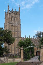
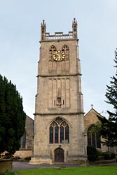
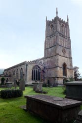
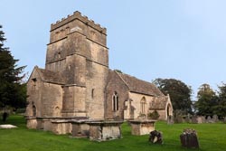
St James Parish Church |
This was my third long walk in England having also walked the Coast-to-Coast and the South Downs. The Coast-to-Coast is nearly 200 miles long over fabulously diverse terrain, and is a most excellent walk. The Cotswold and South Downs, on the other hand, are each 100 miles over (let's say) less diverse terrain. Differentiating the Cotswold from the South Downs (in my opinion) is that there are many more interesting side trips along the South Downs to fill a day's end. So if you are planning a long walk, I suggest you also look at my South Downs Way report.
This report describes my relaxing two week walk of the Cotswold Way with a friend. The report also includes what to expect for weather, how best to navigate, what clothing & equipment to use, getting to/from the path, lodging & gear transfer, and a detailed itinerary & expense list with positive and a few negative comments.
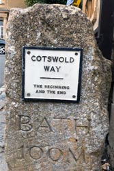
100 Miles to Bath |
Weather:
Having walked the Coast to Coast in 2010 I knew of England's fickled weather. Because September is touted as statistically drier I counted on my good luck for sunny skies. That I mostly received except for a bit of rain in Gloucester on a layover day, while forlornly many days brought hazy skies and the walk over Cleeve Common was through you-can-cut-it-with-a-knife fog.
But weather be damned, I found the adversity of walking in a sometimes foul climate a minor concern. Armed with a good quality Gortex rain shell, rain pants, gators, and boots, I was prepared for what the elements could deliver. I always wore gators to keep the often wet track from soiling my feet, and the day walking over Cleeve Common in thick fog I donned a Gortex rain shell.
Navigation:
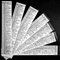
WP |
OSGB |
Elev |
Cotswold Way
|
Take-Along Waypoint Guide |
C001 |
SP1507 |
144 |
Begin, Market Hall, W on High St |
|
H001 |
SP1504 |
144 |
The Kings Hotel |
|
C002 |
SP1485 |
145 |
R, head NW on Hoo Ln by Volunteer Inn |
|
C003 |
SP1428 |
213 |
L, head NW on Kingcomb Ln |
|
C004 |
SP1421 |
215 |
Turn R on cartpath |
|
C005 |
SP1407 |
222 |
Dovers Hill, turn L, head W |
Although the Cotswold is well marked and is an easy track to follow, more likely than not you will go off path at some point. The important consideration is to learn of these errors to recover as soon as possible. In my opinion, there isn't any one navigation aid that will keep you on path, rather I recommend a minimum of two. These are a National Trail map of the Cotswold Way and a handheld GPS, but a simple "key-chain" compass is also useful, so while in thick fog on Cleeve Hill my key-chain compass helped guide us southward. A GPS unit will tell you where you are, while the trail map will identify your location. A GPS unit can also guide you off track to at-the-moment side trips. Additionally, a guide book of the Cotswold Way can be both useful and informative.
Before my walk I downloaded a map of Great Britain to my GPS, and I created a set of GPS waypoints for the walk which identifies the main path from numerous alternates comprising about 400 waypoints: 292 along the main route, 14 alternate paths comprising 72 waypoints, and 55 waypoints demarking various points-of-interest. I also created a Take-Along Guide which identifies each waypoint, a milepost, OSGB coordinate, elevation, % grade, and a brief description. A snippet of this guide is illustrated here, while a comprehensive discussion of these waypoints and free downloads can be found elsewhere on my website at www.wildtramper.com.
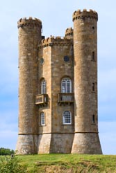
Broadway Tower |
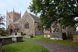
St Michael & All Angels |
When my companion and I were walking, we relied on my Garmin eTrex 30 GPS with downloaded maps and waypoints and the "National Trail Cotswold Way" map along with a Cotswold Way guidebook for miscellaneous information. I copied (two-sided in color) sections of the unwieldy National Trail map and placed the now 8-1/2"x11" copies into a waterproof (Ortlieb brand) 9"x11" map carrier. I found using a map carrier both reliable and convenient, much more so than large cumbersome sheet maps.
Navigation Issues:
Unlike other long tracks I have walked, I found the signing of the Cotswold Way well marked. The only navigation issue is extreme caution should be taken when crossing motorways.
Equipment:
Clothing:
While walking I always wore nylon pants, long sleeve light-weight wool shirt, sturdy waterproof boots, wool socks, gators, and a hat. When the temperature cooled down I added a nylon shirt and/or Gortex shell, and although the weather never turned severely wet I also carried rain pants. While walking I almost never required any additional layers to stay warm, but my day pack always included a fleece shirt, wool cap, and light weight gloves that I sometimes wore in early mornings. I recommend walking only with fast drying, wicking fabrics (e.g. nylon, fleece, and wool) and to stay away from cottons because as the adage says cotton kills.
Hidcote Garden |
Stanway Vicarage |
I strongly recommend bringing a bomb-proof rain jacket. Bomb-proof means a rain jacket that is made of seam-sealed, three-layer-laminated, Gortex fabric, and a jacket with proper head protection, that is a hood which stays in place in heavy rain or wind, and a shell length sufficient to cover part of your lower body. I own both three-layer-laminated Gortex and lighter two-layer-lamented rain gear, and I have learned that the lighter weight materials do not stand up to prolonged foul weather. It pays to use what I call bomb-proof construction for best prolonged comfort in inclement weather as you will likely experience at some point along the path.
Like rain jackets, I own various grades of rain pants. For the Cotswold I brought a good quality, light weight, waterproof and breathable, nylon rain pant rather than bomb-proof Gortex. Thankfully, I did not need to wear my rain pants, although the day on Cleeve Common we walked in wet pea-soup fog. Whether sunny skies or not, I always wore gators to protect my legs from a sometimes wet or muddy track. I brought two hats, one to keep the sun off my thinning hair and the other with a large brim to shed rain from my face.
Hailes Abbey |
Hailes Abbey Vicarage |
What I Carried:
I carried a small 25 liter day pack outfitted with a 2 liter Platypus through-the-straw drinking system. Among other things, the pack contained a personal first aid kit [dental floss, iodine, paper tape, nitrile gloves, second skin, protective mask for first aid/CPR, ibuprofen, acetaminophen, moleskin, various bandages, sew kit with various needles, scissors], LED headlamp, extra batteries, bandana, emergency TP, ditty bag [sunscreen, lip balm, deet (never used), hand sanitizer, eye drops], fleece shirt, wool cap, light-weight fleece gloves, and pack rain cover. Attached to the pack with both a Garmin clip and the all important safety lanyard (as I once lost a GPS when the clip failed) was a Garmin model eTrex 30 GPS with downloaded maps and waypoints. I carried a walking stick.
Devil's Chimney |
Other Logistics:
Reference Books and Maps:
• "The Cotswold Way" by Kev Reynolds is a comprehensive book of the path. It includes numerous maps of the route and sites along the path. There are numerous other guide books available.
• Harvey's "National Trail Cotswold Way" polyethylene maps are continuous strips to 1:40000 scale. This map identifies only the main route, while walking off track to nearby villages the map is often missing. Nonetheless, I found these maps useful to absorb a days journey. Before the walk I two-sided, color copied sections of the map to fit into a waterproof (Ortlieb brand) 9"x11" map carrier. The sections generally comprised one day's walk.
• My GPS was downloaded with Great Britian contour maps. Although these maps should be available through your GPS manufacturer, I chose to use free open source maps from TalkyToaster and I found these maps were both detailed and reliable. Alternatively free world-wide open source maps are available from VeloMap.org.
Saint Mary's Church |
• The National Trails Cotswold Way website This excellent site lists numerous trail information including FAQs and lodging along the way.
• The RambleFest website is another souce of useful information of the Cotswold Way including lodging, places to eat, guidebooks and maps, and more.
Gear Transfer & Lodging:
Unlike most people who walk the Cotswold I booked my own lodging, and used Sherpa Van for the day-to-day baggage transfer. Sherpa Van can also arrange accommodations. If you choose to book as I did, I recommend booking early. I booked nearly a year in advance and was able to pick almost any B&B or inn. I used two websites to find lodging: National Trails Cotswold Way and RambleFest (see Reference section above).

Tapistry |
Cell Phones:
Any unlocked, 4-band, GSM cell phone should work fine in England, the trick is to purchase the correct service provider. On my walk last year I purchased a SIM with service by Orange, and was very satisfied. This year I purchased a SIM from The Carphone Warehouse in Oxford, and they offered only a generic service provider which didn't provide reliable service across the walk. Thus, next time I will search for a SIM by Orange as the service provider.
Getting To/From the Track:
From Heathrow airport my friend and I took the National Express Coach (located between terminals 1 and 3) to Oxford (£24 / 2 hours), then by rail to Stratford-upon-Avon (£17 / 1 hour), and finally by bus to the start of the track at Chipping Campden (£5 / 1 hour). On return from Bath we traveled by rail to London Paddington Station (£32 / 1-1/2 hours).
Distance / Elevation:
The above chart is a distance/elevation graph with distance in miles and elevation in feet. From left to right the path travels from Chipping Campden to Bath. In between (identified in red) are towns, sometimes off-track, with notations for milepost plus one-way off-track walking distance. The table below lists the distance from the start of track in Chipping Campden to various towns that I stayed in, while the off-track distances is measured as the shortest one-way walking distance to available lodging. Other towns near the track are possible but not indicated.
|
Place |
Milepost |
Off-Track |
|
Place |
Milepost |
Off-Track |
|
Chipping Campden |
0 |
|
|
Stroud (ALT via Stroudwater) |
55.7 |
1.6 |
|
Stanton |
10.1 |
0 |
|
Dursley |
62.8 |
0 |
|
Winchcombe |
18.0 |
0 |
|
Wotton-Under-Edge |
69.8 |
0 |
|
Cheltenham |
29.6 |
0.8 |
|
Hawkesbury Upton |
77.6 |
0.4 |
|
Birdlip |
31.2 |
0.1 |
|
Tormarton |
84.6 |
0 |
|
Painswick |
46.5 |
0 |
|
Bath |
102 |
|
The Walk:
Stroudwater Navigation Locks |
Rather than traveling directly to the start of the Cotswold Way in Chipping Campden from our arrival at Heathrow, we chose to spend a few days playing tourist. From Heathrow my friend and I took a National Express Bus to Oxford staying two nights at the very nice and centrally located Bocardo Hotel. Our first order of business was to purchase a SIM card for my cell phone from Carphone Warehouse, a disappointing purchase because the suggested service provider had spotty service along the track (rather than the excellent service from provider Orange of the previous year). Later that first day we perused the city and its many universities with an excellent guided tour organized by the Visit Oxfordshire Tourist Information Center.
The next day we took a bus to Blenheim Palace, a monumental country house, park, and garden in nearby Woodstock. The palace is also the birthplace to Sir Winston Churchill. That evening my friend and I were joined by past Coast-to-Coast walking friends for a brew and dinner at the bustling 13th century Turf Tavern.
Stroud Waterway |
All Saints Church |
The following morning was one to catch a train to Stratford-Upon-Avon, birthplace to Shakespeare and home to the Royal Shakespeare Company. We stayed 2 nights at the Emsley Guest House in the heart of town. That afternoon at the Swan Theater I saw the 17th century revenge tragedy The White Devil by John Webster. In the evening, also at the Swan Theater, my friend and I saw Middleton and Dekker's Jacobean 17th century comedy The Roaring Girl. The latter was enjoyable lite entertainment, but it is no wonder that Shakespeare's plays continue to be popular while Webster's are not.
Our second day in Stratford-Upon-Avon was one of experiencing the history of William Shakespeare by visiting several places that were part of his life. The first, by bus to the nearby village of Wilmcote, was to Mary Arden's Farm, mother to the Elizabethan playwright. The farm is now a working exhibition to reflect life in the16th century and has various rare breeds of animals including Mangalitza and Tamworth Pigs, Cotswold Sheep, Long Horn Cattle, Baggot and Golden Guernsey Goats, Geese and Birds of Prey. While there I personally volunteered to expand my extensive experiences with the useful trade of herding geese - Very cool, but not marketable! Returning to Stratford-Upon-Avon we next visited Shakespeare's Birthplace and Nash's House, the site of Shakespeare's final home. Regrettably time didn't lend itself to visit Anne Hathaway's Cottage & Gardens. That evening we had a very fine dining experience at Lambs of Sheep Street.
Not in Kanas Anymore |
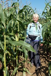
The following morning, our official day zero, we boarded a bus to Chipping Campden and the start of the track. It was an early September weekend which the hotels wanted to believe was still peak season, so finding lodging for one night (rather than two) was problematic. We stayed at the pretentious Kings Inn for it was one of few lodgings that offered one night weekend stays. That afternoon we took a bus to nearby Hidcote Manor Garden, an expansive arts and crafts garden with a maze of narrow pathways, while scattered about were outstanding exhibitions of contemporary sculpture. In the evening, with a craving for Indian food, we dined at the extremely disappointing Maharaja Restaurant.
Methodist Church |
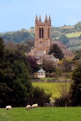
Our first day of walking was 10 miles to Stanton, a day of fair weather and hazy skies, a pattern that often repeated. Like other tracks I've walked in England, I found the Cotswold Way well marked, easy to follow, but nonetheless I was happy to rely on my trustworthy GPS for guidance. That first day brought us to the Broadway Tower, a folly 65 feet tall built in 1798-99 located on the hill above the town of the same name. From its1024 foot elevation we walked down to the town on that busy Saturday morning into Broadway. There we had a relaxing lunch at the Market Pantry. We continued along the path to Stanton and the most excellent Old Post Office B&B. Our lovely host had the kind forethought to arrange dinner reservations for us at The Mount Inn on that busy Saturday evening. There we had a most fine dinner at a table with stupendous views of the countryside.
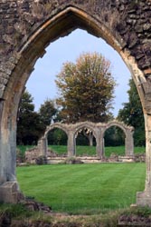
Our second day was a 7 mile walk to Winchcombe, shortened from the normal 8 miles by taking a shortcut just south of Old Stanway skipping an area called Lower Coscombe. Along the way we stopped at Hailes Abbey, now mostly ruins of its former 13th century self. After reaching our lodging at the White Hart Inn in Winchcombe in early afternoon, we strolled over to nearby 15th century Sudeley Castle & Gardens. That evening we dined at the White Hart Inn.
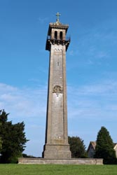
Somerset Monument |
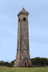
Tyndale Monument |
On our third day we walked 9 miles to the outskirts of Cheltenham staying 0.8 mile off-track at the Charlton Kings Hotel and about 2 miles from the town's center. On this day we reached our highest elevation at Cleeve Hill of 1100 feet, but it was a day of dense fog so we had no views. The Cleeve Hill Golf Club also graces this hill top, and we stopped at the clubhouse for a mid morning snack. But it was a surreal moment when a golf foursome returned from the course all complaining that they lost too many balls in the thick fog, thus abandoning their play. The fog was so thick that the visibility was just 20 feet, thus as a walker I was very happy that I had both a compass and GPS to guide us along the confusing open space golf course paths. We reached our hotel by mid afternoon and then boarded a bus to peruse the heart of Cheltenham. As evening approached we had dinner at Zizzi Ristorante, and although we had a nice Italian dinner we chose it mainly because the city's hoity-toity restaurants opened much too late to satisfy my growing hunger pangs.
| |
|
Our forth day we walked 10-1/2 miles to Birdlip. Along the way we stopped at the Star Bistro, a cooking school enabling young people with disabilities to gain real life work experience. Although the menu was adventurous, sadly the meals were disappointedly bland. After lunch we walked through Crinkley Hill County Park, and then onto Birdlip were we stayed at the Royal George Hotel. That evening we visited the home of some friends for dinner, and by surprise we were treated with some special entertainment. The home, located in the nearby hills, is a small farm with a stable for horses and a riding arena for their young daughters. So we enjoyed watching the kids have fun in the arena, and we were treated by one of the daughters with some show jumping. Very entertaining! Afterwards we all moved inside for dinner, and I particularly enjoyed the cobbler desert that Grandma prepared.
Parish Church of Saint
|
On our fifth day we walked a short 7 miles to Painswick. Along the way we walked off-track to the Great Witcombe Roman Villa ruins. The villa was built during the Roman occupation of England in the first century and is believed to have been occupied until the fifth century. What remains of the villa now are foundation wall outlines, but no structures. Later, as the noon hour approached, we diverted 0.1 mile off-track to The Royal William Pub for a well deserved proper lunch. After lunch we continued to walk when we reached yet another golf course. This one was the Painswick Golf Course, and we stopped at the clubhouse for a snack. Soon we reached Painswick and the delightful Falcon Inn in early afternoon. We then perused the town enjoying its historic setting, churches, and monuments. That evening we had an excellent meal at the Falcon Inn. Both my friend and I thought Painswick a delightful place.

Niagara Fall ... not |
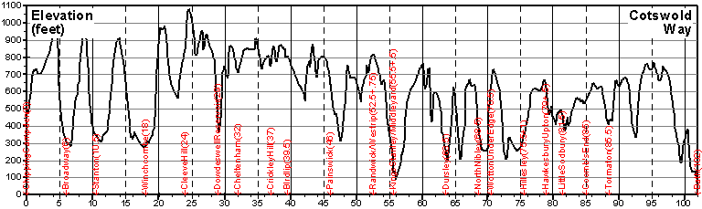
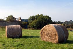
The sixth day was our longest walk of 12-1/2 miles. In the morning we walked through Maitlands Wood, and then through Standish Woods. Then we lost elevation to arrive at the Stroudwater Navigation, a canal opened in 1779 which linked Stroud to the Severn Estuary in England and Wales. As we walked, we passed three locks, but in total there are 12 along its path as the waterway rises 102 feet. Historically, the canal was mainly used to transport coal, but was abandoned in 1954. Now the canal is being restored, and as we walked we saw running paths, new housing flanking sections of the canal, and near the city of Stroud ongoing restoration. Our day ended at the Imperial Hotel in central Stroud located a stones throw from the rail station. After the long day, we humbled ourselves by doing long-overdue domestic duties at the nearby Soap-N-Suds Laundromat. We finished the day with an excellent and non pretentious dinner at the Bisley House Cafe sitting outside in their garden setting.
Friday was our seventh day, and thankfully a day to kick back and relax. Sadly, it was also a day of endless drizzle. Wearing rain gear and carrying umbrellas we walked 2 minutes to the nearby Stroud rail station and traveled to Gloucester, a short journey of about 30 minutes. We played tourist there visiting the Gloucester Cathedral, walking about the docks and viewing a tall ship in the quay, spying the Folk Museum, and enjoying the novelty of the Beatrix Potter Museum. That evening we dined in Stroud at Sorrento Restaurant, having an enjoyable Italian meal.
Saint John the Baptist Church |
On our eight day the drizzle from the previous day had passed, and in its wake we were greeted with clear blue skies. We retraced our steps along a section of the Stroudwater Navigation to rejoin the alternate track which then took us by Selsley and onto Middleyard. There we rejoined the main Cotswold track heading south. We soon reached Stanley Wood and later Coaley Wood. We then climbed an island hill to nearby Cam Peak and finally down to Dursley where we stayed at the charming Underhill House B&B. That evening we dined at the San Remo Italian Grill.
The walk on our ninth day was once again to clear blue skies, and this would be yet another day for walking a golf course. Just outside of Dursley is the Stinchcombe Hill Golf Course which sits on a plateau above the city. Although there is a 0.2 mile shortcut across a thin neck of the plateau, we choose to walk the 3 mile perimeter of the golf course along the plateau boundary, and I have to say it was worthwhile. Thankfully at that earlyish hour on a Sunday morning we didn't have to dodge any golf balls. From Stinchcombe Hill we walked down into North Nibley where we spied a plethora of outlandish street art for their annual September North Nibley Scarecrow Festival. From North Nibley we walked up through Westridge Wood to the Tyndale Monument, a 111 feet tall tower built in 1866 to honor William Tyndale, a translator of the New Testament, who is believed to have been born in the nearby town. We arrived in Wotton-Under-Edge by mid afternoon staying at The Swan Hotel. After touring the town, we had fine dinner at the hotel.
Saint Mary Magdalene Church |
With a bit less walking on our tenth day we chose to get a later start. It was mostly a non eventful day, but we did have a proper lunch. At mid day we diverted 0.6 mile off track to The Fleece Inn where we had a delightful lunch sitting under blue skies in their back yard garden setting. After lunch we spied the Somerset Monument erected in 1846 to commemorate General Lord Edward Somerset, a soldier son of the 5th Duke of Beaufort who had served with distinction at Waterloo. Soon afterward we arrived at Hawkesbury Upton, staying at the Fox Inn.
Our eleventh day was our last walking day. Along the way were several historic sites. The first was Horton Court, now a manor house built from the remains of a Norman hall. It was closed to the public on the day we were there, but we were able to view the buildings from afar. Shortly thereafter we reached Horton Camp, now just earthen remains of a once important hill fort on a promontory of the Cotswold Edge which is believed to date back to the 12th century. Just below the hill fort is the new Millennium Folly, erected in the year 2000, with the subtitle of Swallows and Owls House. And nearby were yet more earthen remains of Little Sodbury Fort, an iron age hill fort reshaped by the Romans. That night we stayed at Noades Studio B&B in Tormarton, and had a classic pub dinner at the nearby The Major's Retreat Pub.
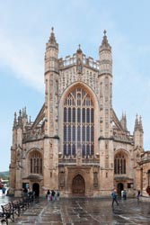
Bath Abbey |
We decided not to walk the twelfth day to Bath. Rather, the night before we scheduled a taxi so as to have more time in Bath. At 9:00 AM our taxi arrived, and 30 minutes later we were shuttled to the heart of Bath at the bargain price of £15 plus a generous £5 tip for the excellent service. So much to see, so little time, and at the Visit Bath Tourist Information Center we loosely planned our day. At 10 AM we joined the first tour of the day of Bath Abbey where our guide took a small group of 8 people up and up and up to the clock tower, the bell tower, and onto the roof where we scuttled across to the tower for stupendous panoramic views of the city and beyond. It was a magnificent one hour tour. Next we joined a free 2-Hour Walking Tour of Bath. Although there were loads of people waiting for this tour, there were also many guides so that we were able to split up into small groups of about 12 each. The group we joined rambled about the city with our guide who showed us many sites, both common and special to him. It was a most excellent and informative tour. Later we walked a self-guided tour of the Roman Baths. That evening we stayed at the wonderful Three Abbey Green located nearby the Bath Abbey, and had a fine dinner at Aió Sardinia on George Street.
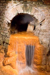
Roman Bath Hot Spring |
With the Cotswold walk now officially complete on this thirteen day, we got up early so as to continue to play tourist in Bath before our journey to London. On this morning we took a tour of No. 1 Royal Crescent, viewed Saint Michael's Church, then walked across the Pulteney Bridge. As the noon hour passed, we rambled to the train station for our 2 hour rail journey to London Paddington Station. Then by tube and foot we arrived at the Morgan Hotel, it was now 4:00 PM. That evening we enjoyed a stupendous production of Comedy of Errors at Shakespeare's Globe Theatre.
Our second day in London was a morning of research for my friend at the British Library and a morning of post card composition for me. Afterwards we played tourist at the always interesting Victoria and Albert Museum. That evening we had the most wonderful Indian dinner at Namaaste Kitchen nearby our hotel, most highly recommended.
It was a day for theater on this Saturday and our third day in London. We had matinée tickets for Hillary Mantel's Wolf Hall and evening tickets for its ongoing drama in Bring Up The Bodies, two 3-hour stories of the history of Thomas Cromwell in King Henry VIII many wives' court, and was performed by the most excellent Royal Shakespeare Company with a superb (nearly 6-hour on-stage) performance by Ben Miles portraying Thomas Cromwell. I have to say that the books were fascinating history while the theater performances were compelling drama.
On this Sunday, our last in London, we took the tube to Heathrow and then a flight home. It was a wonderful holiday.
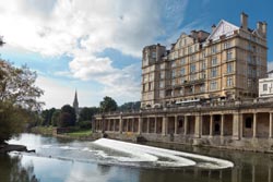
River Avon in Bath |
Detailed Itinerary & Expenses:
The table below lists the places we stayed, various places we ate, and expenses incurred along the Cotswold Way but not including air travel or extra activities before/after the walk while in Oxford, Stratford-upon-Avon, or London. The expense column is listed in British Pounds while the totals are in both British Pounds and US Dollars. Most of the time my friend and I shared a twin room as noted by the "ea" (each) suffix in the cost column, thus that price indicates the cost to each of us. And unless otherwise stated all lodgings are ensuite with bed and breakfast. The comment column generally denotes favorable impressions, but there are exceptions.
|
Date |
£1,474 |
Description |
Comments |
|
|
£30 |
• Guide book: (Cicerone) The Cotswold Way guidebook
|
|
|
9/8 |
£24 |
• Arrive Heathrow, National Express Bus to Oxford
|
|
|
9/10 |
£17 ea
|
• Rail: Oxford to Stratford-upon-Avon
|
|
|
9/12 |
£5
|
• Bus: Stratford-Upon-Avon to Chipping Campden
|
|
|
9/13 |
£40 ea
|
• Stanton @
The Old Post Office B&B, 1386-584398
|
• The very best B&B and host
|
|
9/14 |
£35 ea |
• Winchcombe @ The White Hart Inn, 1242-602359 |
|
|
9/15 |
£50 ea |
• Cheltenham @ Charlton Kings Hotel, 1242-231061 |
|
|
9/16 |
£38 ea |
• Birdlip @ Royal George Hotel, 1452-862506 |
|
|
9/17 |
£40 ea |
• Painswick @ The Falcon Inn, 1452-814222 |
• Great Inn, ask for room overlooking church |
|
9/18 |
£59 |
• Stroud @ Imperial Hotel, 1453-764077 |
• Next to train station, institutional hotel |
|
9/19 |
|
• Rail side-trip to Gloucester
|
|
|
9/20 |
£45 |
• Dursley @ Underhill House B&B, 1453-549617 |
• Great B&B and host |
|
9/21 |
£38 ea |
• Wotton-Under-Edge @ The Swan Hotel, 1453-843004 |
|
|
9/22 |
£45 ea |
• Hawkesbury Upton @ Fox Inn (no website) 1454-238558 |
• Great lunch near track at Fleece Inn |
|
9/23 |
£35 ea |
• Tormarton @ Noades Studio B&B, 1454-218278 |
• Fine B&B and host |
|
9/24 |
£65 ea |
• Bath @ Three Abbey Green, 1225-428558 |
• Excellent location, fine B&B |
|
9/25 |
£32
|
• Rail: Bath to London
|
|