|
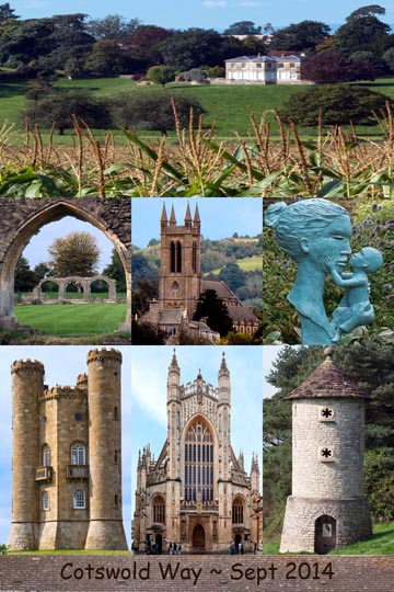
Cotswold Way |
September 2014 |
| |
|
Cotswold: L->R (1) Manor House near Stinchcombe, (2) Hailes Abbey, (3) Saint Michael & All Angels Church in Broadway, (4) Sculpture at Hidcote Garden, (5) Broadway Tower, (6) Bath Abbey, (7) Swallows & Owls House - Millennium Folly at Horton Hill. Read the report of my walk. |
|
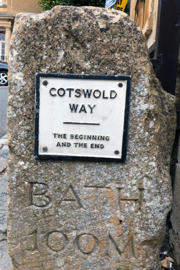
Cotswold Way: My beginning at Chipping Campden with 100 miles of walking to Bath. Along the way would be sights to be seen, food to be enjoyed, and local beer to be savored. [Google map of photo locale]. |
|
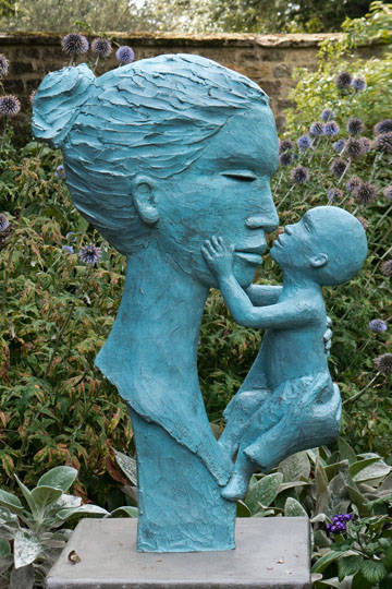
Maternal Bond: Nearby the start of the Cotswold Way in Chipping Campden is Hidcote. It is an arts and crafts garden with a maze of pathways, secret gardens, and when I visited a special sculpture exhibition. |
|
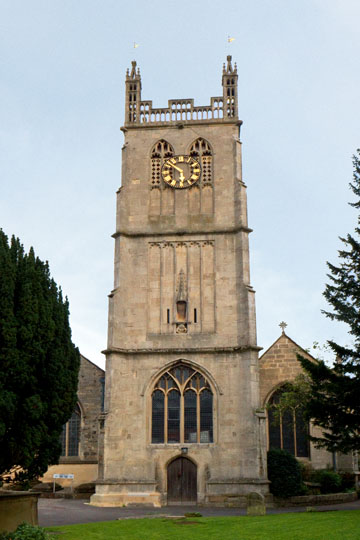
Saint James Parish Church in Chipping Campden. [Google map of photo locale]. |
|
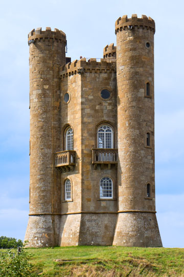
Broadway Tower is a folly located on Broadway Hill near the village of Broadway, and is the second highest point of the Cotswolds after Cleeve Hill. [source Wikipedia] [Google map of photo locale] |
|
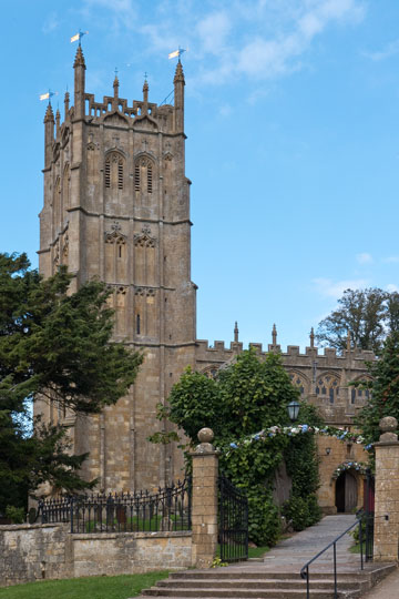
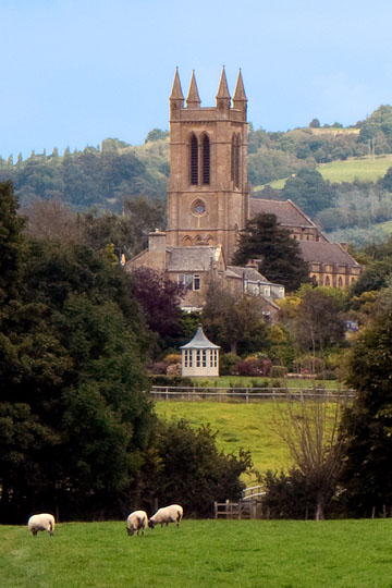
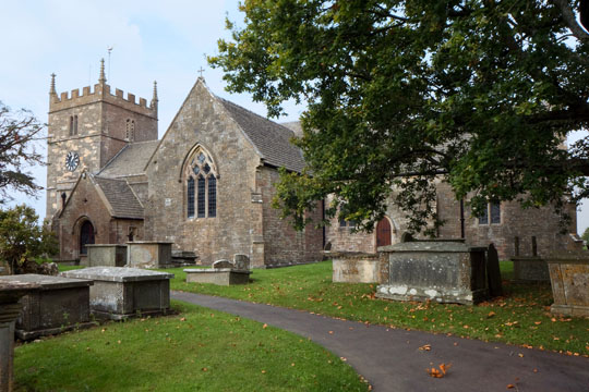
Saint Michael and All Angels Church of Broadway. [Google map of the church, but the photo was taken southeast of the town on the Cotswold Way overlooking the town]. |
|
Stanway Vicarage: This church may be disused, but nearby are a number of vicarage cottages. [Google map of photo locale] |
|
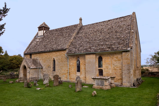
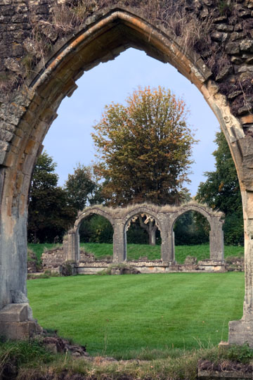
Hailes Church: Outside the remains of the Hailes Abbey is this church. It is older than the abbey, being consecrated in 1175. It later served as the Capella Ante Portas to the Abbey until the Abbey's dissolution in 1539. Inside the church are fine Medieval wall paintings. [source Wikipedia] [Google map of photo locale] |
|
Hailes Abbey: The abbey was founded in 1245 or 1246 by Richard, Earl of Cornwall, called "King of the Romans" and the younger brother of King Henry III of England. Richard founded the abbey to thank God after he had survived a shipwreck. [source Wikipedia] [Google map of photo locale] |
|
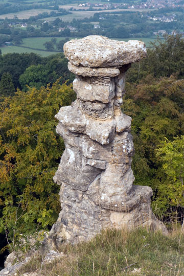
Devil's Chimney is a limestone rock formation that stands above a disused quarry in Leckhampton, near Cheltenham along the Cotswold Way. [source Wikipedia] [Google map of photo locale] |
|
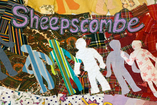
Tapistry from Saint Mary's Church in Painswick. Sheepscombe is a small village about 1-1/2 miles northeast of Painswick. [Google map of photo locale] |
|
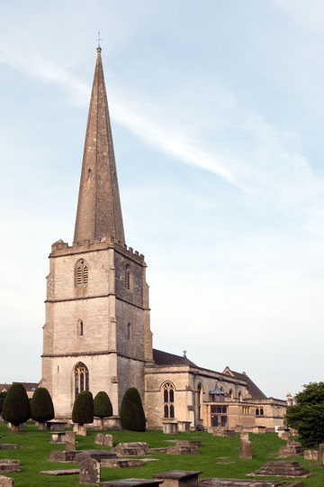
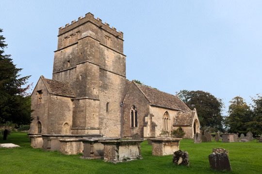
Saint Mary's Church in Painswick. [Google map of photo locale] |
|
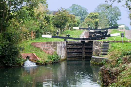
Stroudwater Navigation Lock: With a luxury of a layover day to follow, I diverted from the main Cotswold Way track to the town of Stroud where on the following day took the train for a visit to Gloucester. My diversion followed the Cotswold Canals, a name given to two connected Gloucestershire waterways, The Stroudwater Navigation and The Thames & Severn Canal. The thirty-six mile long waterway links England's two great rivers, The Severn and Thames. The Stroudwater Navigation meets the Thames & Severn Canal at Wallbridge in Stroud. [Google map of photo locale] |
|
Stroud Waterway: This section of the Stroud Waterway was nicely revitalized. [Google map of photo locale] |
|
All Saints Church in Selsley. [Google map of photo locale] |
|
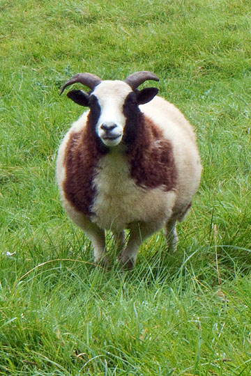
Billy the Kid: There is wildlife along the Cotswold! [Google map of photo locale] |
|
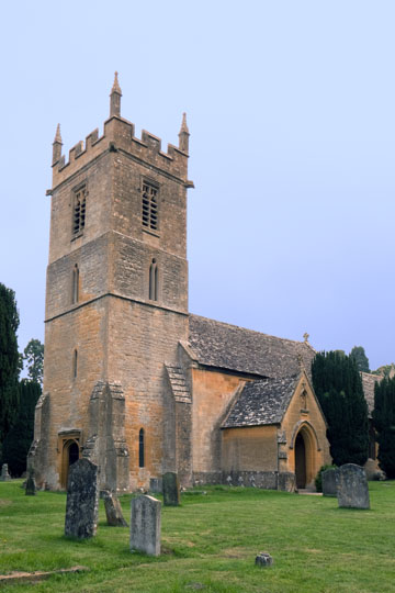
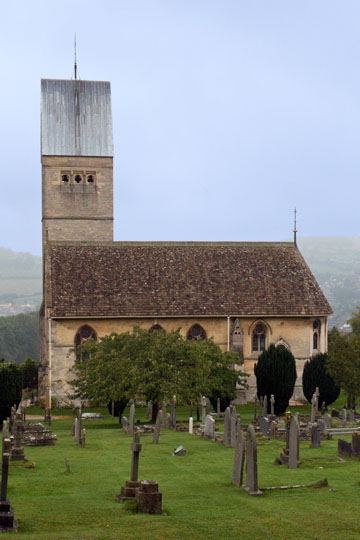
Dursley Parish Church: [Google map of photo locale] |
|
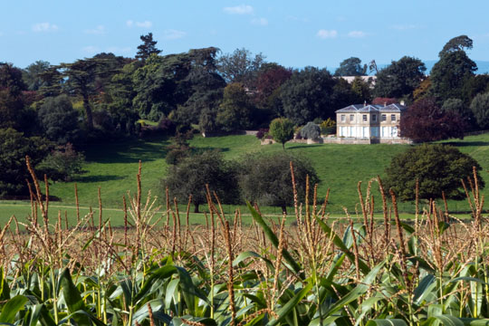
Where the Corn Grows: A lovely manor house in Stancombe Park. [Google map of photo locale] |
|
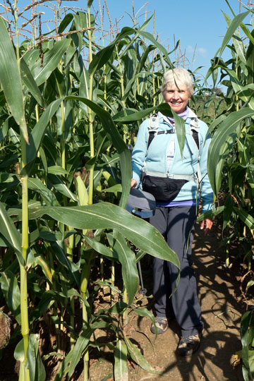
Not in Kansas Anymore, but is this the land of Oz? [Google map of photo locale] |
|
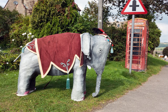
Street Art of the North Nibley Annual Scarecrow Festival, one of many creatures. [source North Nibley Annual Scarecrow Festival] [Google map of photo locale] |
|
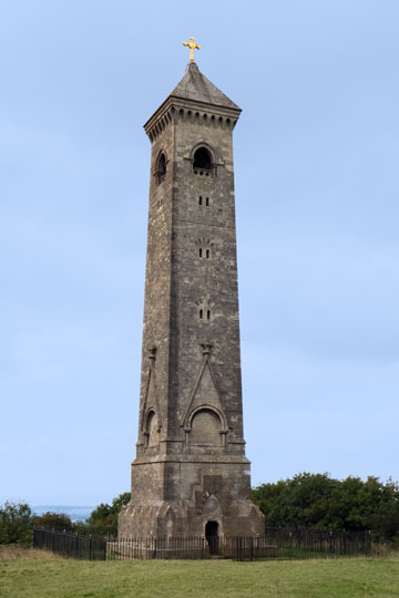
William Tyndale Monument was built in honour of William Tyndale, a translator of the New Testament, who is believed to have been born at nearby North Nibley. The tower was constructed in 1866 and is 111 ft (34 m) tall. [source Wikipedia] [Google map of photo locale] |
|
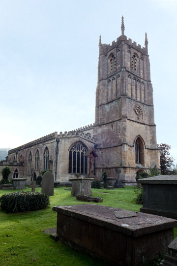
Parish Church of Saint Mary the Virgin in Wotton-Under-Edge. [Google map of photo locale] |
|
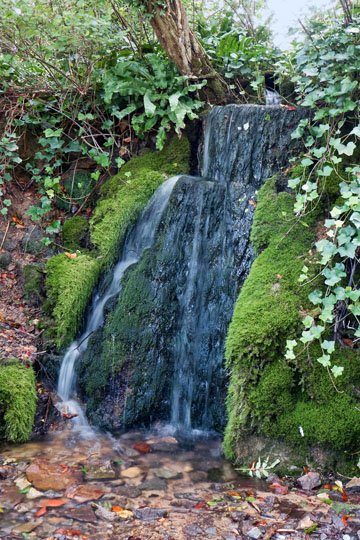
Niagara Fall???: Well, maybe not. [Google map of photo locale] |
|
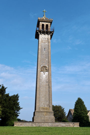
Somerset Monument: This monument was erected in 1846 to commemorate General Lord Edward Somerset. He was a soldier son of the 5th Duke of Beaufort, (whose ancestral home is at Badminton), who had served with distinction at Waterloo. [source Wikipedia] [Google map of photo locale] |
|
Hey, Hey, Hey! [Google map of photo locale] |
|
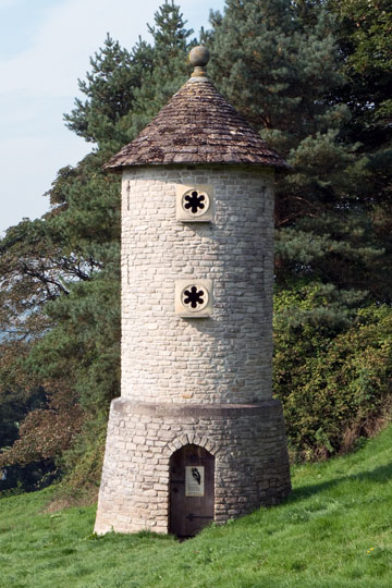
Millennium Folly (also known as a Swallows and Owls House): The tower was built in 2000 along the Cotswold scarp on Horton Hill just below the Iron Age hillfort of Horton Camp. The folly provides nesting places for swallows and barn owls. [source Wikipedia Commons] [Google map of photo locale] |
|
Saint John the Baptist Church in Old Sodbury. [Google map of photo locale] |
|
Saint Mary Magdalene Church in Tormarton. [Google map of photo locale] |
|
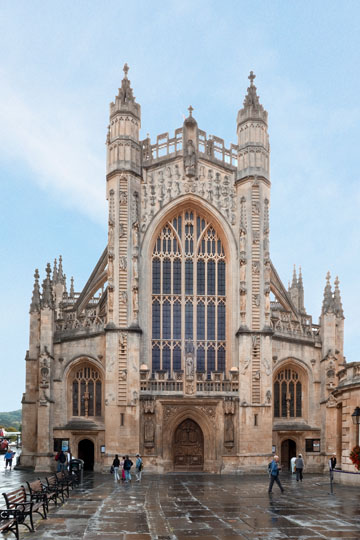
Bath Abbey, formally known as The Abbey Church of Saint Peter and Saint Paul, is an Anglican parish church and a former Benedictine monastery in Bath. Founded in the 7th century and rebuilt in the 12th and 16th centuries, it is one of the largest examples of Perpendicular Gothic architecture. [source Wikipedia] [Google map of photo locale] |
|
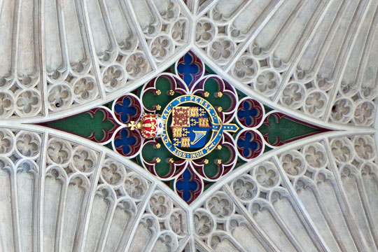
Bath Abbey Lattice Ceiling: The abbey is noted for its fan vaulting originally installed by Robert and William Vertue, with a major restoration by Sir George Gilbert Scott between 1864 and 1874. The fan vaulting provides structural stability by distributing the weight of the roof down ribs that transfer the force into the supporting columns via the flying buttresses. [source Wikipedia] [Google map of photo locale] |
|
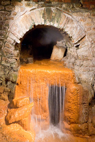
Roman Baths Sacred Spring: The Roman Baths is a Roman site once used for public bathing. In 60-70 AD a temple was constructed above the spring as was a bathing complex over the following 300 years. The Sacred Spring derives its thermal water from deep underground. [source Wikipedia] [Google map of photo locale] |
|
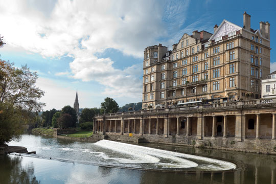
River Avon: The Pulteney Bridge [slightly upstream from where this picture was taken] crosses the River Avon in Bath, while just below the bridge is a weir [shown here]. The bridge was completed in 1774, and connected the city of Bath with the newly built Georgian town of Bathwick. Designed by Robert Adam in a Palladian style, it is exceptional in having shops built across its full span on both sides. [source Wikipedia] [Google map of photo locale] |