
Click on EmigrantReport2005.pdf for a PDF copy of this report. You may also want to check out my 2007 Emigrant Report, besides a show & tell it has a detailed chart of GPS locations with directions of places I visited.
Emigrant Wilderness, August 19 - 23, 2005
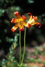
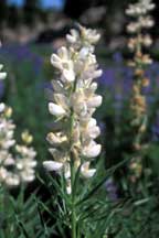
Tiger Lily |
My planned itinerary was to start at the Gianelli Cabin trailhead, spend the first night at Powell Lake (about 2 miles), the next two nights at Long Lake (about 8 miles) with the layover day scouting the nearby lakes, the last night at Toejam Lake (about 6 miles), and the last day return to the trailhead (about 8 miles).
Friday, August 19
I reached the Summit Ranger Station at noon (located at 1 Pinecrest Road where Dodge Ridge Ski area is identified). Got my wilderness permit, directions to the trailhead, and a recommendation for lunch. Down the Pinecrest road 0.9 mile is a sit down restaurant called The Steam Donkey where for about $10 I got a chicken sandwich and a drink, sitting outside enjoying the scenery. After lunch, I traveled to the trailhead by (a) making a turn at the Dodge Ridge Ski area sign (0.6 mile from the Steam Donkey or 0.3 mile from the Ranger Station), (b) continuing 4.3 miles until the road T's making a left hand turn on to Crabtree Road, and (c) continuing on this road for another 8.5 miles to the Gianelli Cabin trailhead passing along the way a horse camp (1.8 miles from the T) and the Crabtree Camp trailhead road (4.5 miles from the T). For what it's worth, there is a pay public shower in the parking area near the restaurant.
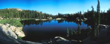
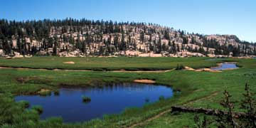
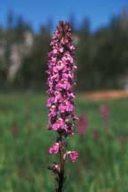
Lowell Lake |
At 3:50P I reached the Powell Lake trail junction, marked with ducks (8905', NAD27 UTM coordinate 11S0249667-4231903). 10 minutes later I found myself a home for the night on the east side of the lake (8864', 11S0249810-4232015). It was an established campsite complete with fire ring, good water access, and nice views of the lake. Although I didn't have any intentions to swim, the water was moderately warm and the lake bottom was either of sand or granite, but no mud. There appeared to be only one other party at the lake, camping on the north side just east of the main peninsula. This is probably the optimum place to stay, but with a long next day I wasn't too interested in optimum, more in convenience.
After setting up camp, I had dinner at about 6P on a rock perch over looking the lake. With a simple long sleeve shirt and my bandana used as a shield over my ears and neck, I was able to tolerate the few mosquitoes (as this would be the case for the entire trip). As dusk approached, the bats came out to provide a splendid aerial display of bug control over the lake. Unfortunately, I was not honored with the same show at the other lakes I visited. I saw a few fish jump, but information from others made it sound like this was not a grand fishing hole.
Saturday, August 20
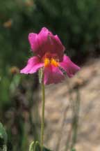
Lewis Monkeyflower |
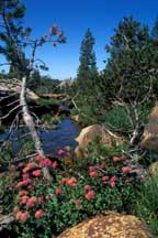
Throughout the day I had stopped many times to take pictures of wild flowers. Most prevalent were a purple daisy and a hundred and one varieties of lupine, but there were also various varieties of monkeyflower, paintbrush, white mariposa lilies, tiger lilies, pussypaws, penstemon, much more, and of course a lot of DYCs. The meadows were lush with green and wild flowers, evidence of the abundant rain this past winter. Even the steeper sloped areas had lots of color. Of course this was my expectation and my reason to trek here on the spur of the moment, I'm glad it came true.
The major creeks were flowing such as the ones in Whiteside Meadow, Salt Lick Meadow, and Spring Meadow. Although crossing them was not a problem, some renavigation was required. There were several sections of trail which had been rerouted to avoid the wet.
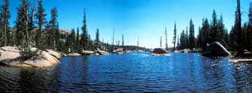
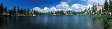
Long Lake |
Sunday, August 21
Trail from Wire/Long Lakes to Deer Lake |
The area of trail from the Long Lake junction down to Deer Lake is a drainage of many small lakes, meadows, bogs, and of course much water and green and wild flowers. No doubt, this is a beautiful section of trail. Often, because of the wet, the trail had taken a diversion from its more normal drier times.
At Deer Lake, where the drainage from both the small lakes and Long Lake enter Deer Lake, is a trail crossing. Here I had some fairly easy rock hopping to cross without getting wet. But this is also where I ended up diverting from my day's plan. Just as I crossed the creek, the obvious trail goes straight and the non obvious main trail goes to the right. Of course I went straight (silly me) and ended up at the south end of Long Lake. I even thought I was gaining too much elevation, but the trail was so well marked that I just assumed it had to be right. Besides, I was busy along the way taking pictures, and it was probably the creek outlet from Long Lake which parallels this trail that provided the resource for such beauty. So after about an hour travel and picture taking, I found myself at the base of the two dams of Long Lake (8737', 11S0258541-4228050). So what to heck, I was there, I did a bit more scouting.
Long Lake |
After my diversion, I headed towards Wood Lake reaching it at 1P. Immediately when you reach the Lake, the trail junctions in three directions. The east junction is probably to various campsites, the west junction up over a small granite face is used to circumnavigate the lake, and the other west junction goes down to a delightful campsite on a small nearby peninsula. Not realizing there were two west bound trails and the fact that I was hungry for lunch, I headed down looking for a place to eat.
I suspect the peninsula campsite is just legal, that is the main camp area is about 100 feet in three directions from the lake. But what a great place. Lots of flat ground for tents, easy water access, lots of trees for shade, and great views. While having a relaxing lunch, I observed many fish jump. Three years previous I also had lunch at Wood Lake but in the channel area between the two main lake halves, and there I saw large (maybe 20") trout swimming in the channel. A fisherman's haven!
I decided that I would leave a trip to Karls Lake and Red Can Lake for another outing. So I meandered back to Long Lake stopping along the way for more pictures. At 4:30P I was back home.
Monday, August 22
Toejam Lake |
Toejam Lake is 2 miles from the junction with virtually no net elevation change, but has a 200' dip in between. Most of the trail is well maintained, but as you get close to the lake there are some steep granite areas which are more difficult to follow. But it really didn't matter (even as I got screwed up both coming and going along this area) because the trail is easily found by identifying the natural features shown on the map. Of course, on the way back I used my GPS to navigate.
Toejam Lake is quite nice to view, it is a natural high alpine lake. It's really amazing that the lake is nestled nearly at the top of the ridge, it made me wonder where all the water came from. It's not particularly large, and there appears to be a foot path entirely around it (although after I set up camp I only covered only about 3/4 of it).
Lemmon's Paintbrush |
Water access was easy, but a nice view for dinner was a bit more difficult to find. The water was certainly warm enough to swim if you were so inclined. At dusk, I saw lots of fish jumping, but the ones nearby were maybe 4" in size. Alas, no bats and no aerial show. Also at dusk I heard a group of two others at the lake, but could not see them, they were on the west shore in the area that I didn't scout. This certainly would be an optional location for a future trip.
Tuesday, August 23
White Lupine |
The journey back was again picturesque, I was surprised how many photos I shot on return. Because there were several steep climbs, I stopped a few times to relax, refuel, and to enjoy the expansive scenery. After the junction to Chewing Gum Lake where the trail crests (about 9100'), I enjoyed the view of Chewing Gum Lake below (about 8800') and ultimately the Crabtree Camp trailhead (about 7200').
Throughout the trip I bumped into about a dozen groups. But on this leg, I met up with a set of what looked like four college kids studying entomology (since each had a bug net attached to their pack). When she asked how the mosquitoes were, I replied that "they were not so bad, but you won't need the nets since they will come to you." You know, if you can't share your years of experience with the young, the world would just turn to crap.
I reached the car at 2P, washed up, changed clothes, and as a 6 on the grunge meter I was ready to go. I stayed entirely on the Crabtree road for 13.4 miles until I reached HWY-108. From there I headed towards Sonora for a well deserved Mexican dinner at Cocina Michoacana (13955 Mono Way, south side of the street and just east of the Burger King). This was my first time at this location of this family owned business, but I always stop at the one in Groveland on HWY-120, yummy yummy.
All in all, it was definitely a grand trip.
Equipment Review
Elephant Head |
Digital Voice Recorder: At 2 ounces and tiny enough to fit in any pocket, it was extremely useful to take notes throughout the day. The model I bought, Olympus bottom of the line ($30), holds a bit more than an hour of recording and has three voice directories. I use the first directory for car notes, the second directory for general hiking notes, and the third directory for the all important photographic notes. A great toy.
Glad Bowl: It's been a couple years since I switched to a 24 once Glad bowl with lid for my dinner/breakfast bowl, but I learned a new trick with it. Besides using it to carry fragile food, and using the lid to let food steep without the worry of bugs and dirt, I learned that cleanup is a breeze by just placing a small amount of hot water in the container, closing the lid, and shaking it vigorously.
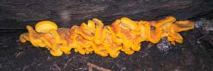
Large Waxed Yellow Mushroom (~2' wide) |
Alcohol Stove: [Note: Since this report, I now use a Coleman propane stove, the head weights 3 ounces, the gas canisters hold 8 ounces, fully adjustable flame from simmer to flame thrower. The best.] The first real extended test of my homemade alcohol stove.
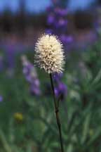
Western Bisort |