|
Cleveland Way |
Sept 2017 |
| |
|
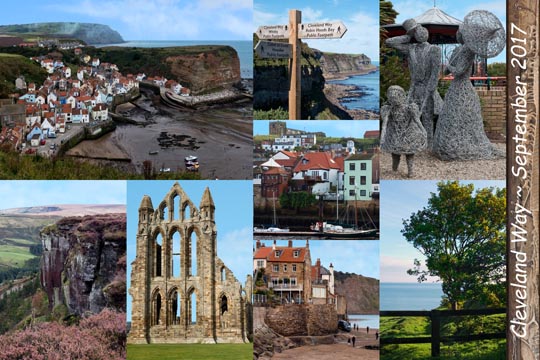
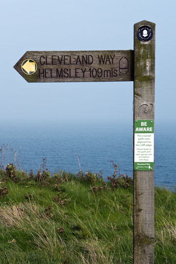
Cleveland Way -- A 110 mile walk along the Cleveland Way circumnavigating the North York Moors in England. Starting in Helmsley I walked across the sometimes dreary high moors interior, then to be treated to stunning panoramic views at the moors plateau edge. Reaching the fabulous North Sea coast I walked from splendid Saltburn-by-the-Sea south to quaint Staithes to Whitby to charming Robin Hoods Bay to Scarborough and ending in Filey. Good eats mostly, fabulous beer always. Pics Top->Bottom, Left->Right: (1) Staithes, (2) Hasty Bank, (3) Whitby Abbey, (4) Cleveland Way joins Coast to Coast Path (5) Whitby, (6) Robin Hoods Bay, (7) A day in the park at Saltburn-by-the-Sea, (8) North Sea vista. |
|
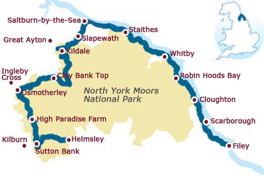
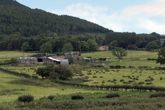
Cleveland Way Map - Upon arriving in Helmsley I explored the nearby Rievaulx Abbey. My 1st walking day was to Kilburn to view its White Horse on the hillside. On day 2 I walked to High Paradise Farm, a highly recommended farmstay. Day 3 was a walk along the high moors to Osmotherley, then by bus to Ingleby Cross. Day 4 began with a bus to Swainby, then a walk with fabulous high moor views, lunch at Lord Stones, then more fabulous views and some late afternoon sleet to Clay Bank Top. Day 5 was a walk in dreary weather and drab scenery to Kildale, and then a local train to Great Ayton. Day 6, a tourist day, to visit Grosmont and then by steam train to Pickering. Day 7 I climbed Roseberry Topping in the morning followed by a dreary walk to Slapewath. Thankfully the skies cleared on day 8 for a wonderful walk to Saltburn-by-the-Sea, staying at The Spa Hotel, my favorite. Now on the North Sea coast, on day 9, I walked to quaint Staithes. Day 10 was another bell weather day, walking to Whitby. On day 11 I explored Whitby visiting its 7th century monastery. Day 12 I walked to quirky Robins Hoods Bay being thankful of more clear skies. Day 13 was a non descript walk to Cloughton. Day 14 I walked to Scarborough, then explored its 12th century castle. Day 15, my last walking day, was in fog and drizzle to Filey. |
|
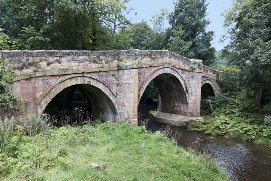
Bridge over River Rye -- About 1 mile from start of the Cleveland Way in Helmsley is this bridge where there is a diversion to visit the nearby Rievaulx Abbey. |
|
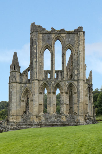
Rievaulx Abbey was a Cistercian abbey in Rievaulx, situated near Helmsley in the North York Moors. It was one of the great abbeys in England until it was seized under Henry VIII of England in 1538 during the dissolution of the monasteries. Reference Wikipedia |
|
Path from Helmsley |
|
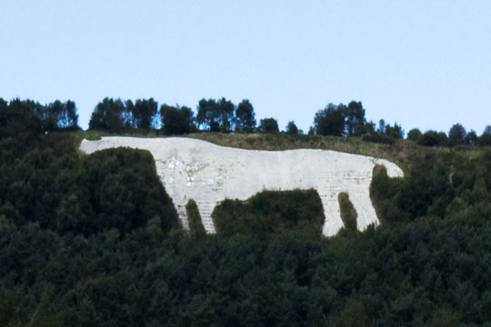
White Horse of Kilburn is a hill figure cut into the hillside in the North York Moors National Park near Kilburn, England. The figure is 318 feet long by 220 ft high and covers about 1.6 acres. The best view is from the village of Kilburn rather than the trail that leads to the figure from above. Reference Wikipedia |
|
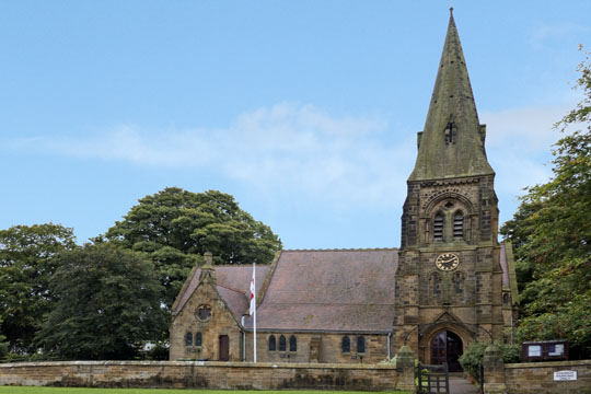
Saint Mary's Church of Kilburn -- Nearby in Kilburn is the showroom for Robert Thompson's, Home of Mouseman Oak Furniture. |
|
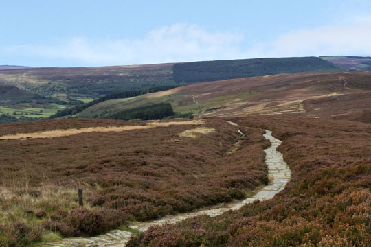
High North York Moors View |
|
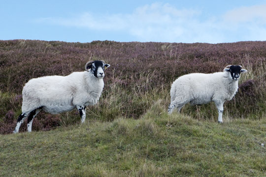
Baaaa.aaa.aaa |
|
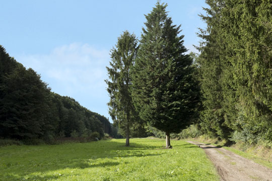
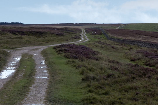
North York Moors -- The walk across the high moor flats was unappealing, especially so on this dreary day. |
|
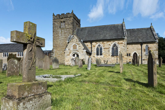
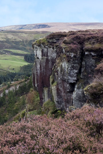
Church of the Holy Cross, Swainby -- The previous night I lodged in Ingleby Cross, off track from the Cleveland Way, rather on the Coast to Coast path. On this morning I walked through the quaint village of Swainby then returned to the official track which joins the Coast to Coast path. This day's walk was one of the best passing over Live Moor, to Whorlton Moor, lunching at Lord Stones, walking past Cringle Moor, to Cold Moor, past the Wainstones, along Hasty Bank, and finally down to Clay Bank Top. Thankfully Mother Nature only threw at me light rain and a bit of hail in between moments of sunshine. |
|
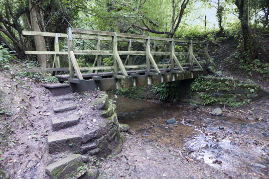
Crook Beck Foot Bridge -- From Swainby I entered an area know as Huthwaite Plantation, a place of forest and creeks. Here I crossed a beck over slippery stone steps. |
|
Hopeful Starbucks -- No one's home, where's my coffee? |
|
Live Moor Plantation |
|
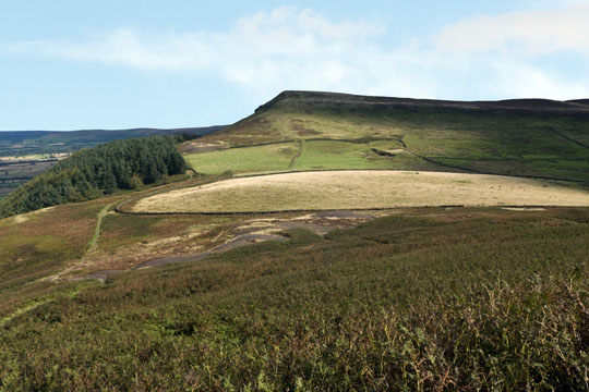
Along Whorlton Moor -- After gaining elevation, the landscape turned to heather. Soon the path dropped, crossed a roadway, and I was at Lord Stones Cafe for a break of tea and a scone. |
|
View from Cringle Moor -- After my break at Lord Stones Cafe, the path climbed to Cringle Moor, then it would drop and rise to Cold Moor, then past the Wainstones to Hasty Bank, and finally drop to Clay Bank Top. |
|
Along Plateau of Hasty Bank -- Upon arrival at the Wainstones, I knew from past experience that cell phone calls were easily made here whereas at Clay Bank Top there is no cell coverage. So here I called the good people at the Buck Inn in Chop Gate for a pick up in 45 minutes to their lodge 2-1/2 miles south of the trail junction of Clay Bank Top. The timing coordination worked perfectly. |
|
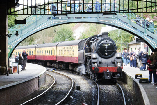
Steam Train at Pickering -- We were a bit off track for lodging on our layover day, staying in Great Ayton. So for a bit of fun, we took the local train to Grosmont, and then boarded the North Yorkshire Moors Railway steam train to Pickering. |
|
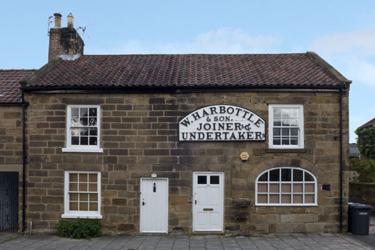
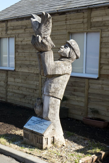
Maker of the Forever Box -- Quality workmanship, no complaints from clientele. |
|
Roseberry Topping -- From Great Ayton I climbed from the west side of Roseberry Topping in thickly overcast weather. Sadly this view was the highlight of the day as the remainder of the day's walk was across nondescript moors, dreary skies, and numerous pheasant/quail hunters roaming about in 4WD vehicles. |
|
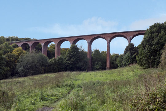
Saltburn Viaduct |
|
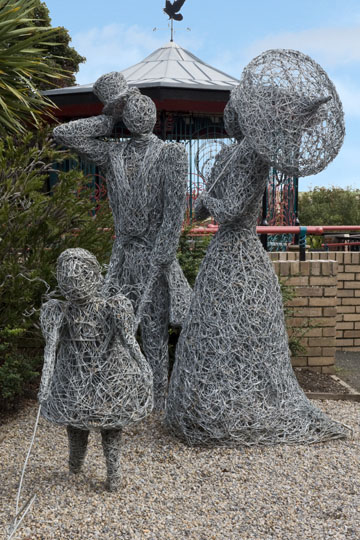
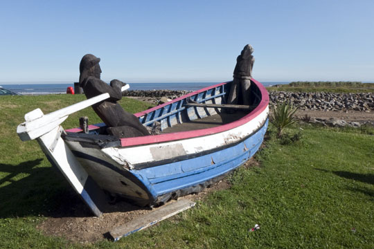
Sunday in the Park -- We were greeted by this charming sculpture when we entered Saltburn-by-the-Sea. While there we stayed at the delightful Spa Hotel. Not only did we have a great room with a view, but the service and especially the dining at the hotel was first rate. Highly recommended. |
|
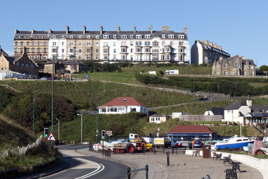
Saltburn-by-the-Sea |
|
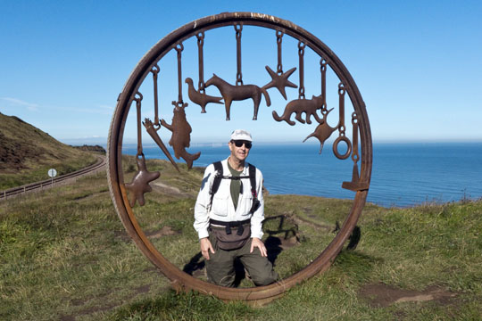
Charm Bracelet -- About 1-1/2 mile east of Saltburn-by-the-Sea is this delightful charm bracelet. |
|
Slinningrove Waterfront |
|
Watchful Sailors of Skinningrove |
|
Skinningrove Pigeon Fanciers |
|
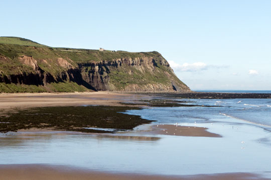
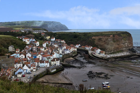
Staithes -- View of the town from the west side of Staithes Beck, the waterway that defines the town. |
|
Staithes -- This view from the east captures the quaintness of this waterfront village. In 1745-46, Staithes's most famous resident, James Cook (born in Marton near Middlesbrough), worked in Staithes as a grocer's apprentice where he first gained his passion for the sea. Reference Wikipedia |
|
Port Mulgrave -- In the early 1850s Sir Charles Palmer opened his first ironstone mine on his coastal property at Rosedale Wyke. The harbour costing £45,000 was built within a year and was formally opened in 1857. It was built so iron ore could be cheaply transported, by sea, to Jarrow to feed Charlie & George Palmers blast furnaces on Tyneside which produced steel for the shipyards. In order to avoid confusion with the Rosedale ironworks in the heart of the North York Moors, Palmer renamed his coastal property Port Mulgrave in honour of the Earl of Mulgrave, a prominent local landowner. The village is located about 1-1/2 miles southeast of Staithes. |
|
Footbridge near Runswick Bay |
|
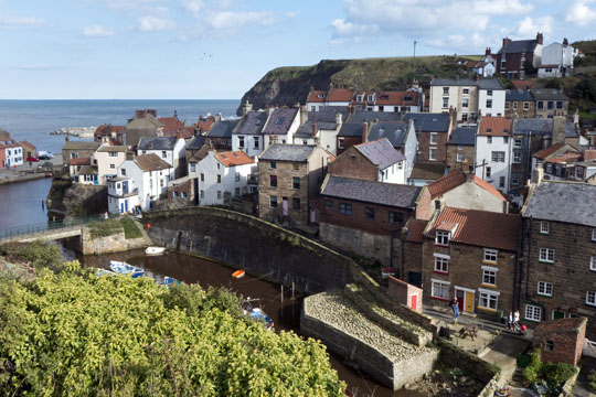
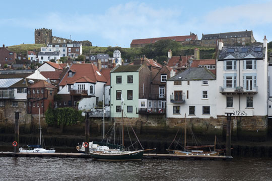
Whitby is a seaside town, port and civil parish in the Borough of Scarborough and English county of North Yorkshire. It is located within the historic boundaries of the North Riding of Yorkshire. Situated on the east coast of Yorkshire at the mouth of the River Esk, Whitby has an established maritime, mineral and tourist heritage. Its East Cliff is home to the ruins of Whitby Abbey, where Cædmon, the earliest recognised English poet, lived. The fishing port developed during the Middle Ages, supporting important herring and whaling fleets, and was (along with the nearby fishing village of Staithes) where Captain Cook learned seamanship. Reference Wikipedia |
|
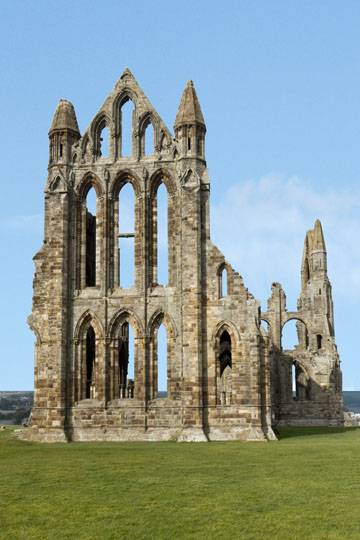
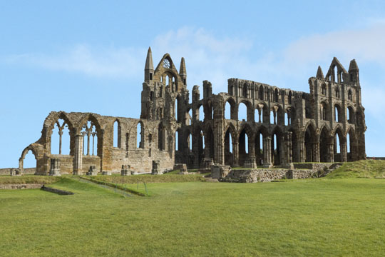
Whitby Abbey was a 7th century Christian monastery that later became a Benedictine abbey. The abbey and its possessions were confiscated by the crown during the Dissolution of the Monasteries under Henry VIII. The abbey church was situated overlooking the North Sea on the East Cliff above Whitby in North Yorkshire, England. Reference Wikipedia |
|
Whitby Abbey -- The first monastery was founded in 657 AD by the Anglo-Saxon era King of Northumbria, Oswy (Oswiu) as Streoneshalh (the older name for Whitby). The name Streoneshalh is thought to signify Fort Bay or Tower Bay in reference to a supposed Roman settlement that previously existed on the site. This contention has never been proven though and alternative theories have been proposed. Reference Wikipedia |
|
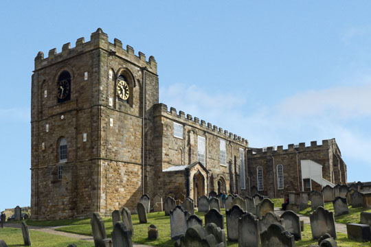
Church of Saint Mary -- The Church of Saint Mary is an Anglican parish church serving the town of Whitby in North Yorkshire England. It was founded around 1110, although its interior dates chiefly from the late 18th century. It is situated on the town's east cliff, overlooking the mouth of the River Esk and the town, nearby the ruins of Whitby Abbey. Church Steps, a flight of 199 steps lead up the hill to the church from the streets below. Reference Wikipedia |
|
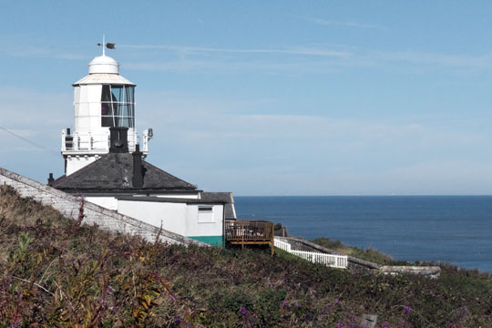
Whitby Lighthouse is located on Ling Hill, on the coast to the south-east of Whitby, beyond Saltwick Bay. It should not be confused with the two lighthouses located in Whitby itself, which protect the town's harbour. Reference Wikipedia |
|
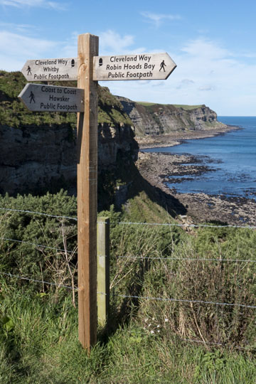
Cleveland Way at C2C ~ For the second time on the Cleveland Way walk I intersected the Coast to Coast path. The first time was just north of Osmotherley on the west side of the North York Moors, and this time along the North Sea Coast. Whereas the C2C ends in Robin Hoods Bay 2-1/2 miles to the south, the Cleveland Way continues many mile further south to end in Filey. |
|
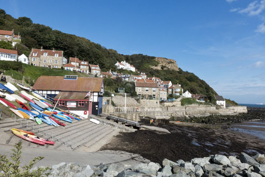
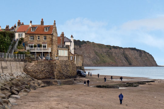
Robin Hoods Bay -- The origin of the name is uncertain, and it is doubtful if Robin Hood was ever in the vicinity. However, an English ballad and legend tell a story of Robin Hood encountering French pirates who came to pillage the fisherman's boats and the northeast coast. The pirates surrendered and Robin Hood returned the loot to the poor people in the village that is now called Robin Hood's Bay. The town, which consists of a maze of tiny streets, has a tradition of smuggling, and there is reputed to be a network of subterranean passageways linking the houses. During the late 18th century smuggling was rife on the Yorkshire coast. Vessels from the continent brought contraband which was distributed by contacts on land and the operations were financed by syndicates who made profits without the risks taken by the seamen and the villagers. Tea, gin, rum, brandy and tobacco were among the contraband smuggled into Yorkshire from the Netherlands and France to avoid the duty. Reference Wikipedia |
|
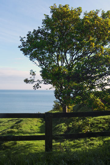
North Sea View -- A short walk south from Robin Hoods Bay brought me to the idyllic setting. |
|
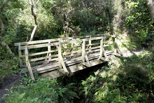
Footbridge over Hayburn Beck -- About 6-1/2 miles south of Robin Hoods Bay is Hayburn Beck. |
|
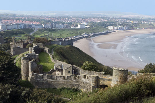
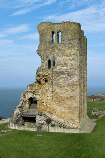
Scarborough Castle is a former medieval Royal fortress situated on a rocky promontory overlooking the North Sea and Scarborough. The site of the castle, encompassing the Iron Age settlement, Roman signal station, an Anglo-Scandinavian settlement and chapel, the 12th-century enclosure castle and 18th-century battery, is a monument of England's national importance. Fortifications for a wooden castle were built in the 1130s, but the present stone castle dates from the 1150s. Over the centuries, several other structures were added, with medieval monarchs investing heavily in what was then an important fortress that guarded the Yorkshire coastline, Scarborough's port trade, and the north of England from Scottish or continental invasion. Reference Wikipedia |
|
Scarborough Castle 12th Century Keep -- The 86-foot-tall 12th-century keep lies within the inner bailey. The keep, with its entrance on the first floor, survives as a shell, with the west wall, interior floors and roof missing, as a result of bombardment in the 17th century. The walls range from 11 to 15 feet in thickness. Reference Wikipedia |
|
The End |