|
Yosemite High |
August 2015 |
| |
|
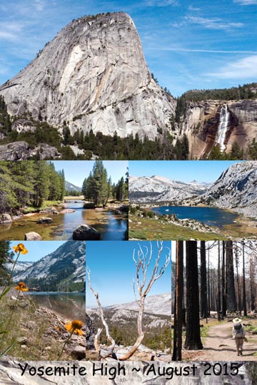
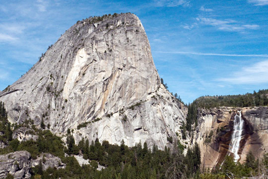
A Yosemite High ~ In August of 2015 a friend and I walked the Camps reveling in the landscape, wildflowers, and blue lakes. Plan your trip, view my How-to Report. Pictures: (1) Liberty Cap & Nevada Falls, (2) Lyell Fork of Tuolumne River, (3) Vogelsang Lake, (4) Cone Flowers at Washburn Lake, (5) Tree Skeleton, (6) 2014 Bunnell Cascade Fire Devastation. |
|
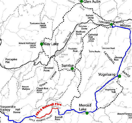
High Sierra Camps Loop ~ Our walk began at Tuolumne Meadows Lodge (2 nights), then 7 miles to Vogelsang (2 nights), then 9 miles to Merced Lake (2 nights) including short side trips to Emeric Lake and lovely Babcock Lake, and 15 miles to Yosemite Valley passing through 3 miles of devastation from the 2014 Bunnell fire. |
|
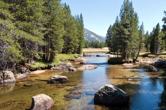
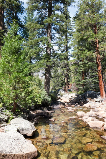
Lyle Fork of Tuolmine River ~ We had 2 full days at Tuolumne Meadows before starting our walk. Early morning of the 2nd day we played car shuttle, driving down to Yosemite Valley where our High Sierra Camp adventure would end 5 days later. There we caught the 8:30 AM hiker's bus to return. We then had a pleasant walk along the Lyle Fork of the Tuolmine River to a spot where we lounged and poked our feet in the water. |
|
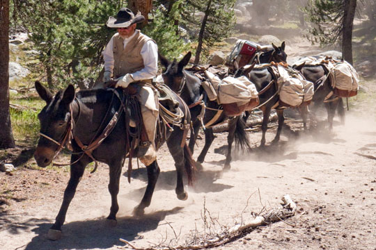
Mule Train ~ Woowa, this ain't Fedx. Not only are the High Sierra Camps provisioned by mule trains, but some people prefer to ride to the camps rather than walk. Others use the mule service to pack their gear to remote locations. What a deal! |
|
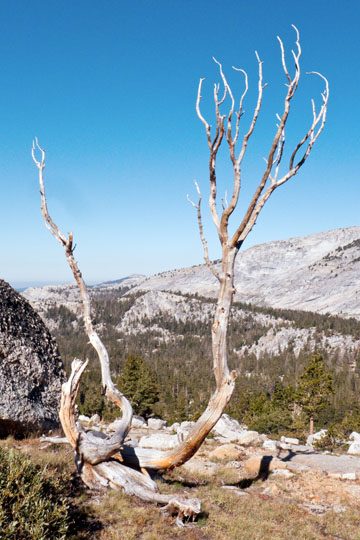
Skeleton ~ On our extra day at Vogelsang (elevation 10,100 ft), we walked to Vogelsang Lake (10,300 feet) and the nearby pass (10,650 feet). Along the way was this tree skeleton standing proud overlooking the granite landscape. The wind whistled through its bare hands singing it's a very hard life. |
|
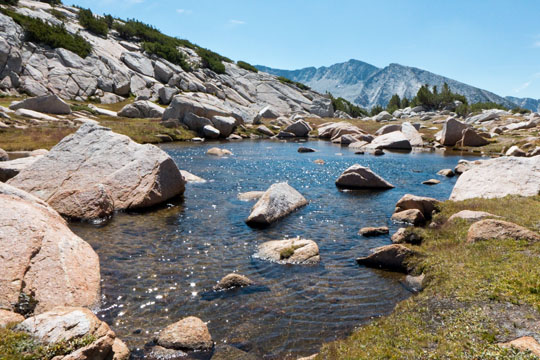
Wetland near Vogelsang Pass ~ Just above Vogelsang Lake and near the pass (10650 feet) is this wetland (10,630 feet). It was a few days earlier, before our High Sierra walk, when we strolled to and explored Lower Granite Lake (10,049 ft). Among the many ponds below that lake following its creek were a plethora of adorable tiny frogs, although none were seen at Granite Lake. Sadly, most of these critters are now gone believed to be the result of stocking the lake with "frog devouring" trout. Who knows, but maybe there are now more mosquitoes around trout stocked lakes than in the past. |
|
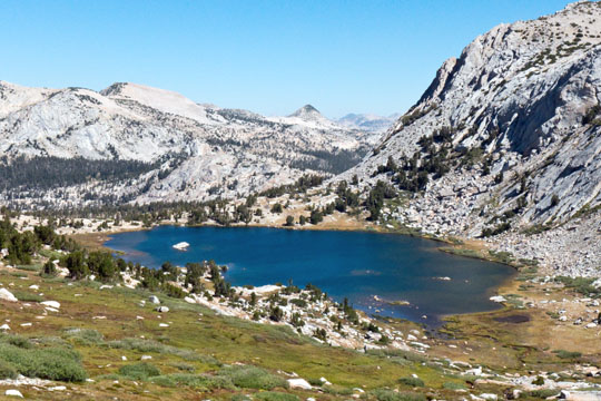
Vogelsang Lake ~ On return from Vogelsang Pass we relaxed at the lake. It was too windy and cold to swim, but we found a sheltered area where we could enjoy the scenery and relax with a book. Although I later heard that another group swam in this lake, ..., burr that's cold! |
|
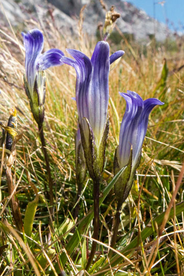
Mountain Gentian nearby Fletcher Lake and Vogelsang High Sierra Camp. |
|
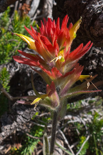
Paintbrush was prolific throughout our High Sierra walk. This guy was found near Fletcher Lake. |
|
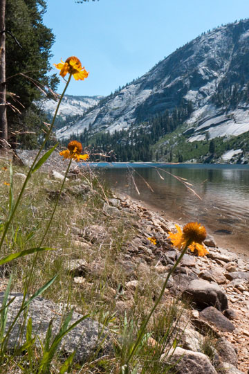
Cone Flowers at Washburn Lake ~ On our extra day at Merced Camp we strolled 3 miles and about 450 feet elevation to Washburn Lake. There we spied a few others from the camp relaxing for the day. We found a nice shady area with a beach to wallow away the afternoon. |
|
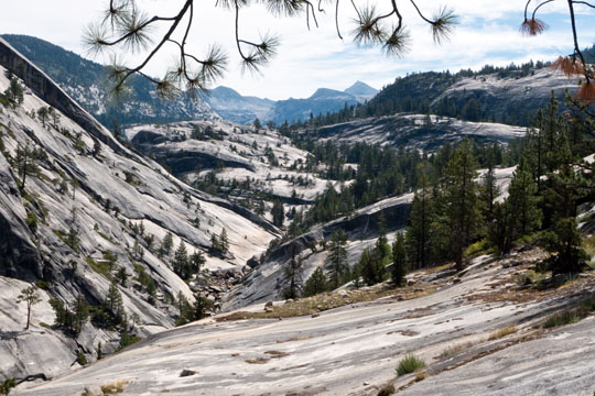
Canyon Along Merced River ~ On our last day we left Merced Camp at 8:30 AM after a hardy breakfast, it was going to be a long day's walk of 15 miles. On paper it seemed much easier as we were ultimately traveling downhill from 7100 feet elevation to 4000 feet to the Valley floor. However, the trail was always rocky, thus we had to take care watching our footing, while along the way were numerous stretches of up hill to contend with. |
|
Placid Merced River ~ After walking about 4.5 miles from Merced Camp we reached the bridge over the Merced River leading to the Bunnell Cascade. We should have stopped for lunch here because just on the far side of the bridge was the boundary to the 2014 Bunnell Cascade fire. |
|
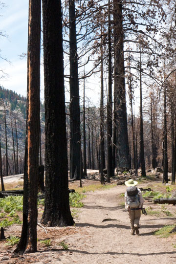
2014 Fire Devastation near Bunnell Cascade ~ In 1990 I enjoyed my first solo backpack trip. I walked from Glacier Point along the Panoramic Trail through Little Yosemite Valley to the Bunnell Cascade where I set up camp. I have very fond memories of that outing, complete with an encounter with a precocious amber colored black bear who roamed the camp. Sadly, that area is now blackened like death. |
|
Libery Cap and Nevada Falls ~ About 1 mile before reaching Little Yosemite Valley the obvious signs of the 2014 Bunnell Cascade fire were gone. We took a short break near the Merced River, but our hopes to wet our feet were dashed as the river was somewhat blackened by soot from the previous year's fire. We then continued by taking the easier John Muir Trail from Nevada Falls to the Valley floor (4.5 miles plus another mile to Camp Curry) rather than the rocky and steeper Mist Trail. When we reached the Valley we spied a concession stand near Happy Isles where we enjoyed a well deserved tall lemonade. Another mile and we were reunited with my car. On the way home we stopped at my favorite Mexican Restaurant, Cocina Mechoacana in Groveland. |